Digital Image: 1952 Pan American World Airways System Map
WorldRoutes-panamerican-1952_d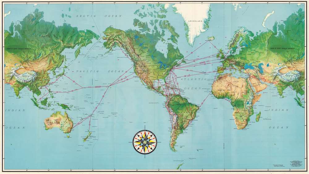


Title
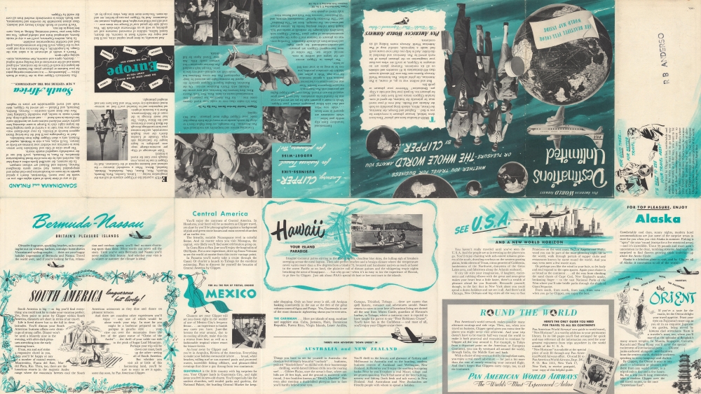
Destinations Unlimited.
1952 (dated) 18 x 31.75 in (45.72 x 80.645 cm) 1 : 40000000
1952 (dated) 18 x 31.75 in (45.72 x 80.645 cm) 1 : 40000000
Description
FOR THE ORIGINAL ANTIQUE MAP, WITH HISTORICAL ANALYSIS, CLICK HERE.
Digital Map Information
Geographicus maintains an archive of high-resolution rare map scans. We scan our maps at 300 DPI or higher, with newer images being 600 DPI, (either TIFF or JPEG, depending on when the scan was done) which is most cases in suitable for enlargement and printing.
Delivery
Once you purchase our digital scan service, you will receive a download link via email - usually within seconds. Digital orders are delivered as ZIP files, an industry standard file compression protocol that any computer should be able to unpack. Some of our files are very large, and can take some time to download. Most files are saved into your computer's 'Downloads' folder. All delivery is electronic. No physical product is shipped.
Credit and Scope of Use
You can use your digial image any way you want! Our digital images are unrestricted by copyright and can be used, modified, and published freely. The textual description that accompanies the original antique map is not included in the sale of digital images and remains protected by copyright. That said, we put significant care and effort into scanning and editing these maps, and we’d appreciate a credit when possible. Should you wish to credit us, please use the following credit line:
Courtesy of Geographicus Rare Antique Maps (https://www.geographicus.com).
How Large Can I Print?
In general, at 300 DPI, you should at least be able to double the size of the actual image, more so with our 600 DPI images. So, if the original was 10 x 12 inches, you can print at 20 x 24 inches, without quality loss. If your display requirements can accommodate some loss in image quality, you can make it even larger. That being said, no quality of scan will allow you to blow up at 10 x 12 inch map to wall size without significant quality loss. For more information, it is best consult a printer or reprographics specialist.
Refunds
If the high resolution image you ordered is unavailable, we will fully refund your purchase. Otherwise, digital images scans are a service, not a tangible product, and cannot be returned or refunded once the download link is used.
Cartographer S
Pan American World Airways (1927 - 1991), originally Pan American Airways, was one of the most important companies in the history of aviation. Under the leadership of Juan Trippe, the company was a pioneer in international passenger air travel, beginning with seaplane services from the United States to South and Central America. In the mid-1930s, it began to offer Transpacific flights from San Francisco to Honolulu, Hong Kong, the Philippines, Australia, and New Zealand. Taking inspiration from nautical transportation, Pan Am dubbed its planes 'Clippers,' adopted other naval terminology, and had pilots and crew wear naval-style uniforms. In seeking to outcompete steamships, Pan Am offered passengers luxurious amenities. Its success in the prewar period left the company in an advantageous position at the start of the jet age, when it became the gold standard for international travel in the passenger air industry. However, the company began to falter in the 1970s and declared bankruptcy in 1991. More by this mapmaker...
Jeppesen (1934 - present), originally Jeppesen and Company, is a Colorado-based company offering products and services related to aeronautical navigation and operations. Founded by aviation pioneer Elrey Borge Jeppesen and with important contributions from his wife, Nadine Jeppesen, a leading female figure in the early history of aviation, the company established a reputation in the mid-20th century for high-quality aeronautical navigation charts. By the 1970s, the company had expanded to other countries and adopted innovative methods, employing computers in navigation and flight planning. It was purchased several times by larger companies, including eventually by Boeing, while also undertaking its own acquisitions. Learn More...
References
OCLC 639166181, 1130727014.