This item has been sold, but you can get on the Waitlist to be notified if another example becomes available, or purchase a digital scan.
1968 Association of African Geological Surveys Geological Map of Africa
AfricaTectonic-asga-1968$650.00

Title
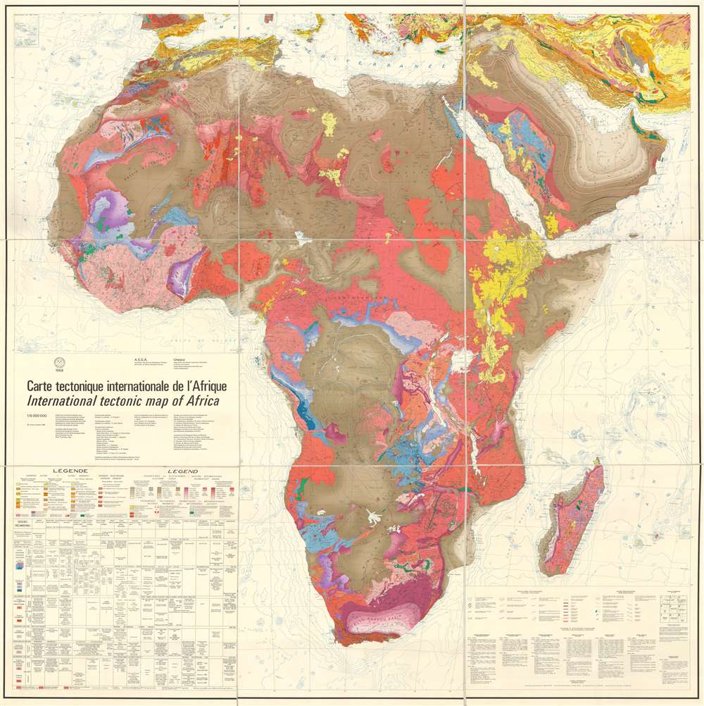
Carte tectonique internationale de l'Afrique. / International tectonic map of Africa.
1968 (dated) 74 x 74 in (187.96 x 187.96 cm) 1 : 5000000
1968 (dated) 74 x 74 in (187.96 x 187.96 cm) 1 : 5000000
Description
This is a 1968 Association des Services Géologiques Africains (Association of African Geological Surveys) and UNESCO tectonic map of Africa. The map depicts the continent from the Atlantic Ocean to the Gulf of Oman, the Arabian Sea, and the Indian Ocean and from the Mediterranean Sea to the Cape of Good Hope. Meticulously detailed, it is apparent that the most up-to-date information available was consulted when compiling this monumental work. An extremely detailed legend, which is situated in the lower left corner, and a list of consulted works, in the lower right corner, explain the various notations used and where the information was sourced. Countries throughout the continent are labeled, some of which were known at that time by names that are no longer used today. Rivers, lakes, and deserts are also labeled. After just one glace, the geologic complexity of this immense continent is immediately apparent.
This map was drawn and printed by the Institut Géographique National-France and compiled under the ægis of the International Geological Congress, Commission for the World Geological Map, Sub-Commission for the World Tectonic Map for the Association des Services Géologiques Africains and UNESCO.
This map was drawn and printed by the Institut Géographique National-France and compiled under the ægis of the International Geological Congress, Commission for the World Geological Map, Sub-Commission for the World Tectonic Map for the Association des Services Géologiques Africains and UNESCO.
Condition
Very good. Mounted on linen. Blank on verso.
References
OCLC 496215534.