This item has been sold, but you can get on the Waitlist to be notified if another example becomes available, or purchase a digital scan.
1889 Flemming / Handtke Map of Africa, German Colonies
Afrika-flemming-1889$150.00


Title
General-Karte von Afrika.
1889 (dated) 25 x 30 in (63.5 x 76.2 cm) 1 : 14500000
1889 (dated) 25 x 30 in (63.5 x 76.2 cm) 1 : 14500000
Description
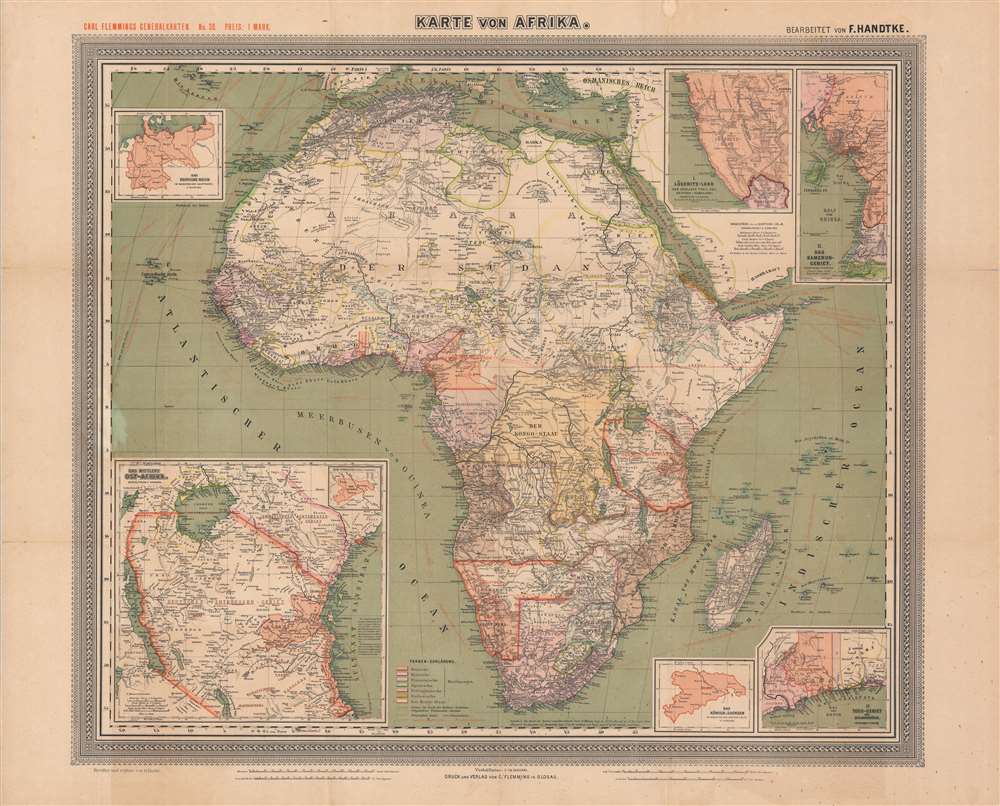
This is a large-format 1889 German map of Africa from the height of the 'Scramble for Africa' drawn by Friedrich Handtke and published by Carl Flemming. It depicts both European colonies and indigenous kingdoms and confederations, and in particular highlights the recently-established German colonies on the continent.
The Scramble began at the Berlin Conference of 1884, wherein European colonization of Africa was regulated and made official, and the doctrine of Effective Occupation introduced, whereby the physical presence of troops, generally at the invitation of a local ruler with whom a protectorate had been signed, was considered grounds for claiming territory. This notion immediately set ambitious European military officers off on rambles through poorly explored areas of Africa to enlist local rulers in their rivalries with other powers.
Though Germany was late to the game in establishing colonies in Africa, playing host to the Berlin Conference gave the county and its chancellor, Otto von Bismark, an advantage. Bismarck initially opposed Germany acquiring overseas colonies, thinking that any benefits accrued were outweighed by the hassle of controlling them, but he radically changed tack on the eve of the Berlin Conference.
The result of these constrasting forces was that German colonial policy was rather confused and driven primarily by private agents, some of whom were not even German. Once a territory was claimed, the Germans proved efficient yet brutal in crushing resistance, building railroads, and pursuing economic benefit. Aside from German Southwest Africa, few German colonists were attracted to Africa, and the white population was mostly limited to colonial officials, soldiers, and missionaries. Among a string of atrocities committed, the suppression of the Maji Maji Rebellion in East Africa and the concurrent Herero and Namaqua genocide in Southwest Africa stand out as especially appalling.
This map appeared in many editions (this is number 32) in the 1880s and early 1890s to keep up with the rapidly changing situation. Multiple editions could even be published in a single year, which was the case in 1889. Given the profusion of editions, the slightly different titles on the map itself and its cover, and the intermingling of physical and digital maps in catalogs, the true distribution of this map is difficult to know with absolute certainty, but it looks to be held by about ten institutions in North America and Europe.
A Closer Look
Extremely rich in geographic and political details, including indigenous kingdoms and tribes, this map encompasses the entire continent and its surrounding waters. Mountains, lakes, rivers, railways, and settlements are indicated throughout. On the water, German and foreign steamship lines (dampferlinien) and telegraph cables are denoted. Six inset maps are included: one of the entire German Reich at top-left and one of Saxony at bottom-right for purposes of comparison, along with maps of the German colonies of Lüderitz-land (in German Southwest Africa), Kamerun, Togo, and German East Africa. European colonies are color-coded according to a key at bottom. Four scales are provided at bottom and longitude is provided according to the Ferro, Greenwich, and Paris Meridians.Scramble for Africa
This map is an artifact of the 'Scramble for Africa,' the series of late 19th and early 20th century occupations, usurpations, annexations, divisions, and land seizures by European powers in Africa. The Scramble for Africa was mainly characterized by heightened occupation and direct ownership of colonial lands. Rivalries and treaties led to several new African states, many of which remain, but few of which paid heed to traditional boundaries or cultural distinctions.The Scramble began at the Berlin Conference of 1884, wherein European colonization of Africa was regulated and made official, and the doctrine of Effective Occupation introduced, whereby the physical presence of troops, generally at the invitation of a local ruler with whom a protectorate had been signed, was considered grounds for claiming territory. This notion immediately set ambitious European military officers off on rambles through poorly explored areas of Africa to enlist local rulers in their rivalries with other powers.
Though Germany was late to the game in establishing colonies in Africa, playing host to the Berlin Conference gave the county and its chancellor, Otto von Bismark, an advantage. Bismarck initially opposed Germany acquiring overseas colonies, thinking that any benefits accrued were outweighed by the hassle of controlling them, but he radically changed tack on the eve of the Berlin Conference.
The German Presence in Africa
Though itself only a unified country for less than twenty years, Prussian-led Germany carved out several colonies on the African continent in the wake of the Berlin Conference, including German East Africa, German Southwest Africa, Kamerun, and Togoland. Bismark, who had engineered these acquisitions, quickly returned to his original view that they were a distraction from the more pressing matter of ensuring German unification and security in the face of potentially hostile powers to its east and west. Within a few years of establishing the African colonies mentioned above, he considered abolishing them or giving them away to the British or Italians. Bismark's successors as chancellor and foreign minister were not much more enthusiastic in acquiring or administering colonies, but Kaiser Wilhelm II aggressively pursued his vision of Weltpolitik, including an extensive colonial empire. 'Lobby groups' such as businessmen, scholars, Social Darwinists, and other colonial enthusiasts, also pushed the government to grab as many colonies as possible.The result of these constrasting forces was that German colonial policy was rather confused and driven primarily by private agents, some of whom were not even German. Once a territory was claimed, the Germans proved efficient yet brutal in crushing resistance, building railroads, and pursuing economic benefit. Aside from German Southwest Africa, few German colonists were attracted to Africa, and the white population was mostly limited to colonial officials, soldiers, and missionaries. Among a string of atrocities committed, the suppression of the Maji Maji Rebellion in East Africa and the concurrent Herero and Namaqua genocide in Southwest Africa stand out as especially appalling.
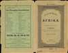
Publication History and Census
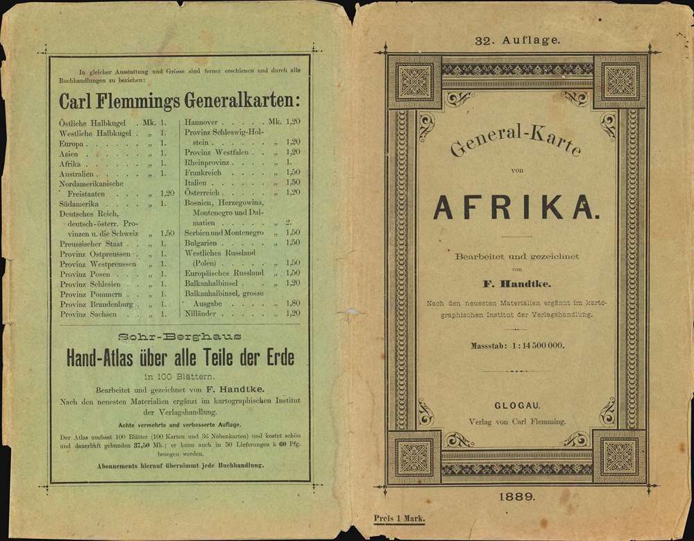
This map was drawn by Friedrich Handtke, 'revised and supplemented' by O. Herkt, and published in 1889 by the firm Carl Flemming, which continued to use the name of its founder after his death. It was No. 38 in the series 'Carl Flemmings Generalkarten.' Among the known examples, it is generally dissected and laid on linen, making this an atypical presentation.This map appeared in many editions (this is number 32) in the 1880s and early 1890s to keep up with the rapidly changing situation. Multiple editions could even be published in a single year, which was the case in 1889. Given the profusion of editions, the slightly different titles on the map itself and its cover, and the intermingling of physical and digital maps in catalogs, the true distribution of this map is difficult to know with absolute certainty, but it looks to be held by about ten institutions in North America and Europe.
CartographerS
Carl Flemming (fl. c. 1840 - c. 1879) was a German cartographer and map publisher active in the late 19th and early 20th centuries. The firm was an early adopter of modern multicolor printing techniques, which it utilized to produce low cost attractive maps focused on the German market. The firm is also known for its children's books. Flemming died in 1878 or 1879, but his firm continued to publish well into the 20th century. Flemming was based in Glogow, a region that is currently part of modern day Poland's Lower Silesian Voivodeship. More by this mapmaker...
Friedrich Handtke (December 7, 1815 - January 25, 1879) was a German engraver and cartographer active in the second half of the 19th century. Handtke was formally trained as a surveyor in the Prussian army. Following his discharge in 1838 he took a position as the head of cartography at the Głogów, Poland, publishing house of Carl Flemming. Initially, Handtke, in an attempt to hide his youth, inscribed his map publications as "Dr. Karl Sohr". From 1838 to 1874, Handtke and Flemming issued some 260 maps, about 168 of which Handke drew himself. Both Flemming and Handke died in 1879 leaving the powerful Flemming publishing house without its heads. Nonetheless, the firm continued to publish, and republish, well into the 20th century. Głogów, where Handtke was based, is currently part of modern day Poland's Lower Silesian Voivodeship. Learn More...
Condition
Good. Wear along fold lines, including one repaired area of loss at a fold intersection at left. Foxing throughout, more noticeable at bottom and left. Some areas of discoloration in margins. Folds into original cover.
References
OCLC 885448549, 1274168843, 1121436954, 57470403.