This item has been sold, but you can get on the Waitlist to be notified if another example becomes available.
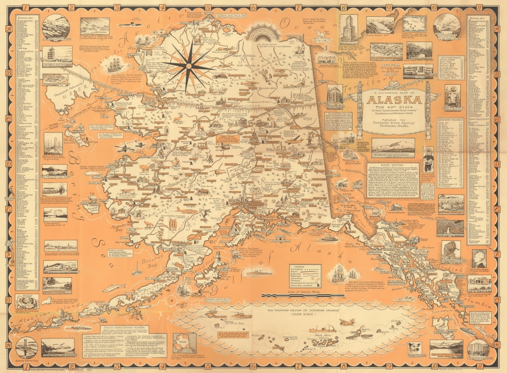
1959 Ernest Dudley Chase Pictorial Map of Alaska
Alaska-chase-1959
Title
1959 (dated) 20 x 27.25 in (50.8 x 69.215 cm) 1 : 4224000
Description
A Closer Look
This map of Alaska is composed in Chase's iconic style; dense with information, history, vignettes, and illustrations. Airplanes (still the most practical mode of transportation in Alaska) appear alongside riverboats, kayaks, and ocean liners. Alaska's world-famous wildlife leaps off the page, with foxes, wolves, caribou, polar bears, musk oxen, and a Kodiak. The Aleutian Islands stretch out toward the left border, with the westernmost islands appearing in the Gulf of Alaska. Pictorial views line the left and right borders along with an alphabetic index of towns and another of mountains and volcanoes.Publication History and Census
This first edition map was drawn and published uncolored by Ernest Dudley Chase in 1958. A second 1958 edition was published in full color. Two 1959 editions were published: one for the Alaska News Agency (which appears to be the most prevalent) and the present edition published for the Fairbanks News Agency. This map is well represented in institutional collections.Cartographer
Ernest Dudley Chase (July 26, 1878 - August 25, 1966) was an American illustrator of greeting cards and pictorial maps active in the first half of the 20th century. From his studio in Winchester, Massachusetts, Chase became famous for his elaborately illustrated pictorial maps. He was born in Lowell, Massachusetts, and attended the Lowell Textile School and the Vesper George Art School. He took work with Butterfield Printing Company in 1900. In 1906, he moved to the W. T. Sheehan Printing Firm. He began producing postcards and greeting cards on his own account in 1908. This initial imprint was Des Arts Publishers, but later, he changed it to Ernest Dudley Chase Publishers. Chase is best known today for his distinctive pictorial maps, most of which he published privately, characterized by dense vignette images of important locations. The biographical pamphlet A Meticulous Maker of Maps describes Chase's attention to detail wherein, pursuing a 'passion for perfection' by stippling his images 'dot-by-dot, with tiny pens' under a magnifying glass. His impressive corpus includes nearly 50 maps focusing on various parts of the United States and Europe, as well as other international locations and novelty pieces. Most are thematic, focusing on topics such as wonders of the world, stamps, aviation, and war. Others, such as his map of The United States as viewed by California and Loveland are satirical. All, in their original editions, are coveted by a dedicated following of modern collectors. More by this mapmaker...

