This item has been sold, but you can get on the Waitlist to be notified if another example becomes available, or purchase a digital scan.
1925 White Pass and Yukon Route Map of Alaska and Northwestern Canada
Alaska-whitepassyukon-1925$150.00


Title
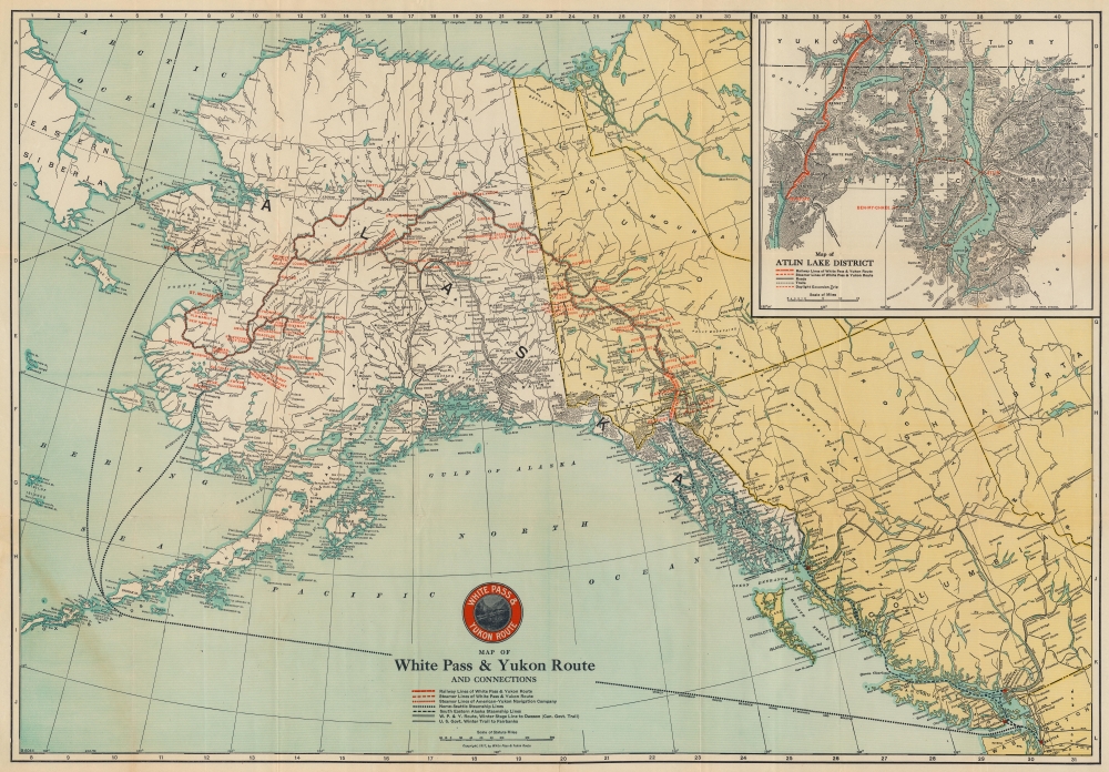
Map of the White Pass and Yukon Route and Connections.
1925 (dated) 21.25 x 30.5 in (53.975 x 77.47 cm) 1 : 4500000
1925 (dated) 21.25 x 30.5 in (53.975 x 77.47 cm) 1 : 4500000
Description
This is a 1925 White Pass and Yukon Route railroad map of Alaska and northwest Canada - the major artery of access to the Klondike Gold Rush.
A Closer Look
The White Pass and Yukon Route (WPY) operated between Skagway and Whitehorse. Its connected Steamer Lines operated from Whitehorse to Dawson, where they connected to the Steamer Lines of the American-Yukon Navigation Company, which continued on to Nenana near Fairbanks. Other railroads in Alaska are also illustrated, including the Alaska Railroad and the U.S. Government Railroad. Also noted are the Winter Stage Line to Dawson and the Richardson Highway. An inset map in the upper right focuses on the Atlin Lake District and the White Pass and Yukon Route railway and steamer lines, along with the region's roads and trails.The White Pass and Yukon Route
The White Pass and Yukon Route is an American and Canadian narrow-gauge railroad connecting Skagway, Alaska, with Whitehorse, the capital of the Yukon Territory. Founded in 1898 during the Klondike Gold Rush as a way of accessing the gold fields, the railroad was completed in 1900. It is an isolated railroad, with no connections to other railroads. The White Pass and Yukon operated until 1982 and then was revived in 1988 as a heritage railway. A reporter writing for the Victoria Colonist on December 2, 1900 wroteIt is no disparagement to other mountain railways to say that the construction of the White Pass and Yukon is among the most brilliant feats of railway engineering in view of the tremendous difficulties to be encountered and the shortness of time in which the work was done.
Publication History and Census
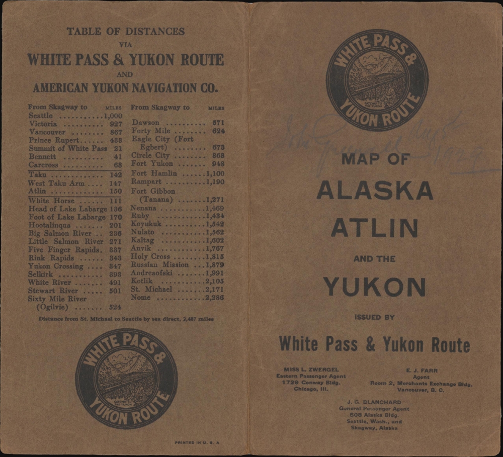
This map was originally created for and published by the White Pass and Yukon Route in 1917 with the present example representing a 1925 edition. Editions of this map began appearing in 1917 and we have located editions from 1922 and 1930. The map is well represented in institutional collections in its various editions. An example representing the 1922 edition is part of the David Rumsey Map Collection.Cartographer
Poole Brothers (1878 - 1968) were a Chicago based firm active in the late 19th and early 20th century with an initial focus on promotional railroad maps. Poole Brothers was founded by George Amos Poole (March 20, 1843 – September 7, 1918). In 1868, Poole, along with his uncle William H. Rand (1828 - 1915) and Andrew McNally (1836 - 1904), purchased the Chicago Tribune's job printing plant and formed the firm Rand McNally. In 1878, he left Rand McNally to form, with his brother William H. Poole, Poole Brothers, a direct competitor to Rand McNally for the lucrative railroad business. Like many of its competitors, Poole Brothers maintained an office on Chicago's Printer's Row (downtown Loop district). Their earliest known work is an 1880 map of Yellowstone National Park. In 1887, Poole Brothers, Andrew McNally, and several others formed the United Typothetae of America, a master printers association. In 1848, they were cited, along with Rand McNally and George Cram, by the Federal Trade Commission for price fixing. Their earliest known work is an 1880 map of Yellowstone National Park. Afterward they went on to produce a vast range of maps and other print products including tickets, cards, coupons, and restaurant menus. In time Poole Brothers merged with Newman-Randolph, which was then acquired by the American Can Company in the early 1960s. The American Can Company liquidated its printing concerns later in the same decade. More by this mapmaker...
Condition
Good. Light wear along original fold lines. Verso repairs to fold separations and at fold intersections. Closed margin tears professionally repaired on verso. Slight loss at a few fold intersections.
References
Rumsey 2384.001. OCLC 13629662.