1960 Pictorial Economic Map of Alicante and Murcia, Spain
AlicanteMurcia-grijelmo-1960$400.00


Title
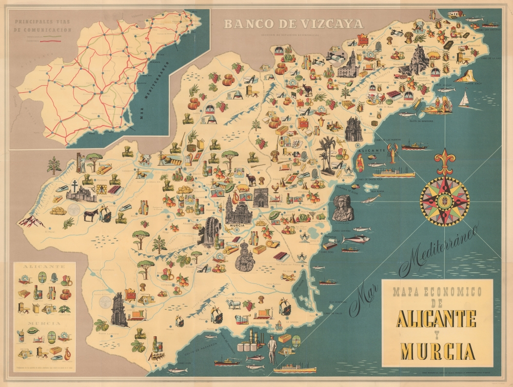
Mapa Economico de Alicante y Murcia.
1960 (undated) 24 x 32 in (60.96 x 81.28 cm)
1960 (undated) 24 x 32 in (60.96 x 81.28 cm)
Description
A scarce c. 1960 Artes Gráficas Grijelmo pictorial map of Alicante and Murcia, Spain, illustrating the regional products and economic drivers.
A Closer Look
Coverage embraces the regions of Murcia and Alicante, located in southeastern Spain on the Mediterranean. Pictorial vignettes illustrate regional products, ranging from fruits and vegetables to power, textiles, tires, shoes, rope, and seafood. An inset map in the upper left details roads and railroads throughout the region - key vectors of trade. Above the map, a subtitle reads 'Banco de Vizcaya'.Publication History and Census
This map was drawn c. 1960 by Artes Gráficas Grijelmo of Bilbao for the Banco de Vizcaya.Cartographer
Artes Gráficas Grijelmo (fl. c. 1930 - 1970) is a Basque publishing house and graphic arts firm based in Bilbao, Spain. More by this mapmaker...
Condition
Very good. Minor tear from left margin extending about 1 inch into the map, stabilized and repaired. Some margin discolorations.