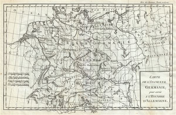
1782 Delisle de Sales Map of Ancient Germany
AncientGermany-sales-1782
Title
1782 (undated) 9 x 14 in (22.86 x 35.56 cm) 1 : 5000000
Description
At the time, 'Germania' was a name given to the lands between the Alps and the Baltic Sea. The region was inhabited mainly by Germanic, but also Celtic, Baltic, Scythian, proto-Slavic people. Caesar Augustus described the Germanic tribesmen north of the Roman Empire as extremely savage and a threat to Roman Gaul to be conquered. His Roman Legions, led by generals Germanicus and Tiberius, conquered Germania Magna to the River Elbe, and occupied it until the Romans were defeated at the Battle of the Teutoburg Forest, in 9AD. The Romans withdrew, establishing the Rhine and the Danube Rivers as Germanic boundary of the Roman Empire.
Tacitus wrote in Germania in 98 BC:
…they affirm Germania to be a recent word, lately bestowed. For those who first passed the Rhine and expulsed the Gauls, and are now named Tungrians, were then called Germani. And thus by degrees the name of a tribe prevailed, not that of the nation; so that by an appellation at first occasioned by fear and conquest, they afterwards chose to be distinguished, and assuming a name lately invented were universally called Germani .This map was issued as part of Delisle de Sales' Histoire des Hommes. Partie de l'Histoire Moderne. This volume is exceedingly rare as most of Sales' work was burnt under the censorship of heresy.
Cartographer
Jean-Baptiste-Claude Delisle de Sales or Jean-Baptiste Isoard de Lisle (1741–1816) was a French philosopher, historian, and accused heretic active in the late 18th century. Sales is best known for his publication of the multi-volume opus The Philosophy of Nature: Treatise on Human Moral Nature. The work, among other ideas, challenged the Biblical theory that the earth was created in 4004 BC. Instead, Sales put forth the theory based upon astronomical observations, that the earth was 140,000 years old. Sales' revolutionary ideas caused him to be declared a heretic by the Catholic Church. His publications were subsequently censored and, for the most part, destroyed. As a consequence all of his works are today extremely rare. Sales was also, notably, a close friend of Voltaire who in 1777 visited him in prison, gifting him 500 pounds towards his release. Delisle de Sales is unrelated to the more famous De L'Isle family of cartographers. More by this mapmaker...

