This item has been sold, but you can get on the Waitlist to be notified if another example becomes available, or purchase a digital scan.
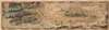
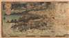
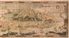
1918 Bernard Sleigh 'Ancient Mappe of Fairyland'
AncientMappeofFariyland-sleigh-1918-3$2,750.00

Title
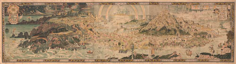
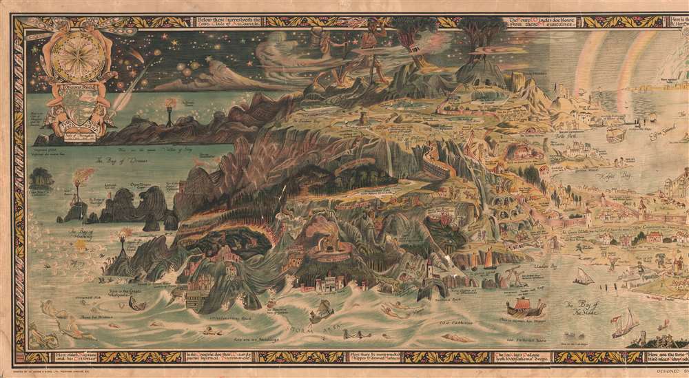
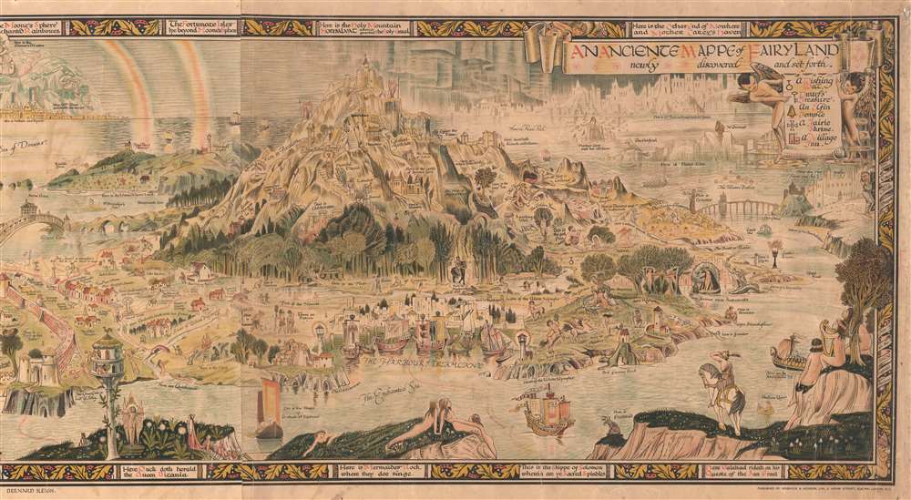
An Anciente Mappe of Fairy Land newly discovered and set forth.
1918 (dated) 20 x 73 in (50.8 x 185.42 cm)
1918 (dated) 20 x 73 in (50.8 x 185.42 cm)
Description
An extraordinary 6-foot-long masterpiece, this is Bernard Sleigh's 1918 fantastical map of Fairy Land - in tis deluxe first edition. This wonderful map offers a wide birds-eye view panorama of the island of 'Fairy Land' which it describes as 'newly discovered and set forth'. Fairy Land is a wonderful juxtaposition of European fairy tales, literature, and Greek mythology. One can travel from King Arthur's Tomb to Peter Pan's House to the 'Bay of Moaning,' or the visit the roost of Dragons, watch Perseus save Andromeda, chat with Hercules, or visit the 'Harbour of Dreamland.' A red line indicates the route of passage 'From the World' to 'a place that never was and always will be.'
As pointed out by map historian Tim Bryars, this map was printed in 1918, the final year of World War I. Bryars astutely asks,
As pointed out by map historian Tim Bryars, this map was printed in 1918, the final year of World War I. Bryars astutely asks,
Could the map constitute a yearning for a return to pre-1914 Edwardian innocence? Compared with the devastated, bomb-blasted landscape of northern France, this vision of a make-believe land may have seemed a seductive escape for a European society bearing the psychological and physical scars of mass conflict.Another approach to this map is to study it within the context of the Arts and Crafts Movement. Sleigh was a close associate of Robert Morris and this map clearly follows Arts and Crafts Movement ideology. The typeface and decoration are very much in the style of Morris's Kelmscott Press and its embrace of traditional pre-industrial era production techniques.
Publication History and Census
Sleigh's map most commonly appears folded or mounted on a board. It was designed by Bernard Sleigh, printed by Griggs and Sons of Peckham, London, and published by Sidgwick and Jackson of Adelphi London. We note six examples (which likely represent multiple different editions) cataloged in OCLC, part of the collections at the Library of Congress, the University of Illinois at Urbana Champaign, the University of Iowa, Texas A and M University, the University of Manchester, and the Bibliothèque nationale de France. Increasingly scarce to the market.Cartographer
Bernard Sleigh (1852 - December 7, 1954) was a British author, muralist, stained-glass artist, illustrator and wood engraver active in London in the late 18th and early 19th centuries. Sleigh was born in Birmingham, England and studied at the Birmingham School of art. He was a student of Arthur Gaskin. His work is deeply influenced by his early association with William Morris and the Arts and Crafts Movement. He was a member of the Royal Birmingham Society of Artists between 1923 and 1928. His most famous cartographic work is An Ancient Mappe of Fairyland, Newly Discovered and Set Forth, published at the end of the Great War or World War I. He also published several less well known maps of Birmingham and other parts of England. Sleigh retired to Chipping Campden in 1937. For those who are unacquainted with 'Chipping Campden' or 'Chippy,' in the heart of England's picturesque Cotswolds, it is a place that seems more akin to 'Fairy Land' than to the modern industrial world. More by this mapmaker...
Condition
Good. Mounted on linen. Exhibits cracking with some small areas of loss along cracks.
References
Bryers, Time, and Haper, Tom, A Histroy of the Twentieth Century in 100 Maps, pages 58-59. Boston Public Library, Leventhal Collection, G9930 1917 .S5. OCLC 65179331.