This item has been sold, but you can get on the Waitlist to be notified if another example becomes available, or purchase a digital scan.
1913 Isbell City Plan or Map of Anna Maria Beach, Anna Maria Key, Florida
AnnaMariaBeach-isbell-1913$200.00

Title
Anna Maria Beach Anna Maria Key Being part of Fractional Section 18, Township 34 S, Range 16 E. Manatee County, Fla.
1913 (undated) 9 x 11.75 in (22.86 x 29.845 cm) 1 : 2400
1913 (undated) 9 x 11.75 in (22.86 x 29.845 cm) 1 : 2400
Description
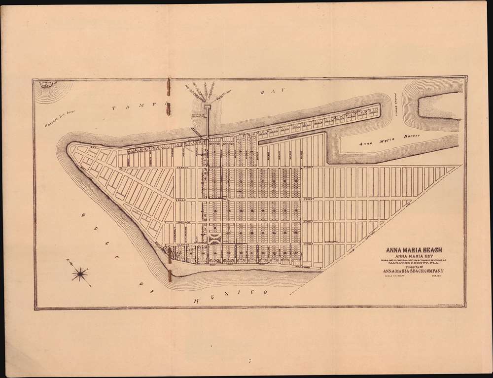
This is Charles E. Isbell's city plan or map of Anna Maria Beach, Florida - one of, if not the first, published maps of the city. Anna Marie Beach is situated on Anna Maria Island, just south of Tampa Bay. Published in a pamphlet by the Anna Maria Beach Company, real estate developers, the map provides a rough plan for the island. City blocks are laid out along a street grid and some blocks are lotted, and an air of modernity pervades. Nonetheless, due to a lack of access, the Florida Land Boom largely bypassed Anna Maria Island. It was not until after World War II that the island underwent major development.
The Anna Maria Beach Company
The Anna Maria Beach Company was founded in 1911 by George Wilhelm Bean, the son of one of the island's original homesteaders, Charles M. Roser. Roser is more famous for inventing the fig newton, the recipe for which he licensed to Nabisco. Bean hoped to turn the island into an elite resort. Inherited Fig Newton wealth financed the island's first streets, sidewalks, water system, vacation cottages, and steamship docks. In 1922 a wooden bridge was completed connecting Anna Maria Island to the mainland.Florida Land Booms
In the second half of the 19th and throughout the early 20th century, Florida experienced a series of land booms and crashes. The first followed the Second Seminole War (1835 - 1842), when the government offered homesteaders who agreed to stay five years 160 acres of free land. The second - represented on this map - follows the arrival of the railroads to central Florida, leading to nearly 15 years of prospered and economic growth - mostly revolving around the booming citrus industry. New settlements sprang up throughout the northern half of the state, many owned by absentee inventors who never personally visited Florida. The boom collapsed in 1894-95 when a series of historic freezes wiped out the citrus harvest. Property depreciation following the freezes allowed Henry Flagler (1830 - 1913) to develop the Florida East Coast Railway. This, and the arrival of the highway system in the 1920s, led to the third Florida land boom from 1920 to the stock-market crash of 1929.Publication History and Census
This map was drawn by Charles E. Isbell and published by the Anna Maria Beach Company c. 1913. An example is cataloged in OCLC and is part of the collection at the University of Florida.Cartographer
Charles Edgar Isbell (July 1863 - 1948) was an American draftsman. Born in Illinois, in 1880 Isbell was living with his family in Chicago where he worked as an elevator boy. Isbell married Helen Torrance on July 24, 1889. By 1902 he and Helen had divorced. Isbell moved to Tampa, Florida, to seek work as a draftsman. There he remarried in 1939, to a woman named Marie, apparently some 14 yeas his junior. By 1935 Isbell had retired and remained in Florida until his death. More by this mapmaker...
Source
Anna Maria Beach Co., 'Anna Maria Beach Florida's Famous Year-Round Resort,' (Lynchburg, VA: J.P. Bell Company) 1913.
Condition
Very good. Bound into original booklet. Exhibits soiling near original staples.
References
OCLC 53325749.