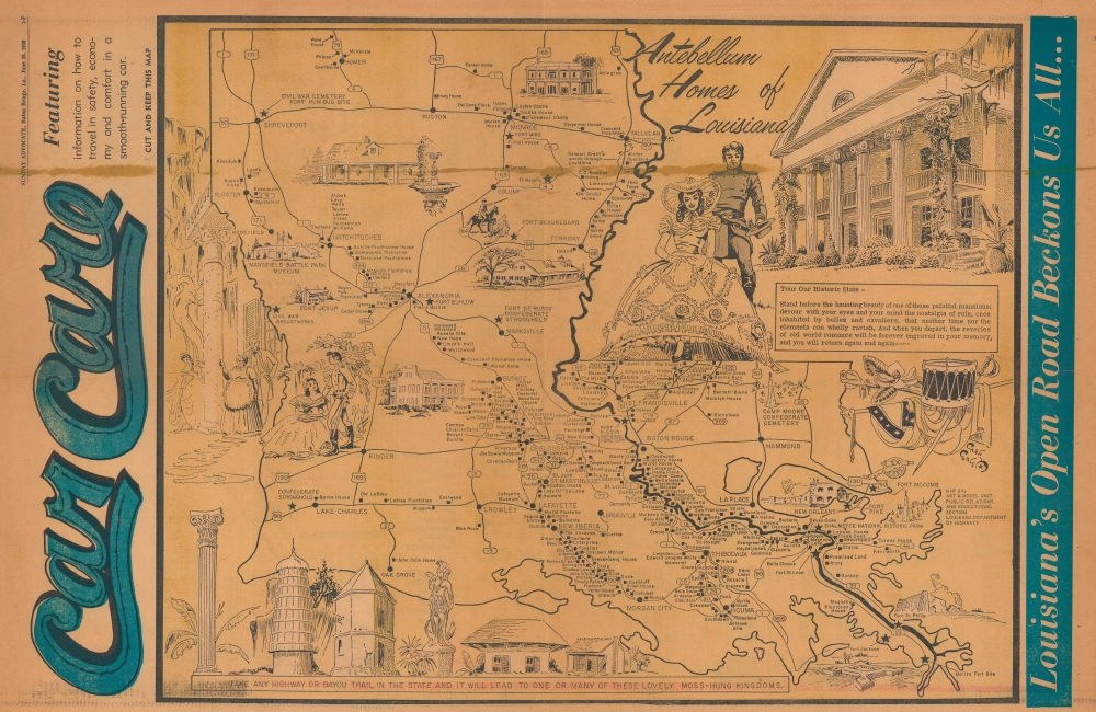
1969 Louisiana Dept. of Highways Pictorial Map of Antebellum Homes in Louisiana
AntebellumHomes-ladepthighways-1969
Title
1969 (dated) 14.25 x 22 in (36.195 x 55.88 cm)
Description
A Closer Look
Coverage embraces Louisiana with grand antebellum mansions highlighted throughout. The highest concentration of homes appears along the River Road, known as 'Millionaire's Row'. Aside from the antebellum mansions, American Civil War sites are identified with illustrations. A battle drum, saber, and Confederate flag appear along the right border, underscoring Confederate nostalgia. Vignettes of 'plantation life' complete this nostalgic aesthetic, with Southern Belles in hoop skirts and young Southern gentlemen in Confederate uniforms.Louisiana's Antebellum Plantation Houses
Over 150 plantations are on the National Registry of Historic Places in Louisiana. These plantations bring in tens of millions of dollars from tourists annually, making them a critical part of Louisiana's tourism economy. The grand plantation houses represent a 'gilded nostalgia' for the Antebellum era. Stoked by the popularity of Gone with the Wind (still the highest-grossing movie of all time when adjusted for inflation), the former plantations profited on touristic nostalgia for hoop skirts and mint juleps. Today, many of the plantations are also incorporating the stories of the enslaved, and a handful focus exclusively on the realities of slavery instead of the 'gilded' history.Publication History and Census
This map was published by the Sunday Advocate, a newspaper in Baton Rouge, Louisiana, on June 29, 1969. The original map was published by the Art and Model Unit Public Relations and Educational Section of the Louisiana Department of Highways c. 1969. It is part of a series of 4 maps of Louisiana done in the same style for the Louisiana Department of Highways, two of which (including the present map) are signed by Department of Highways illustrator Carl V. Corley. (Corley's signature is below the saber and Confederate flag near the right border.) This is the only known surviving example of the Sunday Advocate edition of this map. We note only 6 examples of the Department of Highways edition cataloged in OCLC.Cartographer
Carl Vernon Corley (December 8, 1921 - November 3, 2016) was an American artist. Born in Florence, Mississippi, Corley attended Florence High School and, after graduation, worked for the Coca-Cola Bottling Company as a sign painter for a year. Then, he enlisted in the U.S. Marine Corps and fought in World War II in the Pacific as a scout and sketcher, serving on Guadalcanal, Bougainville, Guam, and Iwo Jima. After the war, Corley returned to Mississippi and worked for the Mississippi Highway Department as a draftsman and illustrator from 1947 until 1961. He moved to Baton Rouge, Louisiana, in 1961 and worked as an engineering artist for the Louisiana Department of Transportation. He created murals, manuals, pamphlets, models, road maps, traffic surveys, and tourism posters of state resources and festivals for the Department for 20 years until he retired in 1981. Aside from his job with the Department of Transportation, Corley contributed homoerotic art to physique magazines beginning in the 1950s, including posters. After moving to Louisiana, Corley wrote more gay pulp fiction, publishing 22 erotic novels between 1966 and 1971. He published the novels and the art under his own name, a rarity for writers and artists in the genre at the time. After retirement, Corley ran the Beaux Arts Gallery out of his home in Zachary, Louisiana, and sold paintings of Louisiana wildlife and landscapes. His artistic style was influenced by French artist Gustave Doré. Duke University bought Corley's papers from him in 1998, including typescripts and published copies of his novels for the gay and lesbian studies special collection. More by this mapmaker...

