
1945 World War II-Era Thematic Map of Antwerp, Belgium: V1 and V2 Attacks

This item has been sold.
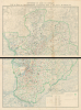
Antwerp V1 and V2 Attack Fall of Shot on Arrondissement of Antwerp from 7 OCt. 44 to 30 March 45.
V1 and V2 attacks on Antwerp after its Liberation.
Choose a Collection:
- Digital Map Information
- Suitable for large format printing
- Full resolution TIFF file
- ICC color profile embedded
- Delivered instantly via download link
This Item
Enquire
V1 and V2 attacks on Antwerp after its Liberation.
This is a c. 1945 thematic map documenting German V1 flying-bomb and V2 rocket impacts across Antwerp and its surrounding district during the closing months of World War II (1939 - 1945). Its colored impact symbols record the bombardment of a liberated city whose port had become essential to supplying the Allied advance into Germany. The map distinguishes weapon types and reported consequences, revealing how widely the attacks extended beyond the docks into residential neighborhoods, outlying villages, and open countryside.A Closer Look
Presented here in two unjoined sheets, the map covers Antwerp and the surrounding arrondissement, or administrative district. A detailed French-language topographic base supplies the underlying landscape: the winding Scheldt, the dock basins north of the city, railways, roads, settlements, woodland, and waterways. Against this subdued background, green boundaries and four colors of impact symbols bring the bombardment into the foreground.The lower-right index identifies 58 numbered communes, together with the town and port. Green linework distinguishes the arrondissement boundary from the smaller communal divisions and the limits of Greater Antwerp; a separate blue-green line identifies the operational port area. These overlapping geographies allow comparisons of the military objective with the much larger territory exposed to attack. The docks and city occupy the western portion of the mapped district, while the impact plotting extends far to their north, east, and south.
The impact key uses black for V1 strikes classified as 'causing incident' and blue for V1 'landfall only'; red and yellow-orange identify the corresponding V2 categories. Museum catalog descriptions interpret these distinctions as impacts with and without explosions, although the map itself uses broader terminology. The symbols locate individual falls, rather than measuring the extent of destruction or the number of casualties at each site.
Dense concentrations cover the urban area and its approaches, but the scattered dots across the outer communes are equally consequential. They show that the bombardment was a regional experience, extending well beyond the intended port target. The map aggregates the entire period from October 7, 1944, through March 30, 1945: individual symbols are not dated, so its emphasis is the cumulative geographical reach of the attacks rather than their daily sequence.
A Liberated City Under Bombardment
British troops liberated Antwerp on September 4, 1944, capturing its port installations largely intact. Their possession did not immediately solve the Allies' supply difficulties: German forces still controlled the Scheldt approaches, which had to be secured before shipping could reach the docks. Following the fighting in the Scheldt and subsequent minesweeping, the port opened to Allied shipping on November 28, 1944. Its proximity to the advancing armies offered an alternative to the increasingly extended supply routes from Normandy.The German V-weapon offensive sought to deny the Allies this logistical advantage. The V1 was a pilotless, jet-propelled flying bomb; the V2 was a ballistic rocket whose supersonic arrival gave those below no warning. Allied anti-aircraft defenses could intercept V1s, but offered no comparable protection against the V2. On December 16, 1944, a V2 struck the crowded Cinema Rex, killing 567 people, including both civilians and Allied servicemen.
The port remained operational, but that outcome should not obscure the demands imposed on its workers, transport services, and defenses. The specialist account Antwerp: City of Sudden Death argues:
The V-weapon campaign against Antwerp is often overlooked by military historians. The indiscriminate bombardment was certainly a terror for the civilian population of Antwerp, but it was also a monumental hindrance to Allied war planners. The Allies had six to seven armies in the field at the time that required food, petroleum, munitions, troops and all the other things needed to fight a war. It is short sighted to say the V-weapons were ineffective simply because the port of Antwerp remained open throughout the campaign…. Throughout the later portion of 1944 and well into 1945, the V-weapons severely curtailed the amount of supplies brought into Antwerp. The port never reached its expected goals, and the Allies were forced to divert ammunition and manpower to Ghent.
Publication History and Census
The map bears no cartographer's signature or publishing imprint. Its closing date establishes that it was compiled after March 30, 1945; the customary attribution to 1945 is not a printed publication date. The Canadian War Museum catalogs its example as issued after April 1945. Antwerp: City of Sudden Death attributes its preparation to Antwerp city officials immediately after the end of the war in Europe. The English title and thematic legends indicate an English-speaking audience, rather than necessarily an English-speaking maker. Its circulation among Allied personnel is independently documented by the Museum aan de Stroom: British serviceman Jack Sharp received an example in a leather carrying case after the V-weapon offensive. Sharp had helped clear unexploded weapons and repair damage in Antwerp; his son subsequently donated his map and case to the museum. Recorded institutional holdings include the American Geographical Society Library at the University of Wisconsin-Milwaukee, the National Library of Scotland, the Erfgoedbibliotheek Hendrik Conscience, and the Universiteit Antwerpen.Condition
Very good. 2 sheets unjoined. Wear along original fold lines. Light creasing. Some soiling. Verso repair to a fold separation. Closed small edge tears professionally repaired on verso. Could be joined to create large wall map. Top sheet measures 28.5x41 inches. Bottom sheet measures 25.5x41 inches.
References
OCLC 37894873, 902051253. Imperial War Museum LBY M. 79 / 172. Canadian War Museum 19710184-001. King, Benjamin, 'Antwerp and the German Attack on Allies Supply Lines 1944 - 1945', pp. 2 - 5.