This item has been sold, but you can get on the Waitlist to be notified if another example becomes available, or purchase a digital scan.
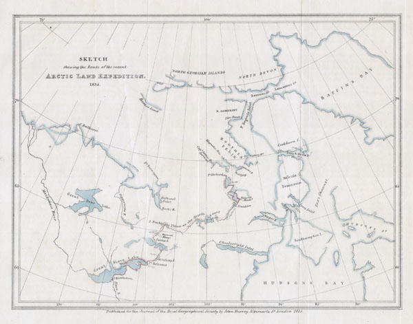
1835 Murray Map of the Arctic Land Expedition (Hudson Bay, Canada)
ArcticExp-murray-1835$80.00

Title
Sketch shewing the Route of the recent Arctic Land Expedition.
1835 7 x 9 in (17.78 x 22.86 cm)
1835 7 x 9 in (17.78 x 22.86 cm)
Description
This hard to find map, dating to 1835, was drawn by the Royal Geographical Society cartographer John Murray to illustrated the journal of the Arctic Land Expedition. Depicts the parts of Canada north of Hudson Bay to Baffin Bay in the northeast and Great Bear Lake in the west. Region depicted is only partially correct and is indicative of the early period of Arctic exploration.
Condition
Very good condition. Original folds.