This item has been sold, but you can get on the Waitlist to be notified if another example becomes available, or purchase a digital scan.
1925 Waterlow Buenos Aires Pacific Railways Railroad Map of Argentina
ArgentineRailways-waterlow-1925$500.00

Title
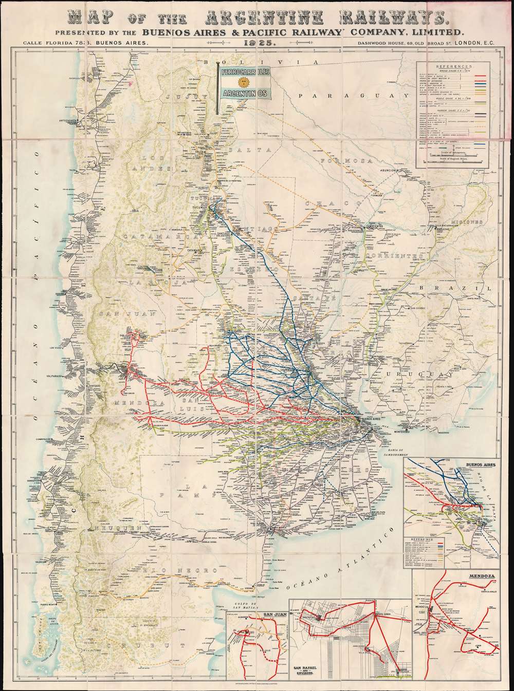
Map of the Argentine Railways. Presented by the Buenos Aires and Pacific Railway Company, Limited.
1925 (dated) 40 x 29.5 in (101.6 x 74.93 cm) 1 : 2900000
1925 (dated) 40 x 29.5 in (101.6 x 74.93 cm) 1 : 2900000
Description
This is a striking 1925 chromolithograph railroad map of Argentina and Chile. The map covers from Atlantic to Pacific and from Tocopilla to Isla Chiloe and Rawson. Railroad lines are coded by color and design, with a focus, in red, on the routes operated by the Buenos Aires and Pacific Railway - who sponsored this map. This map was likely made to spur additional British investment in Argentine railroad infrastructure - much of which was already heavily leveraged to British consortiums. Insets in the lower right detail railroad connections in Buenos Aires, Mendoza, San Juan, and San Rafael.
Buenos Aires and Pacific Railway
The Buenos Aires and Pacific Railway Co. Ltd. (BAPRO) was a 'Big Four' British-owned, broad railroad serving the Cordoba, San Luis, and Santa Fe provinces of Argentina. The railroad was founded in 1872 by John E. Clark, who received a concession from Argentina to connect Buenos Aires to Chilean railroad networks. The line between Buenos Aires and Valparaiso, Chile, was completed in 1910 when a link between Mendoza and Santa Rosa de Los Andes was opened by the Transandino Railway Company. The completion of this connection fulfilled a long-held ambition dating to at least the early 18th century, when explorers and investors began agitating for a practical route between the Rio de la Plata and Valparaiso - thus eliminating the need to transport goods by treacherous maritime routes around Cape Horn or by wagon over the Andes. The railroad continued to grow and expand its network in Argentina, purchasing smaller connecting railroads and building new lines. It was a 'Bit Four' railroad, one of four privately-owned British-run railroads that comprised the main trunk of the Argentine railroad network. In addition to the BAPRO, there were the Buenos Aires Western Railway, Buenos Aires Great Southern Railway, and Central Argentine Railways - all of which appear on this map. The BAPRO operated until 1948, when President Juan Peron nationalized the Argentine Railway system.Chromolithography
Chromolithography is a color lithographic technique developed in the mid-19th century. The process involved using multiple lithographic stones, one for each color, to yield a rich composite effect. Oftentimes, the process would start with a black basecoat upon which subsequent colors were layered. Some chromolithographs used 30 or more separate lithographic stones to achieve the desired product. Chromolithograph color could also be effectively blended for even more dramatic results. The process became extremely popular in the late 19th and early 20th centuries, when it emerged as the dominate method of color printing. The vivid color chromolithography produced made it exceptionally effective for advertising and propaganda imagery.Publication History and Census
This map was first published by Waterlow and Sons of London and Buenos Aires around 1913 and went through multiple editions through the present example, 1925. Nonetheless, the map appears rarely. We note one example of the 1913 edition at the University of Toronto, and the OCLC cites examples of the present 1925 edition at the British Library St. Pancras, the Staatsbibliothek zu Berlin, and the University of Cambridge.Cartographer
Waterlow and Sons (1810 - 1961) was a British engraving and printing concern active in London specializing in currency, postage stamps, bond certificates, and occasionally maps. The firm was founded by James Waterlow (1790 - 1876) in 1810 on Birchin Lane, London, as a legal document printer and copyist. By 1852, they had expanded into stamps and his sons, Albert, Alfred, Sydney, and Walter joined the business. One year after James Waterlow's death, in 1877, infighting among the sons led Alfred Waterlow to split off, forming Waterlow Brothers and Layton. The rift was settled by 1920, and the two firms once again merged under the Waterlow and Sons imprint. They were involved in the Portuguese Bank Note Affair of 1925, wherein the Portuguese fraudster Artur Virgílio Alves Reis convinced the firm to print 200,000 banknotes of 500 Portuguese Escudos each, amounting to roughly 88% of Portugal's GDP. The affair was settled in court with a ruling against Waterlow. In 1928, Waterlow lost its most lucrative contract, printing English banknotes, and began to fall into decline. In 1961, they were acquired by Purnell and Sons who, shortly afterwards, sold the firm to De La Rue. Ironically, De La Rue acquired the contract to print Bank of England banknotes again in 2003 – 75 years after Waterlow lost it! More by this mapmaker...
Condition
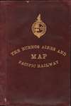
Very good. Some discoloration from glues used to apply linen backing. Bleed from red leather binder upper right. Detached from binder, which is itself worn and damaged where originally attached to map.
References
OCLC 556319610. University of Toronto, G5351 .P3 2900 1912-13.