1885 Iron Mountain Railway Map of Arkansas Land Grants For Sale
Arkansas-ironmountain-1885$650.00


Title
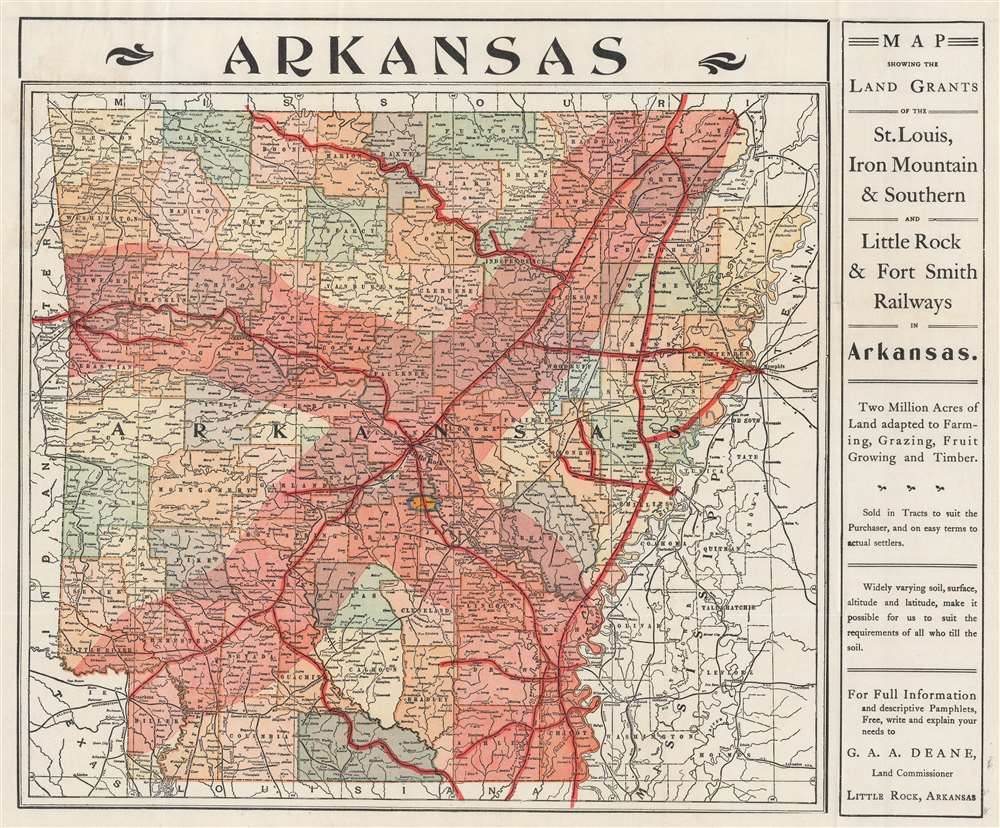
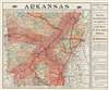
Map Showing the Land Grands of the St. Louis, Iron Mountain and Southern, and Little Rock and Fort Smith Railways in Arkansas.
1885 (undated) 13.5 x 16.5 in (34.29 x 41.91 cm) 1 : 1382400
1885 (undated) 13.5 x 16.5 in (34.29 x 41.91 cm) 1 : 1382400
Description
An intriguing document, with map and letter, regarding railroad grant and early town development in Arkansas. Published in 1885 by the Land Department of the Iron Mountain Railway in Little Rock, Arkansas, this map of Arkansas highlights land for sale by the Iron Mountain Railway. All rail lines are highlighted in dark red. A lighter shade of red emanates outward along both sides of most of the rail lines, illustrating where railroad land grants are located and available for purchase.
Accompanying Documents
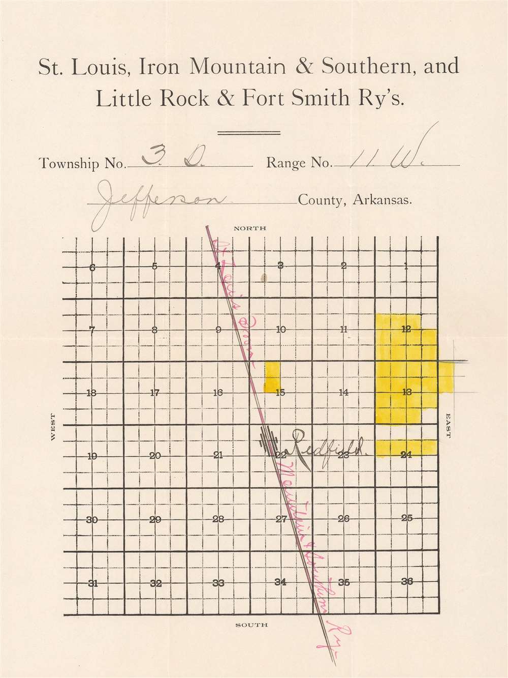
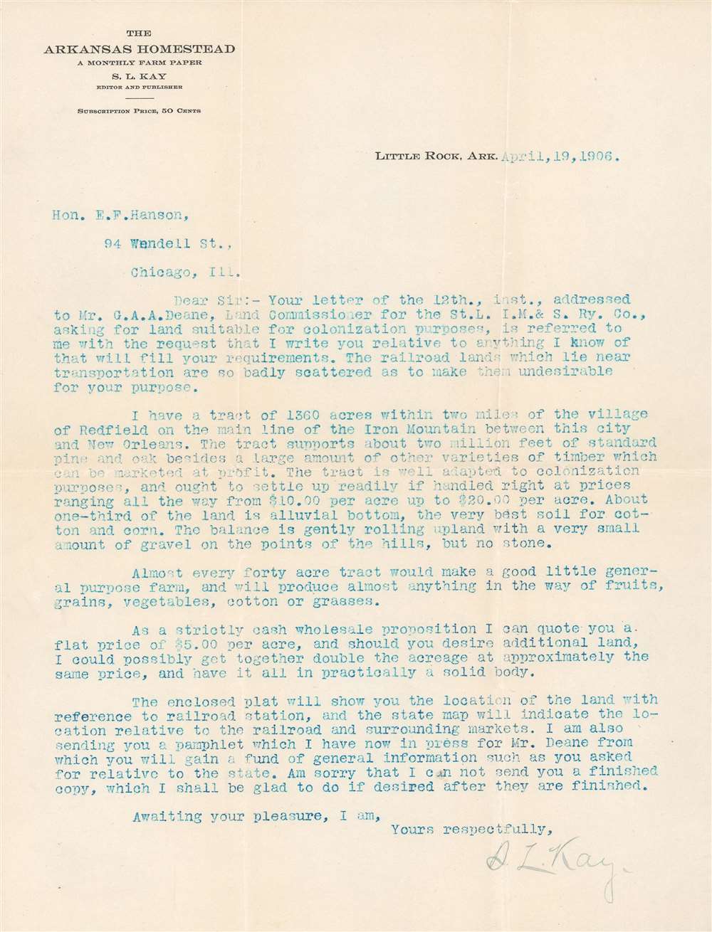
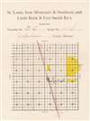
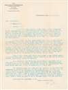
This particular map is accompanied by a letter from Mr. S. L. Kay to a Mr. E. F. Hanson concerning purchasing land for 'colonization'. Mr. Kay proposed a 1360-acre tract two miles from Redfield, Arkansas, on the Iron Mountain main line. He included a small map of the proposed land, which is also present. In his letter, Mr. Kay proposed that Mr. Hanson purchase the land at a wholesale rate and even offered pricing.The St. Louis, Iron Mountain, and Southern Railway
Frequently referred to simply as the Iron Mountain Railway, the St. Louis, Iron Mountain, and Southern Railway operated in Missouri and Arkansas from 1874 until 1917. The railroad connected St. Louis, Missouri, and Texarkana, Arkansas, and was originally established to transport iron ore from Iron Mountain, Missouri, to St. Louis. Jay Gould bought the railroad in 1883. The Iron Mountain ceased to exist as an independent railroad after it was merged into the Missouri Pacific Railroad on May 12, 1917. The Iron Mountain Railway was robbed twice. First on January 31, 1874, by the James-Younger Gang at Gad's Hill, Missouri, and then on November 3, 1893, by the 'One-Time Train Robbery Gang' at Olyphant, Arkansas.Railroad Land Grants
In the mid to late 19th century, both the Federal government and state governments encouraged railroad construction by offering land grants to railroad companies. Nearly all land in the western United States was surveyed into one square mile sections. Every other section on either side of the proposed railroad route was granted to the railroad. This checkerboard pattern extended twenty miles on either side of the route. Then, railroads opened land offices and advertised extensively to sell land at an enormous profit.Publication History and Census
This map was issued by the Land Department of the Iron Mountain Railway in 1885. Two examples appear in OCLC and are part of the institutional collections at Yale University and the University of Texas at Arlington. Another example is part of the institutional collection at the Arkansas State Archives. The added letter makes this piece unique.Condition
Very good. Even overall toning. Accompanied by original binder, typed letter, and plat map.
References
OCLC 709802636.