This item has been sold, but you can get on the Waitlist to be notified if another example becomes available, or purchase a digital scan.
1906 Survey of India Map of East Bengal and Assam, India
AssamBengal-surveyofindia-1906$825.00

Title
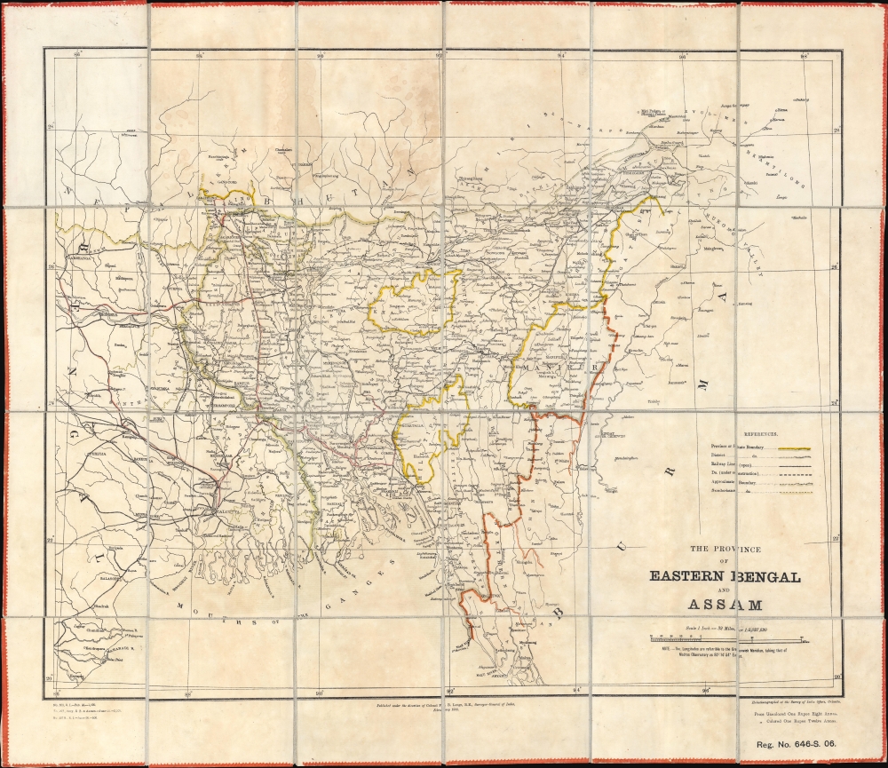
The Province of Eastern Bengal and Assam.
1906 (dated) 22.25 x 25.25 in (56.515 x 64.135 cm) 1 : 2027520
1906 (dated) 22.25 x 25.25 in (56.515 x 64.135 cm) 1 : 2027520
Description
This is a rare 1906 Survey of India map of 'East Bengal and Assam', an ephemeral Muslim-majority province created by the 1905 Partition of Bengal. The 1905 Partition of Bengal ignited both Indian-Hindu and -Muslim nationalism, influencing the 1947 Partition of India and the creation of East Pakistan and, eventually, Bangladesh.
A Closer Look
The map illustrates the Muslim-majority province of 'East Bengal and Assam', created in 1905. Calcutta, then the capital of British India, appears just outside the province's borders. The extensive railroad network in and around Calcutta and to the north is illustrated. When compared with the lack of railroads in East Bengal, the disparity is striking.1905 Partition of Bengal and the Province of 'Eastern Bengal and Assam'
The British Raj announced the First Petition of Bengal on July 20, 1905, creating the provinces of West Bengal, with a majority Hindu population, and 'East Bengal and Assam', with a majority Muslim population. While the British colonial government asserted that division was purely administrative (the Bengal Presidency was a huge geographic area), Bengalis saw the religion-themed segregation as a 'divide and rule' policy. This sentiment inflamed both Bengali and Hindu nationalism, leading to a reinvigorated Indian National Congress. Hindus viewed the partition with disdain and loudly voiced their discontent. Simultaneously, Muslims in 'East Bengal and Assam', although supportive of the new province, considered the 'divide and rule' stratagem an attack on Bengali nationalism. The partition also led to the creation of the All India Muslim League and helped foment Muslim nationalism within India. The partition lasted for six years, ending in 1911, when King George V announced that eastern Bengal would rejoin the Bengal Presidency. Nonetheless, the 1905 Partition inspired the creation of East Pakistan in the 1947 Partition of India and the 1971 emergence of Bangladesh.Publication History and Census
This map was created and published by the Survey of India in February 1906 under the direction of Francis Bacon Longe, Surveyor-General of India. We note 5 examples cataloged in OCLC: the Library of Congress, the National Library of Scotland, the University of Manchester, the University of Oxford, and the British Library.CartographerS
Survey of India (1767 - Present) is India's central engineering agency in charge of mapping and surveying the country. It was founded in 1767 by Major James Rennell, who took the post of first Surveyor General, with the mission to map and consolidate the territories of the British East India Company. The Survey undertook the Great Trigonometrical Survey between 1802 and 1852 in an attempt to accurately measure the Indian Subcontinent - considered one of the greatest feats of mapping of all time. It also sponsored clandestine surveys, at times disguised as Buddhist pilgrims, to infiltrate and map Tibet, then a closed country. With India's independence in 1947, the Survey was folded into the new Indian government, which it remains part of to this day. More by this mapmaker...
Francis Bacon Longe (October 31, 1856 - June 2, 1922) was a British surveyor, cartographer, and military officer. He attended Cheltenham College before entering the Royal Military Academy Woolwich at the end of 1873. He received his commission in 1876 and joined the Royal Engineers and volunteered for service in India. After arriving in India in January 1879, he received orders to Jellalabad, Afghanistan, and was soon assigned the the 7th Company, Bengal Sappers and Miners. His unit fought in the Second Anglo-Afghan War and Longe was among the first troops to enter Kabul. He was appointed to the Survey of India in 1880, and surveyed around Kabul and Kandahar in 1880 and 1881. He worked in Mysore and the United Provinces from 1881 until 1885, when he was appointed Personal Assistant to the Surveyor-General and sent to Calcutta. He served as Survey Officer on several survey missions, including the 1894 Chin-Manipur Commission. He was appointed Assitant Surveyor-General in 1896 and served as Survey Officer for the 1897-1898 Burma-China Boundary Commission. He was appointed Deputy Surveyor-General in 1900. He served as Surveyor-General of India from 1904 through 1911 when he held the rank of lieutenant colonel. He died in London in 1922. While in India he fell in love with May Ethel Marion Calliope, an English woman that had been born in Bengal who was already married with two sons. She divorced her first husband (a Mr. Sankey) and she and Longe married almost immediately after it was final on March 31, 1905. Their marriage did not produce any more children. Learn More...
Condition
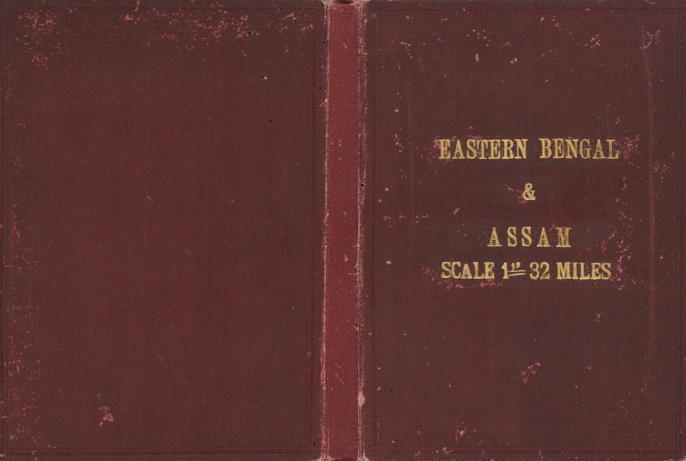
Good. Dissected and mounted on original linen in 24 panels. Toning. Light dampstaining.
References
OCLC 48597537, 557222892.