This item has been sold, but you can get on the Waitlist to be notified if another example becomes available, or purchase a digital scan.
1931 National Development Bureau Road Map of New England, Ontario, Quebec
AtlanticSheet-natdevbureau-1931$62.50

Title
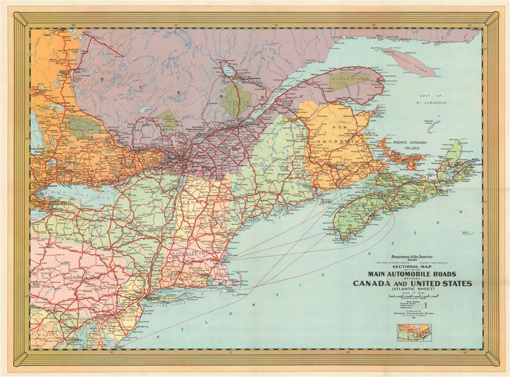
Sectional Map Indicating Main Automobile Roads Between Canada and United States (Atlantic Sheet).
1931 (dated) 28.75 x 38.75 in (73.025 x 98.425 cm) 1 : 1900800
1931 (dated) 28.75 x 38.75 in (73.025 x 98.425 cm) 1 : 1900800
Description
This is a National Development Bureau road map of New England and Ontario, Quebec, and the Maritime Provinces. Depicting the region from Georgian Bay to the Atlantic Ocean and from Iroquois Falls, Ontario, to Washington, D.C., the map highlights road connections between the two countries. Red lines representing major highways meander their way across the continent. Green splotches marking provincial and national parks in Canada stand out against the multicolored Canadian provinces. Dashed lines trace sea lanes between New York, Boston, and Philadelphia and New Brunswick and Nova Scotia.
Publication History and Census
This map was created by the National Development Bureau, which took charge of promoting tourism in Canada in the early 1930s, and published in 1931. Nine examples are cataloged in OCLC and are part of the collections at the Connecticut State Library, the University of Connecticut, Harvard College, the University of New Hampshire Durham, the Osher Map Library at the University of Southern Maine, the University of Chicago, the Newberry Library, the Wisconsin Historical Society, and the University of Florida.Condition
Very good. Light wear and toning along original fold lines. Blank on verso.
References
OCLC 56524538.