
This item below is out of stock, but another example (left) is available. To view the available item, click "Details."
Details
1862 Johnson Map of Australia
1862 (undated) $150.00
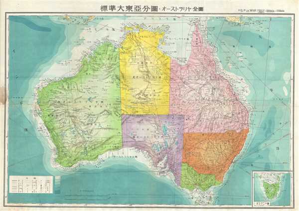
1943 or Showa 18 World War II Era Japanese Map of Australia
Australia2-showa18-1943$150.00

Title
Australia.
1943 (undated) 20 x 29 in (50.8 x 73.66 cm) 1 : 7500000
1943 (undated) 20 x 29 in (50.8 x 73.66 cm) 1 : 7500000
Description
This is an attractive Japanese map of Australia dating to World War II. Issued in 1943, the map covers the entirety of the continent with color-coding according to state. Offers superb detail regarding both topographical and political elements. Notes cities, roads, trade routes on air, sea and land, and uses shading to display oceanic depths. While Allied World War II maps of this region are fairly common it is extremely rare to come across their Japanese counterparts. All text is in Japanese. This map was created by the Japanese during World War II and was issued as map no. 15, part of a 20 map series detailing of parts of Asia and the Pacific.
Condition
Very good. Minor wear and toning along original fold lines. Minor creasing near title. Accompanied by original cover no. 15.