This item has been sold, but you can get on the Waitlist to be notified if another example becomes available, or purchase a digital scan.
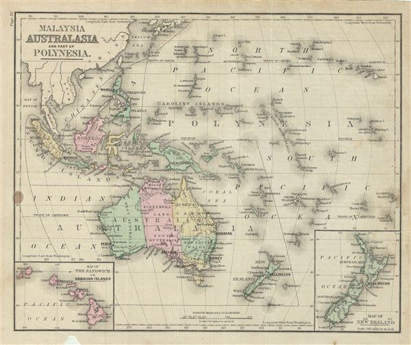
1879 Warren Map of Australia and Polynesia
AustraliaPolynesia-warren-1879$35.00

Title
Malaysia Australia and Part of Polynesia.
1879 (undated) 9.5 x 11.5 in (24.13 x 29.21 cm)
1879 (undated) 9.5 x 11.5 in (24.13 x 29.21 cm)
Description
This is an example of David M. Warren's 1879 map of Australia and Polynesia. It covers Australia, Polynesia, Melanesia and Malaysia. An inset in the lower left quadrant depicts the Sandwich or Hawaiian Islands. Another inset in the lower right quadrant features New Zealand. This map depicts the continent of Australia with good detail along the coast and a largely unexplored interior and divided into its provincial divisions of North Australia, West Australia, South Australia, New South Wales, Victoria, Alexandra Land and Queens Land. Throughout, the map identifies various cities, towns, rivers, deserts, islands, mountain passes and an assortment of additional topographical details. The map is color coded according to regional and political boundaries with elevation rendered by hachure. Issued as page 93 in the 1879 edition of Warren's Common-School Geography.
Source
Warren, D. M., Common School Geography, 1879.
Condition
Very good. Even overall toning. Text on verso. Verso repair at few places near margins. Some foxing.