1947 Lindblad Pictorial Map of Australia, New Zealand, and Indonesia
Australien-lindblad-1947$1,500.00


Title
Australien i bilder.
1947 (undated) 67 x 51 in (170.18 x 129.54 cm) 1 : 3700000
1947 (undated) 67 x 51 in (170.18 x 129.54 cm) 1 : 3700000
Description
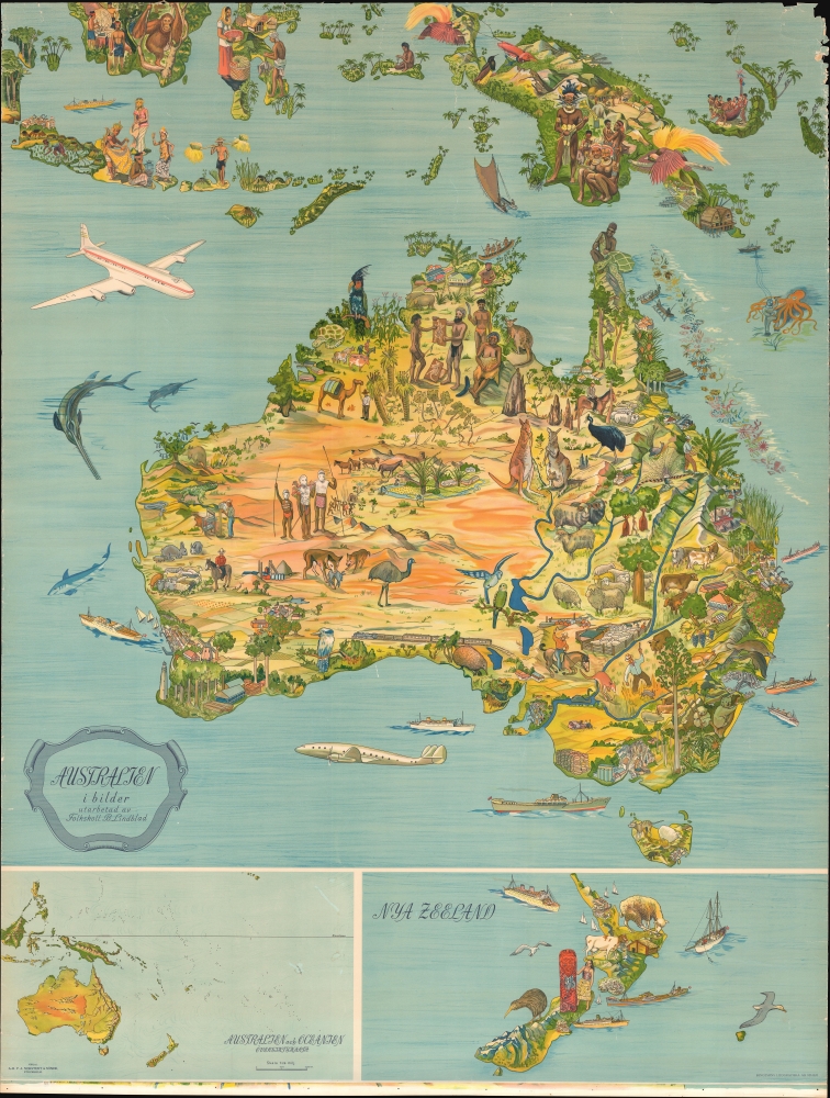
This is a c. 1947 B. Lindblad pictorial map of Australia, New Zealand, and Indonesia.
A Closer Look
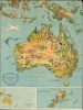
The map depicts from Sumatra to eastern Australia and from Borneo and Sulawesi to Tasmania. Beautifully illustrated, Australia's native celebrated flora and fauna populate the map: emu, parakeets, kangaroos, koalas, echidnas, bearded dragons, platypus, and a kookaburra, etc. A Tasmanian devil and the now-extinct Tasmanian tiger appear in Tasmania. Though unlabeled, cities are illustrated in profile throughout, including Sydney with its famous harbor bridge. The Great Barrier Reef, with stunning corals, is illustrated off the northeast coast. Aboriginal people appear throughout. Two inset maps at the bottom depict New Zealand and Greater Oceania.Dating the Map and Publication History
Though undated, the illustration of a Douglas C-74 Globemaster narrows the date. The C-74 was a cargo aircraft built by the Douglas Aircraft Company between 1945 and 1947. The second, more iconic aircraft, located just below Australia, is a Lockheed Constellation, built between 1943 and 1958. The Constellation holds the distinction of being the first commercial airliner with a pressurized cabin. The first Constellation to enter commercial service was delivered to TWA in October 1945. Qantas, an Australian airline, took delivery of their first Constellation in October 1947.Publication History and Census
This map was created by B. Lindblad and published by P.A. Norstedt and Söner c. 1947. We have been unable to locate any examples in institutional collections. Scarce on the private market.Cartographer
Per Adolf Norstedt (January 28, 1763 - September 20, 1840) was Swedish merchant and publisher based in Stockholm, Sweden. Per Adolf founded Norstedt in 1821 with the acquisition of the Lindhska Publishing concern. He brought his sons, Carl and Adolf, into the business in 1823, renaming it P. A. Norstedt och Söner. In 1833, the firm took over all publications for the Royal Family, becoming the de facto state publisher. When Carl and Adolf died, both without an heir, the company fell to Emilia Norstedt, a nice of Per Adolf, who brought her husband, Gustaf Philip Laurin (1808–1859), and three children, Gösta Laurin (1836–1879), Carl Laurin (1840–1917) and Albert Laurin (1842–1878), into the business. Carl, who was trained as a civil engineer, upgraded the printing processes with advanced lithographic presses and modernized the overall operations. Today Norstedt it is the oldest and one of the largest continuously active publishers in Sweden. More by this mapmaker...
Condition
Good. Mounted on linen. Wear and some loss along edges. Some crackling.