This item has been sold, but you can get on the Waitlist to be notified if another example becomes available, or purchase a digital scan.
1946 Moulder Pictorial Map of Barbados
Barbados-moulder-1946$125.00

Title
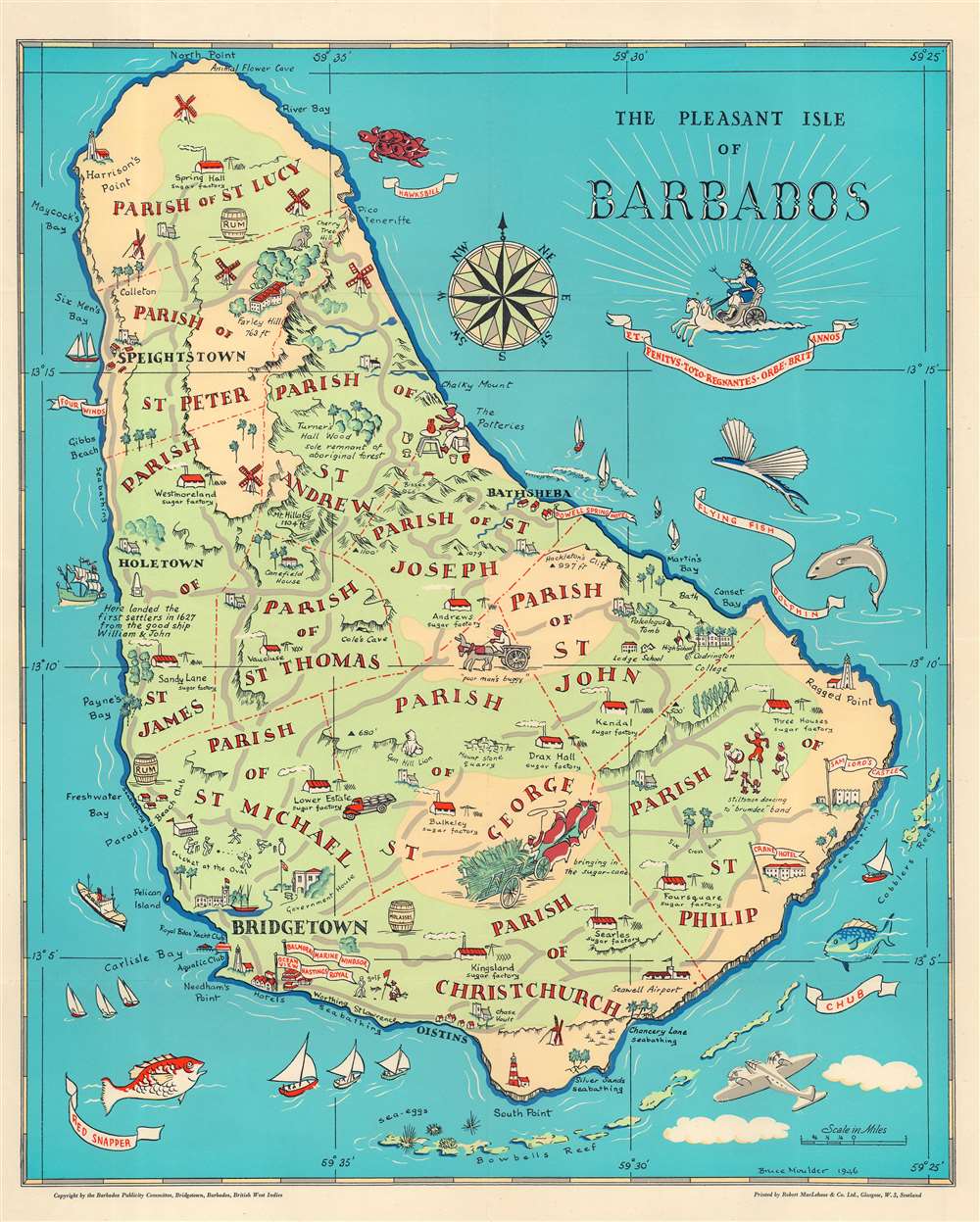
The Pleasant Isle of Barbados.
1946 (dated) 21.25 x 17.25 in (53.975 x 43.815 cm) 1 : 63360
1946 (dated) 21.25 x 17.25 in (53.975 x 43.815 cm) 1 : 63360
Description
This is a 1946 Bruce Moulder pictorial map of Barbados. Pictorial icons illustrate the island's sugar factories, windmills, and lighthouses. Other illustrations mark hotels, important buildings (such as the Government House in Bridgetown), and the Seawell Airport. A handful of short descriptions provide historical information. Beaches where swimming is possible are noted with the word 'seabathing'. Red dotted and dashed lines separate the island's parishes, each of which is labeled. The Caribbean's diverse sea life encircles the map, with a hawksbill turtle, a flying fish, and a red snapper illustrated.
Publication History and Census
This map was drawn by Bruce Moulder, printed by Robert MacLehose and Company in Glasgow, and published by the Barbados Publicity Committee. We note three examples cataloged in the OCLC, at the University of Michigan, the University of Illinois at Urbana Champaign, and the Universiteitsbibliotheek Leiden.Cartographer
Richard Bruce Moulder (1907 - May 5, 1966) was a British architectural designer born in British Guiana. Very little is definitively known about Moulder, but our research indicates that he spent most of his life on Barbados. He married Mary Gwendoline Pitcher in 1933, with whom he had two children, at least one of them a daughter. He died in Barbados in 1966. More by this mapmaker...
Condition
Very good.
References
OCLC 236425224.