1915 Republic of China Internal Affairs Map of Beijing, China w/suburbs
BeijingSuburbs-roc-1915$2,500.00

Title
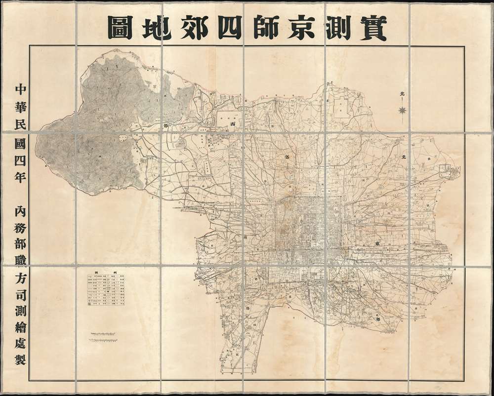
Surveyed Map of Beijing and the Four Suburbs. / 實測京師四郊地圖
1915 (dated) 43.5 x 54.25 in (110.49 x 137.795 cm) 1 : 36200
1915 (dated) 43.5 x 54.25 in (110.49 x 137.795 cm) 1 : 36200
Description
An extraordinarily detailed large format 1915 (Mingou 4) map of Beijing and its 4 suburbs (East, West, North, South) issued by the Republic of China Ministry of Internal Affairs. At the time these regions were being incorporated under the administrative sovereignty of Beijing, but at the same time, operated somewhat independently, with separate regional governance and policing forces. Coverage extends from the old walled city to the surrounding areas, reaching as far northwest as today's Yangtaishan Scenic Area, east to (roughly) Xinggu, and south to Xihongmenzhen, encompassing the 'suburban' surroundings of the Republic's capital. This map was intended for administrative use and offers impressive detail throughout, naming different types of terrain and topographical detail, as well as illustrating transportation networks, administrative infrastructures (schools, electrical lines, etc.), mercantile infrastructure (shops, factories), and policing districts.
Publication History and Census
The map was probably engraved and published before August, when the Republic of China was replaced by short-lived resuscitation of the Empire of China under, Yuan Shikai, the Hongxian Emperor (洪憲皇帝). It was prepared by the Surveying and Mapping Office, Staff Division, of the ROC Ministry of Internal Affairs. Examples are scarce. There is an OCLC reference, but no identified holdings. We are aware of at least one example at the Beijing University, on in Taiwan, and a third in Kyoto.Condition
Good. Some minor discoloration and toning. Old linen backing replaced with fresh conservator linen. Some edge wear along old folds.
References
OCLC 301940264.