This item has been sold, but you can get on the Waitlist to be notified if another example becomes available, or purchase a digital scan.
1954 Syco Publicite City Map or Plan of Beirut, Lebanon
Beirut-syco-1954$175.00

Title
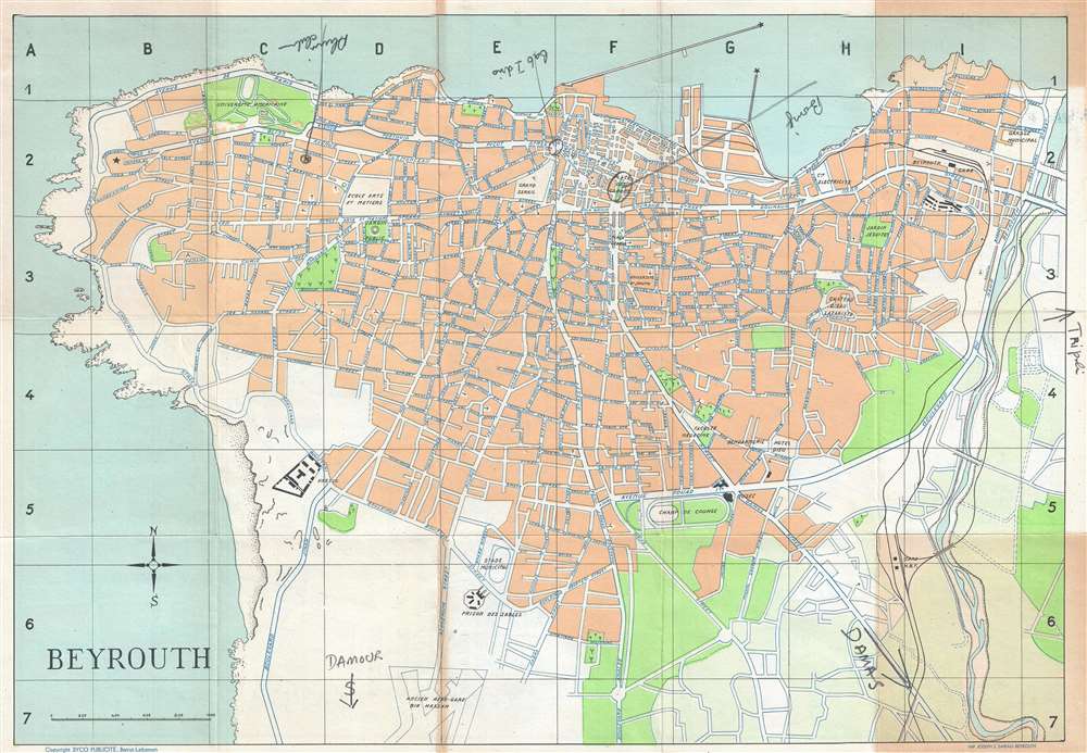
Beyrouth.
1954 (undated) 13.25 x 19.5 in (33.655 x 49.53 cm) 1 : 14500
1954 (undated) 13.25 x 19.5 in (33.655 x 49.53 cm) 1 : 14500
Description
This is a 1954 Syco Publicité city map or plan of Beirut (Beyrouth), Lebanon. The map depicts the city from the Mediterranean Sea to the Beirut River and from the Mediterranean Sea to the old Bir Hassan Airfield. Created just over ten years after Lebanon achieved independence, the map bears a mix of Arabic, French, and English street names, and most sites of interest to tourists are labeled in French. Some of these include the École Arts et Metiers, the Université Américaine, the jardin public, and the jardin jesuite. Manuscript notations are also present which highlight to Place des Canons, the Alum(?) Club, and the roads to Tripoli and Damascus.
This map was created and published by Syco Publicité and published in Beirut.
This map was created and published by Syco Publicité and published in Beirut.
Source
New Guide of Beirut with Plan and Index to Streets'. (Beirut: Syco Publicité) 1954.
Condition
Very good. Toning to upper and lower right corners. Map of central Beirut on verso. Accompanied by original booklet.
References
Library of Congress Call Number 2014592386, Shelf Order G7474.B4 1954.