This item has been sold, but you can get on the Waitlist to be notified if another example becomes available, or purchase a digital scan.
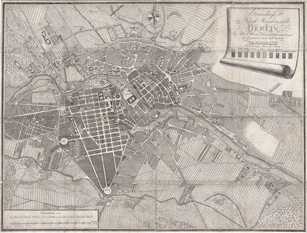
1786 Sotzmann Map of Berlin, Germany
Berlin-sotzmann-1786$475.00

Title
Grundriss der Königl. Residenzstädte Berlin im Jahre 1786 von neuen zusammengetragen und gestochen durch D. F. Sotzmann.
1786 (dated) 13 x 17.5 in (33.02 x 44.45 cm) 1 : 16000
1786 (dated) 13 x 17.5 in (33.02 x 44.45 cm) 1 : 16000
Description
An extremely scarce 1786 map of Berlin, Germany by F. Nicolai and D. F. Sotzmann. This appears to be a first edition. Centered on the Spree River, this map covers central Berlin and the surrounding farmland as it existed in the late 18th century. Streets, city blocks, and important buildings are labeled. Soltzmann also introduces the innovative and uncommon labeling technique of using different forms of hachuring to identify urban zones. In all there are 10 different forms of hachuring, each representing a different part of the city. A key to this appears below the title in the upper right. Soltzmann issued another edition of this map, with similar but updated cartography and a more detailed key in 1798.
Condition
Good. Originally folded with considerable wear along old fold lines. Since flattened and backed on archive tissue. Minor loss at some fold intersections.
References
Zentral- und Landesbibliothek Berlin: B 54/1786/2. OCLC 254073748.

