This item has been sold, but you can get on the Waitlist to be notified if another example becomes available, or purchase a digital scan.
1859 Colton / Ondarza Folding Wall Map of Bolivia - a seminal map!
Bolivia-colton-1859-2$3,500.00

Title
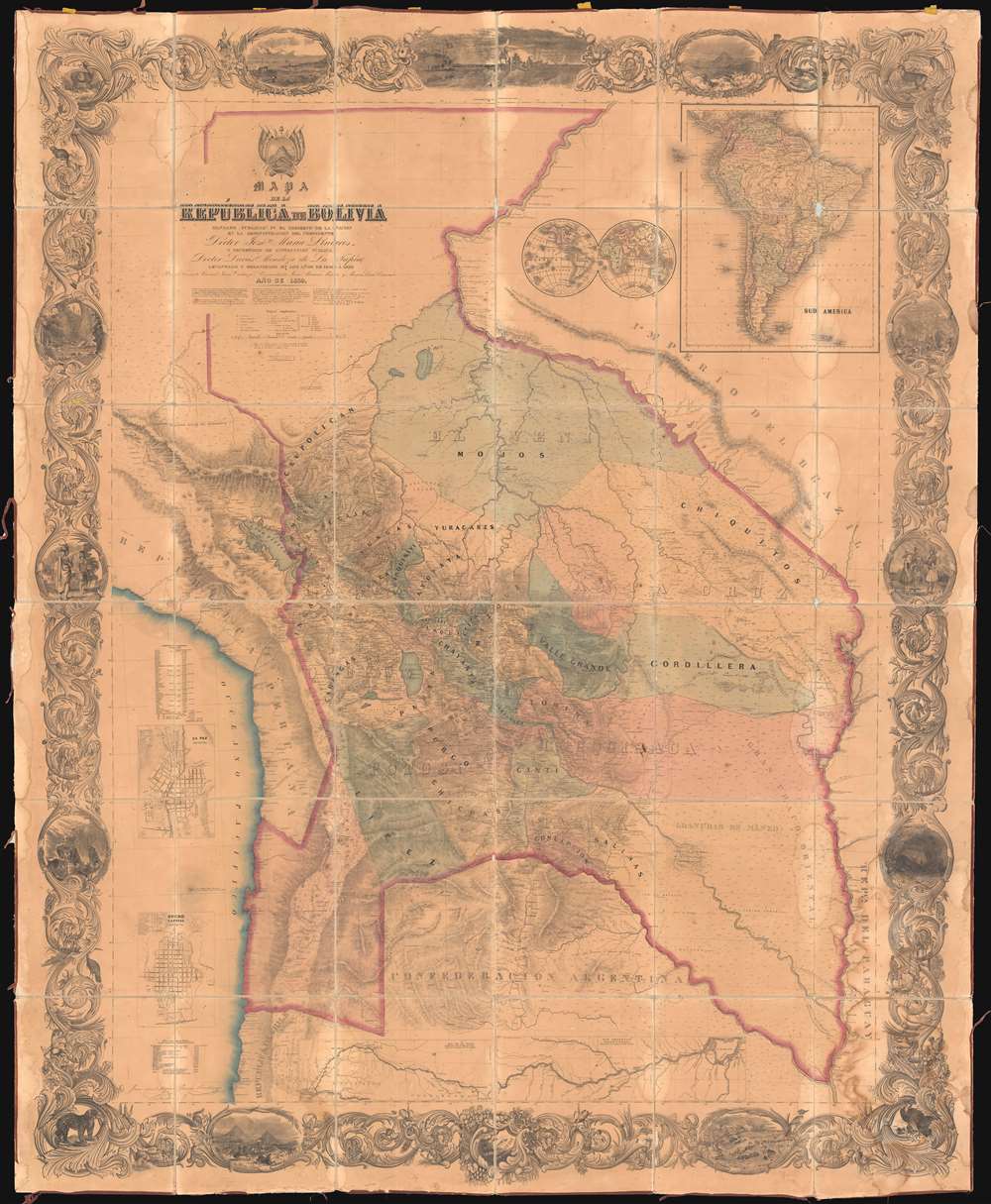
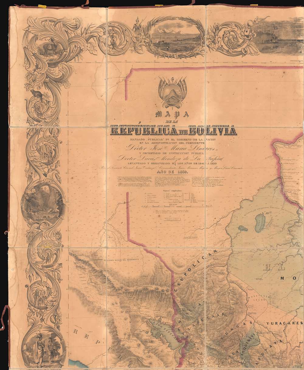
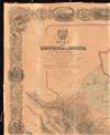
Mapa de la Republica de Bolivia mandado publicar pr el Gobierno de la Nacion en la Administracion del Presidente Doctor José Maria Linares... Levantado y organindo en los años de 1842 à 1859 Por el Teniente Coronel Juan Ondarza, Commandante Juan Mariano Mujia y Mayor Lucio Camacho.
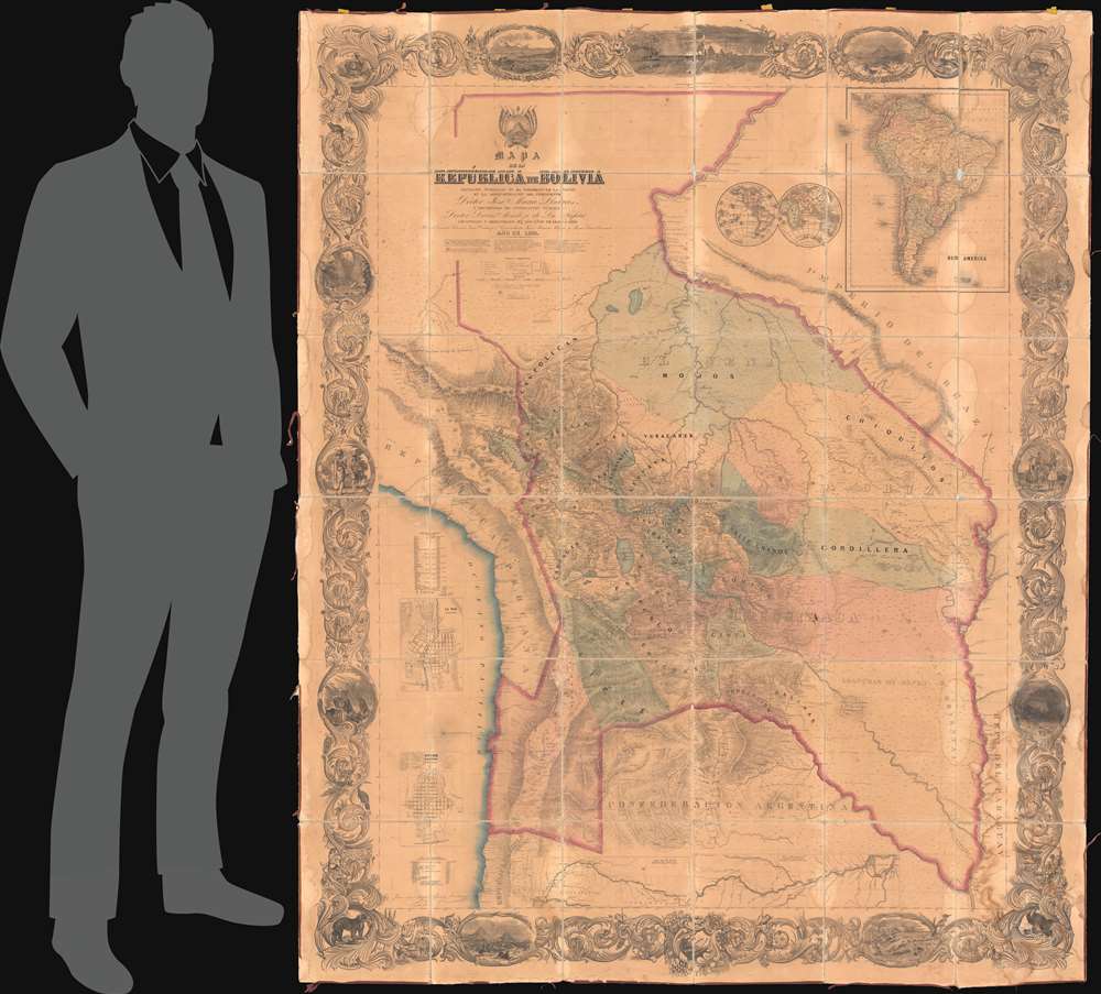
1859 (dated) 71.5 x 58 in (181.61 x 147.32 cm) 1 : 1575000
1859 (dated) 71.5 x 58 in (181.61 x 147.32 cm) 1 : 1575000
Description
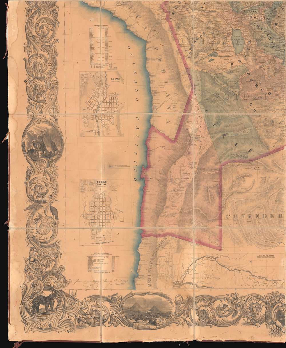
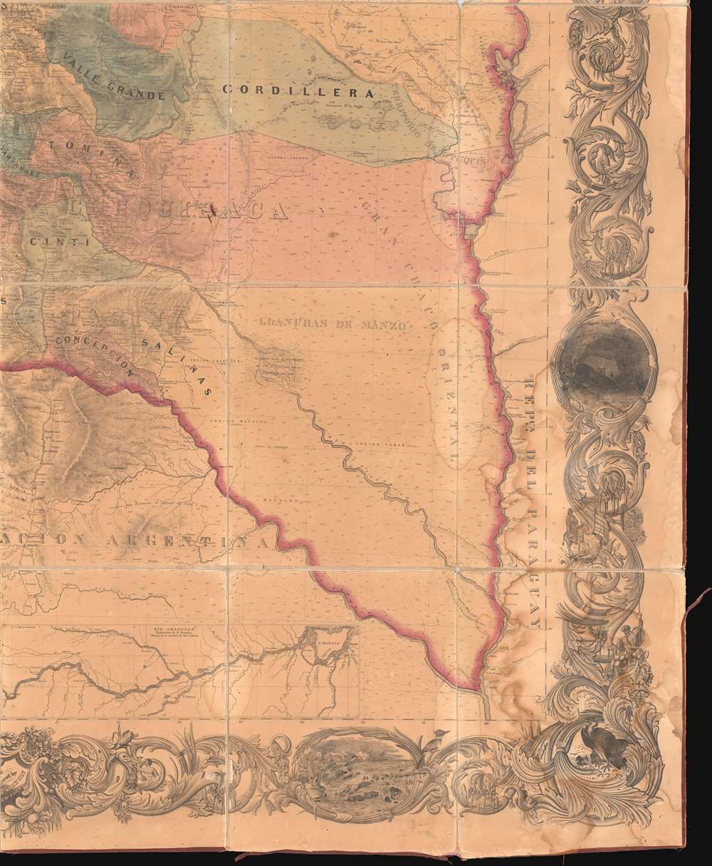
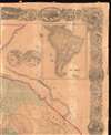
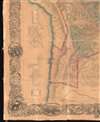
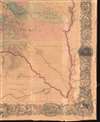
A magnificent and important map of extreme significance, this is J. H. Colton and Juan Ondarza Lara's great 1859 national map of Bolivia. This map is highly significant and influential on multiple levels. First, it is the largest and most important map of Bolivia to appear in the 19th century. Second, it is the second national map produced by an American commercial publisher, J. H. Colton, at the behest of a foreign government. Third, (and unfortunately) Colton was never paid for this map, which forced him into bankruptcy in 1859 and thus into a business arrangement with A. J. Johnson, whose use of Colton's map plates catalyzed his rise to become, for a time, the world's largest map publisher.
The Map Itself
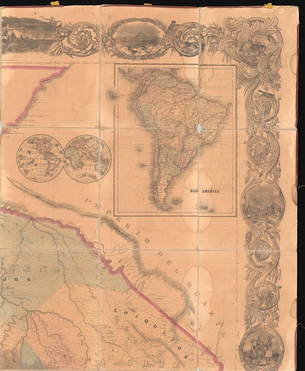
The map is a titanic production resulting from surveys completed between 1842 and 1858 by Juan Ondarza, Juan Mariano Mujia, and to a lesser extent, Lucio Camacho. Presented in Spanish, it covers all of Bolivia as it then stood, extending from the Rio Yavari to the Rio Madera, west to the Pacific, south as far as Puerto Copiapo, east to the confluence of the Rio Bermenjo and Rio Paraguay. Topography is rendered in hachure and the map is color coded by regional political divisions.The First Scientific Map of Bolivia
According to Lawlor,When Bolivia gained its independence, the country was little more than a grab bag of warring regions. Self-rule caught it unprepared. It lacked political institutions, a governing class, a working constitution. Only the military could preserve the peace, and so it happened that he who ran the army ran the country. (Lawlor 1989: 137-38).Military men have always been quick to recognize the importance of cartography and Bolivia's military dictators, the caudillos, realized an accurate map was the first step in consolidating and centralizing power. The first national map of Bolivia was issued in 1843 by the French surveyor Felipe Bertres (Mapa Corografico de la Republica de Bolivia, 1 : 2400000, Arrowsmith: London), but lacking actual survey work, was rife with error. Even before Bertres published his map, the military surveyors Ondarza and Mujia were dispatched to complete a full scientific survey. This was the first concerted effort to produce a detailed trigonometrical survey of Bolivia. The work, which took some 16 years, was described by Ondarza,
Strewn with immense, colossal, and terrible dangers, having to cross the country from one end to another, through primeval forests, wilderness, deep valleys and unhealthy, high, and inaccessible mountain ranges and frigid, raging rivers and finally compromising life apart from the savage tribes with whom we daily saw open struggle.
Labor inmensa, colosal y sembrada de terribles peligros, teniendo que recorrer el país de un confín a otro, a través de selvas vírgenes, desiertas, vegas profundas y malsanas, cordilleras altas e inaccesibles y frígidas, ríos caudalosos y en fin comprometiendo la vida, aparte de las tribus salvajes que a diario se veían en lucha abierta con ellos.
Political Instability in Bolivia
While Ondarza was busy completing the national survey, a pro-civilian 1857 military coup d'etat established José María Linares (1808 - 1861) as Bolivia's new president. A progressive leader who anticipated a bright future for Bolivia, Linares enthusiastically supported Ondarza's survey and pushed for its publication in the form of a grand-format national map. On March 8th 1858, Ondarza was sent by the Linares government on a tour of Europe and the United States to contract publishers capable of consolidating the massive survey into a single published work.Colton, Meet Bolivia!
In New York, Ondarza found his man in J. H. Colton, then the largest publisher of maps in the United States. For quality and price, Ondarza determined Colton's work to be superior to European competitors. After some negotiation, on the September 21, 1858, Ondarza contracted Colton to engrave and print 'artistically and in the best manner' 10,000 copies of the map for 25,000 dollars (roughly equivalent to 750,000 USD today), 2,000 of which were paid outright as a deposit, the remainder to be remitted by the Bolivian government upon delivery of the finished maps. Colton took to the project with enthusiasm and, within the year, working hand-in-hand with Ondarza, produced a spectacular wall-sized map, which was printed, colorized by hand, then dissected and laid down onto linen in 36 panels - as here.Troubles in Transit
In 1859, Colton shipped 2000 maps from the initial print run to Bolivia where they were well received and sold at 12 dollars (about 350 USD today) each. Delivery of the remaining 8000 copies was undertaken by Ondarza, who sailed with them to the city of Arica in Tacna, Bolivia (now Chile). There they languished, locked in the customs warehouse until 1868, when Arica, and the rest of Tacna, was destroyed by a massive earthquake and tsunami (Arica Earthquake of 1868). Some reports suggest that as many as 3000 of these may have escaped destruction to be subsequently sold in La Paz at 5 dollars per map.Bolivia Refuses to Pay Colton
Meanwhile, despite the overwhelmingly positive reception of the original 2000 maps, the government of Bolivia failed to pay Colton. According to their original agreement, payment was due in March of 1860. There is a Bolivian government resolution dating to May 7 of 1860 ordering payment, but for some reason, no remittance was issued. Subsequently, with constant legal pressure from Colton and his lawyer, Rowan Hinten Helper, some 40 Bolivian legislative resolutions to pay followed, but again and again, no payment was forthcoming. Things became considerably more complicated after January of 1861 when Jose Maria Linares, whose name is on this map, was overthrown by his own minister of war, José María de Achá Valiente (1810 - 1868). Acha committed to pay Colton in installments of 800 dollars per month and most likely was sincere in his intent, but he himself was overthrown by Mariano Melgarejo (1820 -1871) in 1864.Melgarejo Uses Colton's Map to Give Away the Country
Melgarejo was a brute of a man and perhaps Bolivia's most incompetent caudillo. In one instance, Melgarejo is said to have been presented with a magnificent white horse by the minister of Brazil, most likely Jose Maria da Silva Paranhos (1819 - 1880), the Viscount of Rio Branco. To show his appreciation Melgarejo pulled out a gigantic map of Bolivia, no doubt an example this very map, laid it down on the ground, and tracing the horse's hoof granted all of the land contained within, the modern Brazilian state of Acre, to Brazil. This foolish move resulted in the loss of much of Bolivia's rubber rich Amazon.Colton Driven into Bankruptcy – Sells out to Johnson
By 1859 Colton, having paid out of pocket for the manufacture some 10,000 of these enormous maps, found himself in a situation of extreme financial hardship and with considerable high-interest debt. Of this Colton writes,I myself had had to pay seven per cent [interest], and, in some cases, considerably more than seven per cent, for money to sustain me in the very business wherein Bolivia, in consequence of having failed to fulfill her equitable obligations, greatly embarrassed and crippled me.J. H. Colton and Company appears on the bankruptcy rolls of the 1859 New York Postal Register. At this point, Colton came to an unspecified agreement, presumably in the form of some sort of financial bailout, with Vermont businessmen Alvin J. Johnson and Ross Browning. Colton either licensed or sold his printing plates to the new firm 'Johnson and Browning'. The 1859 issue of Colton's signature publication, the General Atlas gives credit to 'Johnson and Browning'. Subsequently, in 1860, Johnson and Browning issued their own atlas, the first edition of Johnson's New Illustrated (Steel Plate) Family Atlas, which identified Colton as the publisher. Johnson's atlas, while making use of the Colton map plates, was a cheaper production and consequently more accessible. It enjoyed enormous commercial success, catapulting Johnson to become the world's largest publisher by 1864. As for Colton, he continued to publish his own Colton's General Atlas but shared map plates with Johnson for the remainder of his career.
Colton vs. Bolivia and Appeals to Congress
For the remainder of his life, Colton continued to seek redress with Bolivia over the matter of the unpaid Mapa de la Republica de Boliva. Finally, in 1874, still unpaid, Colton appealed directly to the United States Congress to intervene. With his lawyer, Hinton Rowan Helper (1829 - 1909), Colton published a booklet for submission to Congress, entitled Bolivia, as the Insidious Author and Persistent Perpetrator of a New International Crime. The United States Senate subsequently passed a resolution on January 19, 1875 to intervene with the government of Bolivia on Colton's behalf. The Bolivian government finally began paying Colton erratically over the next several years - often through banks in Peru who siphoned off as much as 50% of the payments. Some claims suggest that Colton was ultimately paid 200,000 USD, including interest, but we find this highly questionable. After paying substantial legal fees and repayment of loans, it is more likely Colton only received a small portion of the original 23,000 USD due.The First (or Second) Foreign National Map Published in the United States
This map has long been considered the first foreign national map published in the United States. However, in 2016, we discovered an earlier map of the First Republic of Colombia (1819 - 1831), issued by Henry Schenck Tanner (1786 - 1858), that we believe holds this distinction. The Tanner map, issued at the behest of the Bolivar government in Colombia, was issued in 1825, making this map of Bolivia the second foreign national map published in the United States.In Summation
And so, at last, this important map is put into some historical context while offered here for sale. In recap, Colton and Ondarza's map of Bolivia is a) the largest and most important map of Bolivia published in the 19th century, b) is the second foreign national map produced by an American commercial publisher at the behest of a foreign nation, and c) the cost of its publication, and the compounding refusal of Bolivia to pay the agreed sum, resulted directly in the bankruptcy of America's premier cartographic publisher and at the same time contributed to the rise of A. J. Johnson, who would in a short time become the world's largest publisher.Publication History and Census
The history of the map can be broken down as follows. According to Colton, 10,000 examples were produced in New York City in 1859. Two thousand were delivered to La Paz, of which one thousand were sold at 12 USD each. An additional 8,000 were shipped to Tanca via the Peruvian port of Arica, where they languished in Bolivian customs until being lost in the 1868 Arica Earthquake. Some references suggest that as many as 3000 of these may have survived and were sold at 5 USD per map. Less reliable references suggest that others were offered for sale in Buenos Aires for 25 USD per map (likely some part of the remaining 1000 that were left in La Paz), although this is highly uncertain. Over the years some filtered back to North America and Europe, but most were destroyed or lost during Bolivia's late 19th century political turmoil. This map is now extremely rare.CartographerS
Juan Ondarza Lara (May 17, 1827 - January 7, 1875) was a Bolivian soldier, engineer, and geographer. He was born in Sucre, Bolivia, on May 17, 1827. Ondarza joined the Bolivian Army at 13 years and, after being decorated in the Battle of Ingava, joined the Army Topographical Bureau (Topografica del Ejercito) and was educated under the tutelage of French immigrant Felipe Bertres. Bertres issued a map of Bolivia in 1843, but this was found to be rife with error. Ondarza, along with assistants Juan Mariano Mujia and to a lesser extent Lucio Camacho, were commissioned to complete a thorough survey of the country. They invested 14 years in the project: 11 years traveling throughout Bolivia taking astronomical observations, and 3 years compiling the relevant information. Ondarza, along with Juan Mariano Mujia, then traveled to the United States and Europe searching for a publisher for his great map. While in the United States Ondarza joined the National Academy of Sciences, in England, the Royal Geographical Society, and in France, the Paris Geographical Society. His map was finally published in 1959 by the American cartographic publisher J. H. Colton. Ondarza subsequently returned to Bolivia where he fell afoul of the new corrupt government of Mariano Melgarejo and forced into exile. He returned to Bolivia in 1872 during the subsequent administration of Tomas Frias Ametller. Afterwards he explored Lake Titicaca before dying in La Paz on January 7, 1875. His brother, Abdon Ondarza is also famous for founding the coastal city of Antofagasta (then Bolivia, now Chile). More by this mapmaker...
Joseph Hutchins Colton (July 5, 1800 - July 29, 1893), often publishing as J. H. Colton, was an important American map and atlas publisher active from 1833 to 1897. Colton's firm arose from humble beginnings when he moved to New York in 1831 and befriended the established engraver, Samuel Stiles. He worked under Stiles as the 'Co.' in Stiles and Co. from 1833 to 1836. Colton quickly recognized an emerging market in railroad maps and immigrant guides. Not a cartographer or engraver himself, Colton's initial business practice mostly involved purchasing the copyrights of other cartographers, most notably David H. Burr, and reissuing them with updated engraving and border work. His first maps, produced in 1833, were based on earlier Burr maps and depicted New York State and New York City. Between 1833 and 1855, Colton proceeded to publish a large corpus of guidebooks and railroad maps, which proved popular. In the early 1850s, Colton brought his two sons, George Woolworth Colton (1827 - 1901) and Charles B. Colton (1832 - 1916), into the map business. G. W. Colton, trained as a cartographer and engraver, was particularly inspired by the idea of creating a large and detailed world atlas to compete with established European firms for the U.S. market. In 1855, G.W. Colton issued volume one of the impressive two-volume Colton's Atlas of the World. Volume two followed a year later. Possibly because of the expense of purchasing a two-volume atlas set, the sales of the Atlas of the World did not meet Colton's expectations, and so, in 1856, the firm also issued the atlas as a single volume. The maps contained in this superb work were all original engravings, and most bear an 1855 copyright. All of the maps were surrounded by an attractive spiral motif border that would become a hallmark of Colton's atlas maps well into the 1880s. In 1857, the slightly smaller Colton's General Atlas replaced the Atlas of the World. Most early editions of the General Atlas published from 1857 to 1859 do not have the trademark Colton spiral border, which was removed to allow the maps to fit into a smaller format volume. Their customers must have missed the border because it was reinstated in 1860 and remained in all subsequent publications of the atlas. There were also darker times ahead; in 1858, Colton was commissioned at a sum of 25,000 USD by the government of Bolivia to produce and deliver 10,000 copies of a large format map of that country. Although Colton completed the contract in good faith, delivering the maps at his own expense, he was never paid by Bolivia, which was at the time in the midst of a series of national revolutions. Colton would spend the remainder of his days fighting with the Bolivian and Peruvian governments over this payment, and in the end, after a congressional intervention, he received as much as 100,000 USD in compensation. Nonetheless, at the time, it was a disastrous blow. J. H. Colton and Company is listed as one of New York's failed companies in the postal record of 1859. This led Colton into the arms of Alvin Jewett Johnson and Ross C. Browning. The 1859 edition of Colton's General Atlas lists Johnson and Browning as the 'Successor's to J. H. Colton' suggesting an outright buyout, but given that both companies continued to publish separately, the reality is likely more complex. Whatever the case may have been, this arrangement gave Johnson and Browning access to many of Colton's map plates and gave birth to Johnson's New Illustrated (Steel Plate) Family Atlas. The Johnson's Atlas was published parallel to Colton's atlases well into the 1880s. The Colton firm itself subsequently published several other atlases including an Atlas of America, the Illustrated Cabinet Atlas, the Octavo Atlas of the Union, and Colton's Quarto Atlas of the World. They also published a large corpus of wall maps, pocket maps, and guides. The last known publications of the Colton firm date to 1897 and include a map and a view, both issued in association with the Merchant's Association of New York. Alice M. Colton married August R. Ohman (May 3, 1859 - April 22, 1934) on January 5, 1897. In 1898, Ohman joined the Colton firm, which continued to publish as Colton, Ohman & Co. until 1901. Learn More...
Condition
Good. Some wear and damage at original fold intersections - see image. Overall toning.
References
Bibliotheque nationale de France, departement Cartes et plans, GE D-14678. OCLC: 249282651. Holmberg, E. A., Viaje por la gobernacion de los Andes (puna de Atacama) (Buenos Aires, 1900) page 6. Dauer, Quinn, Natural Disasters and Comparative State-Formation and Nation-Building: Earthquakes in Argentina and Chine (1822-1939). Bertres, F., Mapa Corografico de la Republica de Bolivia con la Topografia de las Fronteras Limitrofes. Formado pr. el Coronel de Yngenieros F. Bertres, 1843, (London: Arrowsmith) 1843, OCLC 556644655. Conzelman, C. S., Coca leaf and sindicato democracy in the Bolivian Yungas: The Andeanization of Western political models and the rise of the New Left (University of Colorado at Boulder, 2007), pages 92-93. Brown, David, Southern Outcast: Hinton Rowan Helper and The Impending Crisis of the South, page 249 Costa de la Torre, Arturo, Hombres celebres de Bolivia: Juan Ondarza, autor del mapa de Bolivia; Abdon Senen Ondarza, fundador de Antofagasta. Apuntes historicos: sobre el Litoral de Bolivia en el Paciífico, (La Paz) 1970. OCLC: 319714359. Helper, Rowan Hinton, Bolivia, as the insidious author and persistent perpetrator of A New International Crime, (Washington) 1874. Helper, Rowan Hinton, Oddments of Andean Diplomacy; and Other Oddments, 1879.