This copy is copyright protected.
Copyright © 2024 Geographicus Rare Antique Maps
1967 Tej Brothers Map or City Plan of Mumbai (Bombay), India
Bombay-tejbros-1967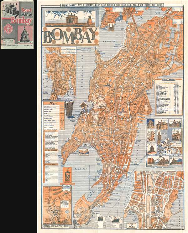

Copyright © 2024 Geographicus Rare Antique Maps | Geographicus Rare Antique Maps
This copy is copyright protected.
Copyright © 2024 Geographicus Rare Antique Maps