This item has been sold, but you can get on the Waitlist to be notified if another example becomes available, or purchase a digital scan.
1895 Times of India Map of Bombay, India
Bombay-times-1895-2$675.00

Title
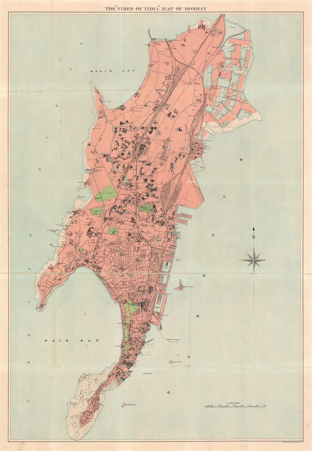
The 'Times of India' Map of Bombay.
1895 (undated) 37.5 x 26 in (95.25 x 66.04 cm)
1895 (undated) 37.5 x 26 in (95.25 x 66.04 cm)
Description
This is an extremely scarce and attractive c. 1895 Times of India map of Bombay (Mumbai), India. The map depicts the Island of Bombay in extraordinary detail and notes numerous individual buildings, rail lines, city parks, and streets. The Victoria Terminus, the mint, the Town Hall, the dockyard, the cemetery, police stations, and the House of Corrections are among the identified locations. Others include Victoria Gardens, and various factories, docks, churches, temples, chapels, social clubs, and racecourses. Oil refineries, including the ones owned by Standard Oil, appear along the right coast near the timber ponds. A handful of manuscript notations mark locations visited by a traveler who arrived on November 7, 1929. These include The Ballard Piere, 30 Altamont Road (on modern day Mumbai's 'Billionaire's Row'), and the Hughes Road railway station.
Publication History and Census
This map was created by the Times of India and sold by Stanford's Geographical Establishment of London. Unfortunately, unclear cataloging practices make it impossible to know if this map was published in several editions or only one. Examples dated to 1900 are cataloged in OCLC as being part of the institutional collections at Columbia University, the University of Oxford, and the Bibliothèque nationale de France.CartographerS
The Times of India (fl. November 3, 1898 - present) was founded under the British Raj on November 3, 1838 as The Bombay Times and Journal of Commerce. Initially it was a bi-weekly newspaper offering English language news from Europe, America and the subcontinent. It adopted its current name, The Times of India in 1861 shortly after transitioning to a daily. While originally a British owned and operated concern, following independence, the Times was taken over by the Dalmiyas family. Today the Times owned by the Sahu Jain group, is the world largest daily broadsheet newspaper. The group also own several other major India based publishing concerns. More by this mapmaker...
Edward Stanford (May 27, 1827 - November 3, 1904) was one of the most prolific map publishing firms of the late 19th century. The company began as a partnership in 1848 between the 21 year old Edward Stanford and the established map dealer Trelawney Saunders. By 1853 the partnership had dissolved and Edward Stanford took full control of the business. A subsequent series of expansions and exciting new map issues finally led to the production of Stanford's masterwork, "Stanford's Library Map of London". This map is still available and remains somewhat accurate. At the time of publishing it was hailed by the Royal Geographical Society as "the most perfect map of London that has ever been issued". In 1882 Edward Stanford Sr. passed the firm on to his son, Edward Stanford Jr. who continued in his father's proud tradition. Today the Stanford firm still publishes maps and remains one of the most important and prolific cartographic publishers in the world. Learn More...
Condition
Good. Mounted on linen. Exhibits wear and slight loss along original fold lines and at fold intersections. Blank on verso.
References
OCLC 49413464.