1947 Chisholm and Winn Pictorial Map of Boston w/ Paul Revere's Ride
BostonRevereSet-chisholmwinn-1947$250.00

Title
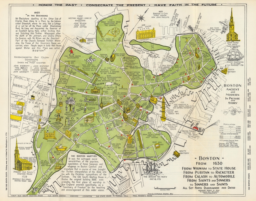
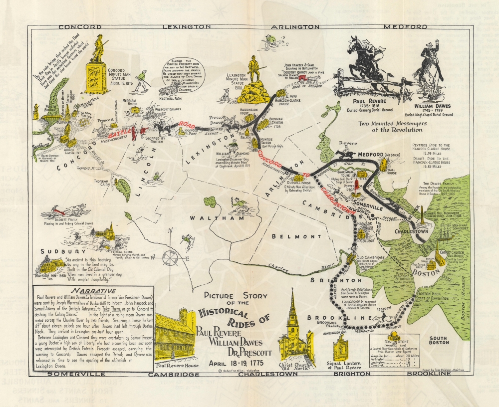
Boston from 1630 From Wigwam to State House From Puritan to Racketeer From Calash to Automobile From Saints and Sinners to Sinners and Saints All Set Forth Diagramed and Dated. / Picture Story of the Historical Rides of Paul Revere William Dawes Dr. Prescott April 18-19, 1775.
1947 (undated) 16.25 x 20.5 in (41.275 x 52.07 cm) 1 : 3500
1947 (undated) 16.25 x 20.5 in (41.275 x 52.07 cm) 1 : 3500
Description
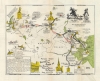
This is Ivan Chisholm and Robert Winn's 1947 pictorial map of Boston from 1630 to the 1940s - featuring the Midnight Ride made by Paul Revere, William Dawes, and Dr. Prescott.
A Map of Boston
A brilliant green highlights Boston as it appeared during the American Revolutionary War (1775 - 1783). A black line marks the original water line, while streets and piers constructed on reclaimed land appear in white. Streets are labeled, and Boston landmarks appear pictorially: the Custom House, numerous churches and cathedrals, the North and South Battery, the State House, and Boston's North Station. Other vignettes illustrate moments in Boston's history, such as the prohibition of bathtubs, the 'Cage for Sabbath Breakers', the pillory, and the stocks. Red dots mark historic locations, including the site of the Boston Massacre, Samuel Adams' birthplace, Benjamin Franklin's birthplace, and numerous taverns and inns.Paul Revere's Ride
A pictorial map celebrating what has become known as 'Paul Revere's Ride' occupies the verso. The map traces the routes Paul Revere and William Dawes from Boston to Lexington, marking their stops and recounting the events of the famed Midnight Ride. Illustrations of houses, taverns, and other period locations appear alongside depictions of the Minute Man statues in Lexington and Concord.Publication History and Census
This map was drawn by Ivan A. Chisholm and published by Robert M. Winn c. 1947. We note 4 examples cataloged on OCLC: Harvard University, the University of Illinois at Chicago, the University of Illinois at Urbana Champaign, and the University of California Berkeley. A different company published a second edition in the early 1960s.CartographerS
Ivan Alexander Chisholm (April 21, 1885 - 19??) was a Canadian American draftsman, engraver, surveyor, and civil engineer active in Boston. Born in Oxford, Nova Scotia, Canada, Chisholm appeared in the city directory of Quincy, Massachusetts, in 1908 and is listed as a civil engineer. By 1913, he had moved to Boston, where he was working as a draftsman for the Boston Transit Commission by 1914. During the 1930s and 1940s, Chisholm lived in Braintree, Massachusetts, but by the 1950s, he was back in Boston. More by this mapmaker...
Robert Mullin Winn (September 11, 1888 - May 14, 1969) was an American historian and unofficial guide of Boston, Massachusetts. Born in Claremont, New Hampshire, Winn attended school in Claremont and graduated from Stevens High School in 1909. He continued his education at Springfield College and graduated in 1914. During World War I, he worked as secretary of the Young Men's Christian Association at Fort Revere in Boston, Massachusetts. After the war, Winn moved to Quincy, Massachusetts, and helped organize the Granite Trust Company's savings department. In 1929 - 1930, Winn was part of the group that organized the Massachusetts Bay Tercentenary. From the 1930s through the mid-1950s, Winn was Boston's 'official greeter - without portfolio'. He also helped set up Boston's Freedom Trail. He married Alice Seeber on June 5, 1915, with whom he had two daughters. Learn More...
Condition
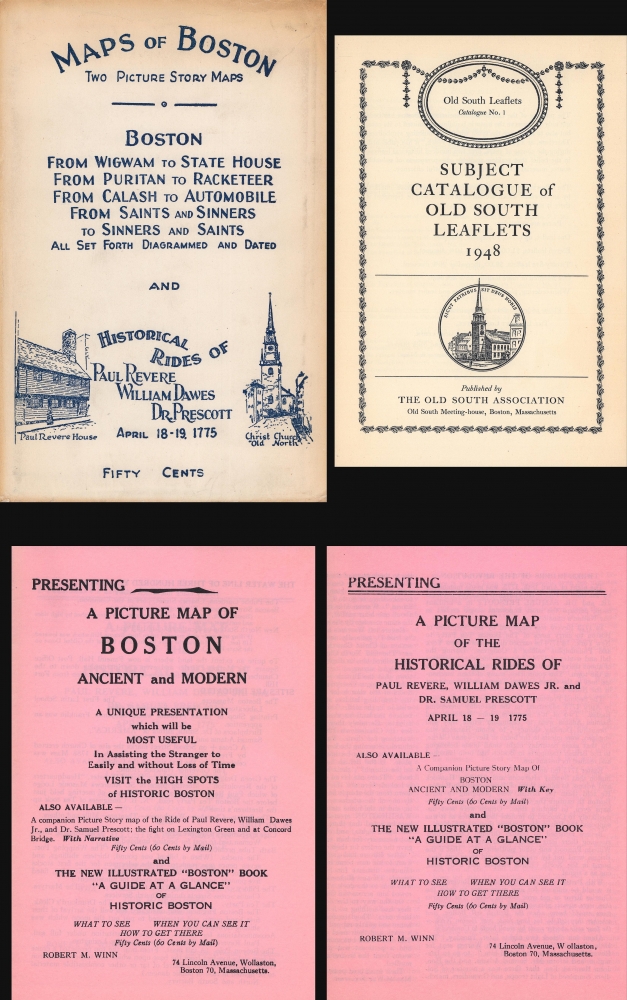
Excellent. Light wear along original fold lines. Accompanied by the original envelope, pamphlets describing both maps, and a catalog of leaflets published by the Old South Association.
References
OCLC 14768798.