This item has been sold, but you can get on the Waitlist to be notified if another example becomes available, or purchase a digital scan.
1880 Photo-Electrotype Company City Plan or Map of Boston and Vicinity
BostonVicinity-photoelectrotype-1880$475.00

Title
Map of Boston and Vicinity from the Latest Surveys.
1880 (undated) 32 x 22.25 in (81.28 x 56.515 cm) 1 : 27648
1880 (undated) 32 x 22.25 in (81.28 x 56.515 cm) 1 : 27648
Description
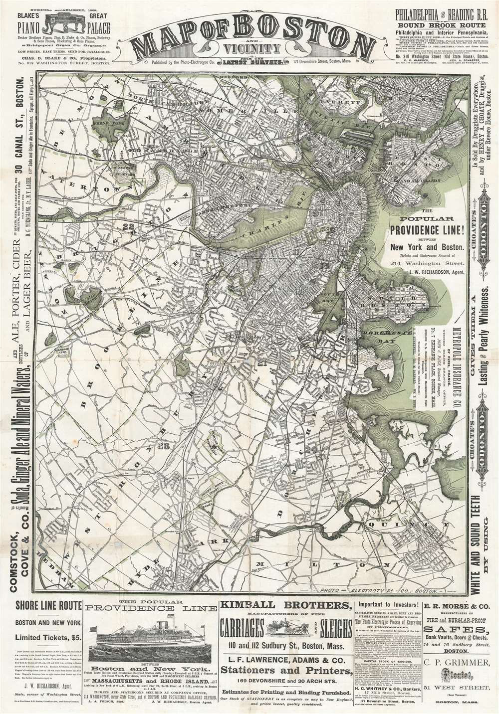
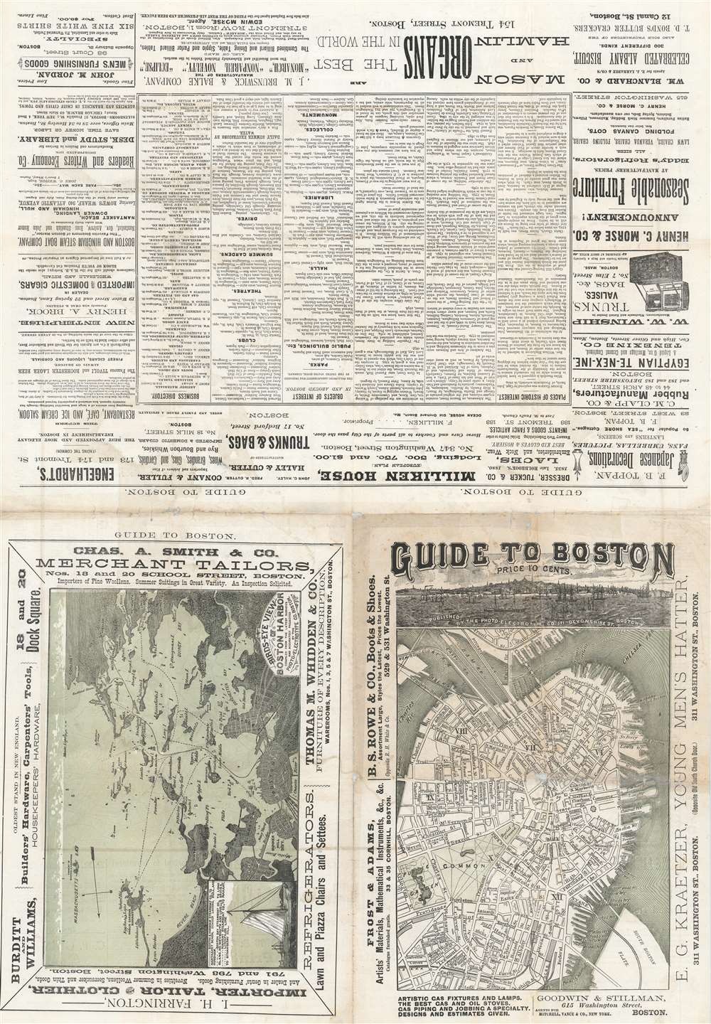
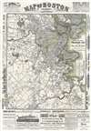
This is a c. 1880 Photo-Electrotype Company city plan or map of Boston and vicinity. The map depicts the region from Newton to East Boston and from Medford and Chelsea to Milton, Hyde Park, and Dedham. Innumerable streets are illustrated and add to the incredible amount of detail presented. Railroad tracks, bridges, parks, and wharves represent Boston's economic importance. The 'urban sprawl' spreading out from the historic center of town underscores the city's growth and prosperity. Advertisements for pianos, alcohol and ginger ale, ferries between New York and Boston, carriages, and printers occupy the borders. A smaller map of central Boston and a bird's-eye view of Boston Harbor are printed on the verso, along with more advertisements.
Publication History and Census
This map was created and published by the Photo-Electrotype Company of Boston c. 1880. Little is known about this business's operations, except that it was founded in Boston in 1877 by James H. Stark and William H. Mumler. Stark was president of the company until 1900, when he sold off his holdings in the company and went into real estate.Cartographer
James Henry Stark (July 6, 1846 - August 30, 1919) was an American publisher active in the late 19th and early 20th centuries. Stark was born in Mutcham, Surrey, England. As a young man in England he was raised by Thomas Cook, the famous English travel agent. He moved to the United States in 1856, when he was 9 or 10. In the United States, he studied at Hawes Grammar School in South Boston, and later attended the Lincoln School and the Boston Latin School. He began studying printing, particularly stereotyping and electrotyping, in 1864. In 1870 he established himself as a printer at the corner of Water and Congress Streets. He prospered until the Great Boston Fire of 1872, when his establishment burnt to the ground. After the fire, he turned his attention to yachting, suggesting access to considerable wealth, and sailed from Boston to the Caribbean and to South America, where he prospected for and discovered gold in Dutch Giana. He eventually returned to Boston, where he once again went into the printing business, establishing a stereotype and electrotype foundry at 1717 Devonshire Street. Stark partnered with William H. Mumler (1832 - 1884) in 1877 to found the Photo-Electrotype Company, one of the earliest American photolithography companies. Stark sold his shares of the company in 1900 and turned to Real Estate. Through his interest in Yachting and Caribbean travel, and possibly influenced by his connected to Thomas Cook, Start also had a successful business composing and writing guidebooks for various West India Islands. He also issued the Stranger's Guide to Boston. More by this mapmaker...
Condition
Average. Exhibits wear along original fold lines and some loss at fold intersections. Printed material on both sides. Old cellophane tape repairs evident on both sides, which we were unable to remove. A professional paper restorer would likely be able to remove it. Nonetheless, the map presents nicely and is very rare.