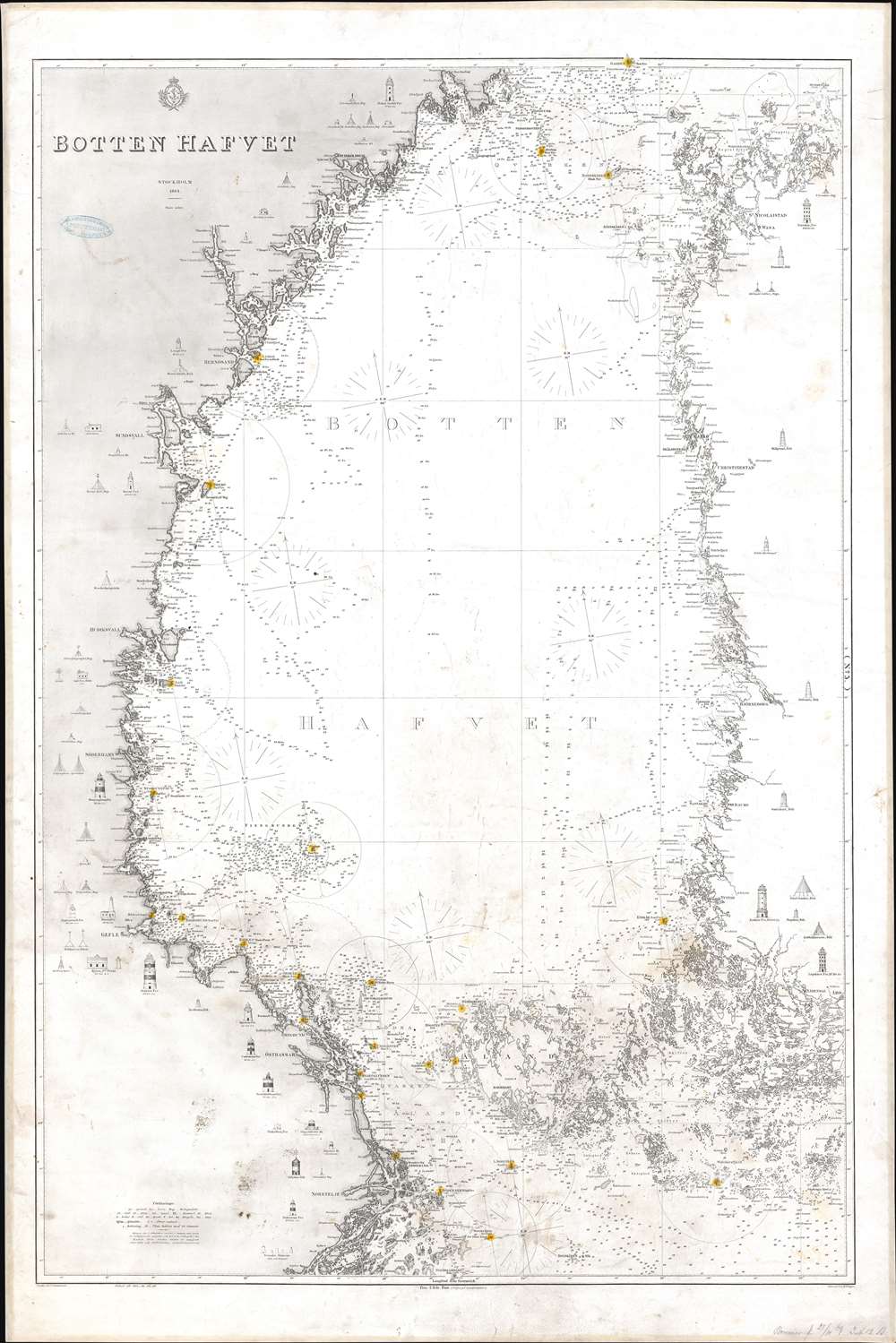
1868 Swedish Royal Nautical Chart / Map of the Bothnian Sea
BottenHafvet-royalswedish-1868$700.00


Title
Botten Hafvet.
1868 (dated) 44 x 29.5 in (111.76 x 74.93 cm) 1 : 450000
1868 (dated) 44 x 29.5 in (111.76 x 74.93 cm) 1 : 450000
Description
This is an 1868 Royal Swedish Nautical Chart Archive nautical chart or maritime map of the Bothnian Sea, or Bottenhavet in Swedish. The Bothnian Sea is a body of water situated between Sweden and Finland, part of the larger Gulf of Bothnia. Depicting from Gadden south to Lulla, both coastlines are illustrated in detail. Coastal islands are illustrated and labeled. Countless depth soundings, coastal lights, and other navigation aids are highlighted. Many of these lighthouses are illustrated in profile along the Swedish and Finnish coastlines - useful for helping the mariner to recognize them and thus know his location.
Publication History and Census
This map was drawn by I. Cronstrand, engraved by V.A. Dellinger, and published by the Royal Swedish Nautical Chart Archive. Editions were published beginning in 1864, with updates published in annually through at least 1868. This chart is not cataloged in OCLC and we have been unable to locate any other examples.Condition
Good. Full professional restoration. Mounted on linen. Exhibits areas of infill, soiling, dampstaining, and toning.