1868 Swedish Nautical Chart / Map of Bothnian Bay
BottenWiken-royalswedish-1868$1,000.00
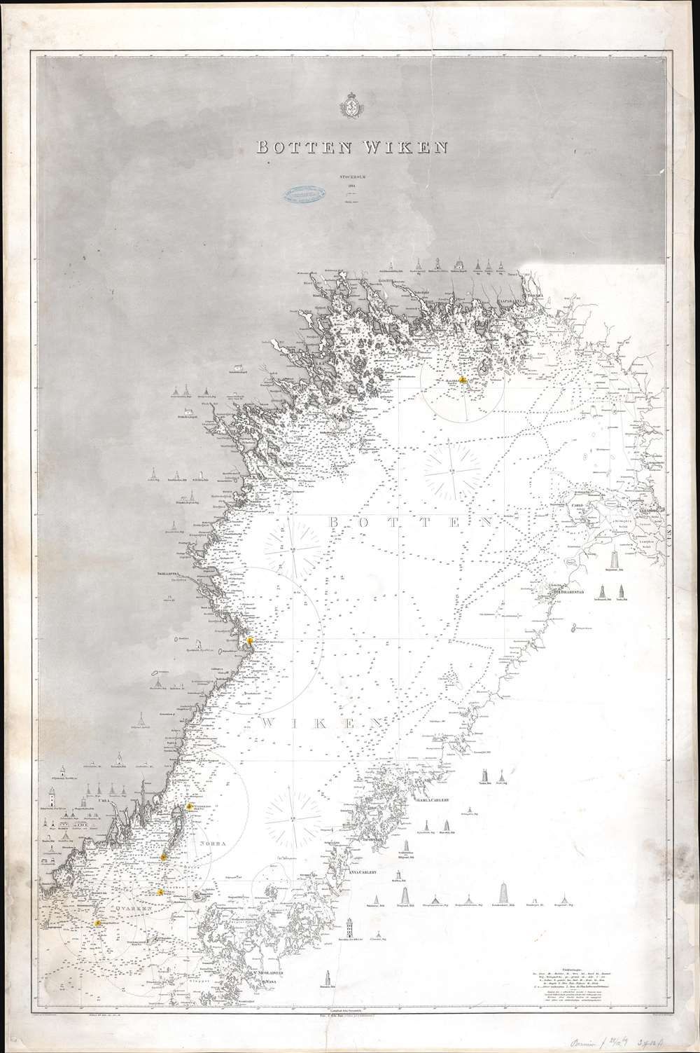

Title
Botten Wiken.
1868 (dated) 44 x 29.25 in (111.76 x 74.295 cm) 1 : 450000
1868 (dated) 44 x 29.25 in (111.76 x 74.295 cm) 1 : 450000
Description
This is an 1868 Royal Swedish Nautical Chart Archive nautical chart or maritime map of Bothnian Bay or Bottenviken in Swedish. Situated between Sweden and Finland, both the Finnish and Swedish coasts are depicted in impressive detail, with fjords, islands, and rivers illustrated. Lighthouses are marked throughout with profile views of many appearing in the blank inland regions. The Northern Quark (Norra Qvarken) is labeled near the bottom border.
Bothnian Bay
Bothnian Bay is the northern part of the Gulf of Bothnia with Sweden to the west and Finland to the east. It is bordered on the south by the Northern Quark (Kvarken), which, at its shallowest, is only eighty-two (82) feet deep. Sometime within the next 2,000 years Bothnian Bay will become a large freshwater lake because the land is still rising.Publication History and Census
This chart was published in 1868 by the Royal Swedish Nautical Chart Archive. It does not appear in OCLC and we have been unable to locate any other known examples.Condition
Good. Full professional restoration. Mounted on linen. Exhibits closed tears extending seventeen (17) inches from the bottom border and six (6) inches from the top border. Exhibits areas of toning and infill.