This item has been sold, but you can get on the Waitlist to be notified if another example becomes available, or purchase a digital scan.
1926 Royal Geographical Society Map of East Africa: Kenya, Tanzania
BoundariesEastAfrica-royalgeographical-1926$125.00

Title
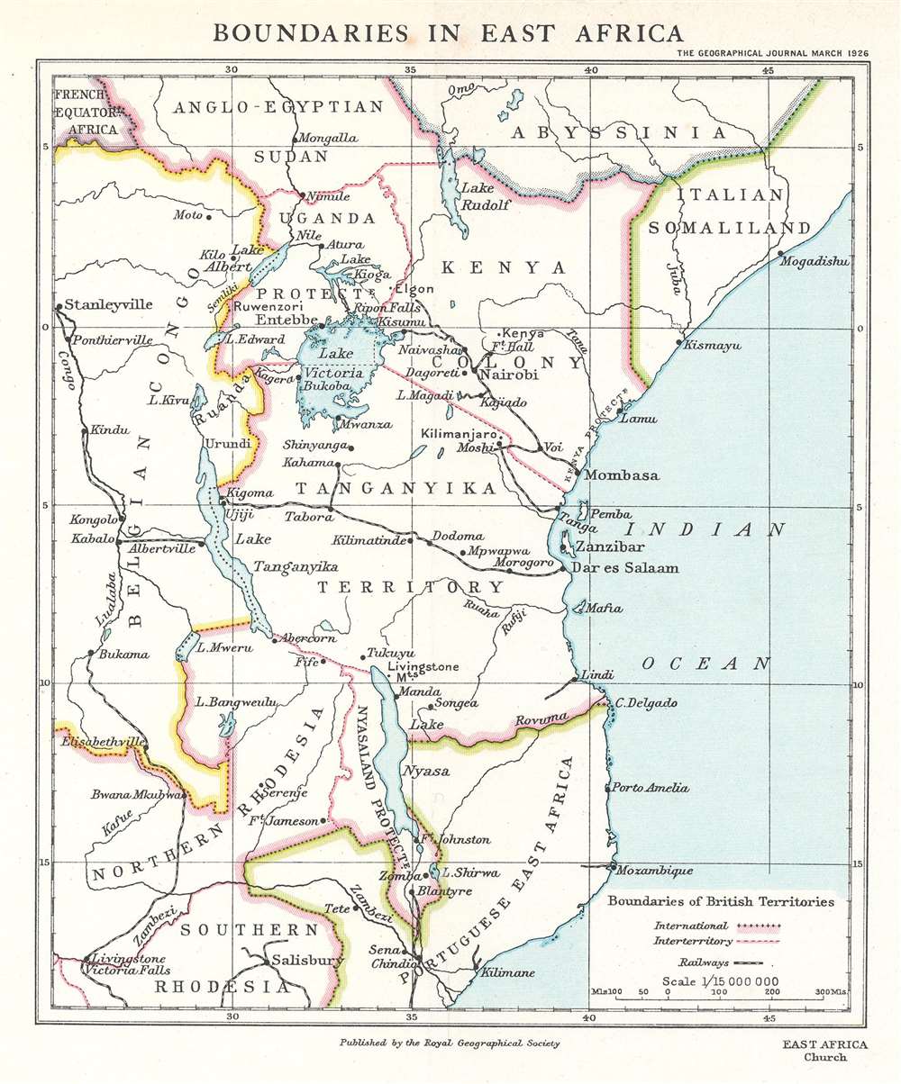
Boundaries in East Africa.
1926 (dated) 8.75 x 7 in (22.225 x 17.78 cm) 1 : 15000000
1926 (dated) 8.75 x 7 in (22.225 x 17.78 cm) 1 : 15000000
Description
This is a 1926 Royal Geographical Society map of East Africa, accompanying an article detailing the itinerary and findings of the East African Commission. The map depicts from Abyssinia and Anglo-Egyptian Sudan south to Southern Rhodesia, thus embracing the modern-day nations of Kenya, Tanzania, Mozambique, Zambia, and parts of the Congo, Ethiopia, Uganda, and Somalia. Several railways, including the Central Tanganyika Railway, are illustrated. Major cities and other settlements are identified, such as Livingstone, Zomba, Dar es Salaam, Tabora, Entebbe, and Nairobi.
The East African Commission
The East African Commission, also known as the Ormsby-Gore Commission, was created in 1924 to review and suggest pathways to economic development, improve the social conditions, and create closer ties between the five regional British dependencies. William Ormsby-Gore served as the commission's chairman. Two Parliamentarians, A.G. Church and F.C. Linfield, were also appointed. The commission left England on August 15, 1924, and returned by late December. Parliamentary leadership changed while the commission traveled, leading to its findings and recommendations being largely ignored.Publication History and Census
This map was created by the Royal Geographical Society to accompany an article written by A.G. Church for the December 1926 edition of The Geographical Journal entitled 'The Inter-relations of East African Territories'. We have been unable to locate any other cataloged examples of the separate map.Cartographer
Royal Geographical Society (fl. 1830 - present) is a British Society established in 1830 to promote geographical science and exploration. Originally titled the "Geographical Society of London", the RGS received its royal charter from Queen Victoria in 1859 shortly after absorbing several similar but more regional societies including the African Association, the Raleigh Club and the Palestine Association. The RGS sponsored many of the most important and exciting voyages of exploration ever undertaken, including the exploration of Charles Darwin, David Livingstone, Robert Falcon Scott, Richard F. Burton, John Speke, George Hayward, H. M Stanley, Ernest Shackleton and Sir Edmond Hillary. Today, the RGS remains a leading global sponsor of geographical and scientific studies. The Society is based in Lowther Lodge, South Kensington, London. More by this mapmaker...
Source
Church, A.G., 'The Inter-Relations of East African Territories', The Geographical Journal Vol. 67, No. 3, (London: Royal Geographical Society) 1926.
Condition
Very good. Exhibits light wear along original fold lines. Exhibits light toning.