
Royal Geographical Society

Royal Geographical Society (fl. 1830 - present) is a British Society established in 1830 to promote geographical science and exploration. Originally titled the "Geographical Society of London", the RGS received its royal charter from Queen Victoria in 1859 shortly after absorbing several similar but more regional societies including the African Association, the Raleigh Club and the Palestine Association. The RGS sponsored many of the most important and exciting voyages of exploration ever undertaken, including the exploration of Charles Darwin, David Livingstone, Robert Falcon Scott, Richard F. Burton, John Speke, George Hayward, H. M Stanley, Ernest Shackleton and Sir Edmond Hillary. Today, the RGS remains a leading global sponsor of geographical and scientific studies. The Society is based in Lowther Lodge, South Kensington, London.
The first European expedition into the Tian Shan Mountains.
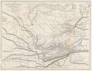
Map of Russian and Chinese Frontier Illustrating the Journey of Semenof to the Tian-Shan Mounts. and R. Jaxartes and Golubof's Issyk-kul Expedition.
$575.00
Acquire
- Digital Map Information
- Suitable for large format printing
- File Size: 12.88 MB
- File Type: ZIP / TIFF
- ICC color profile embedded
- Delivered instantly via download link
This is an 1861 John Murray map of Central Asia tracing Pyotr Semyonov's (1827 - 1914) first European ascent into the Tian Shan Mountains. The map depicts the region from Lake Balkash south to the Tian Shan Mountains, encompassing modern-day Kyrgyzstan, Kazakhstan, and western China - at the time considered one of the most remote and inaccessible parts of the world. (more details)
900 miles further up Yangtze than any previous Westerner.
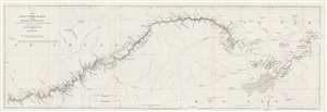
China. The Yang-Tsze Kiang, from Han-Kow to Ping-Shan; reduced from the large Chart (of which this is the Index) from the Survey of Captain T. Blakiston R.A.
$125.00
Acquire
- Digital Map Information
- Suitable for large format printing
- File Size: 6.32 MB
- File Type: ZIP / TIFF
- ICC color profile embedded
- Delivered instantly via download link
This is an 1862 John Arrowsmith map of the Yangtze River, China. Coverage extends from Hankou (Hankow) to Pingshan. The map follows 1861 Thomas Wright Blakiston (December 27, 1832 - October 15, 1891) Yangtze River Expedition. Blakiston's expedition traveled over 900 miles further up the river than any previous Western navigation. Blakiston also conducted detailed surveys of the Yangtze and produced a landmark map of the river. The present map acts as a key for Blakiston's larger map. Cities and towns of varying size are labeled throughout. Additional notations mark the now submerged Yangtze Gorges and other physical features. (more details)
Landmark map of an Amazon tributary.
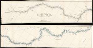
Map of the River Purûs, From Near its Source to its Mouth.
$300.00
Acquire
- Digital Map Information
- Suitable for large format printing
- File Size: 18.98 MB
- File Type: ZIP / TIFF
- ICC color profile embedded
- Delivered instantly via download link
This is landmark 1866 William Chandless map of the Purûs River in Brazil and Peri is he first accurate map of the river's 1,866-mile course. Chandless took measurements throughout his expedition, covering both the ascent and the descent of the river. He identifies tributaries, islands, and Indian villages, and includes a handful of comments concerning the river's depth and width. In the appendix to his article on the expedition, Chandless addresses the creation of the map:
This has been made from bearings and distances taken throughout the whole river, and from observations with sextant and artificial horizon (mercurial). Observations of latitude were taken at 79 points, and time observations for longitude by chronometer at about three-fourths of them. So far as was possible, time observations were repeated at the principal points on the down voyage, so as to be dependent on chronometer for a few days only.Even today the Purûs River basis is considered on of the most remote, biodiverse, and inaccessible parts of the Amazon Rainforest. In 2008, a previously unknown pre-Columbian civilization was discovered in the upper region of the river close to the Bolivian border. After much of the forest in the region was cleared for agricultural use, satellite pictures revealed the remains of large geometric earthworks. (more details)
A 'valuable map' of the Sinai Peninsula - RGS
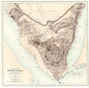
The Peninsula of Mount Sinai. A Sketch from Observations on the Ground by the Rev. F. W. Holland. M.A.
$750.00
Acquire
- Digital Map Information
- Suitable for large format printing
- Full resolution TIFF file
- ICC color profile embedded
- Delivered instantly via download link
This is Frederick Whitmore Holland's 1868 map of the Sinai Peninsula. The peninsula's mountainous terrain is illustrated in detail, with numerous peaks labeled with transliterations of their Arabic names. Holland traces the many wadis (valley, ravine, or channel that is dry except in the rainy season) and provides some commentary on the terrain. Mount Sinai, labeled here as J. Musa (its Arabic name), appears just south of the center of the peninsula. (more details)
First detailed map of the Juruá River, one of the longest tributaries of the Amazon.
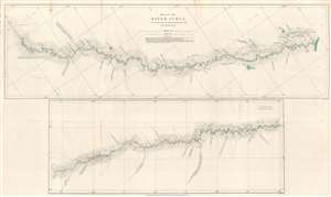
Map of the River Juruá.
$250.00
Acquire
- Digital Map Information
- Suitable for large format printing
- File Size: 13.33 MB
- File Type: ZIP / TIFF
- ICC color profile embedded
- Delivered instantly via download link
This is an 1869 William Chandless map of the Juruá River. The map divides the Juruá into two sections. The upper map illustrates the Juruá from its confluence with the Amazon to a point near Lake Ocoá. The lower map illustrates the upper portion of the river from Lake Ocoá to the point where the expedition reversed course. Small black crosses mark astronomical observations, and the dashed lines indicate the mouth of a lake or tributary. Chandless includes comments on the nature of the tributaries, and also notes the locations of the few tribal villages he encountered. (more details)
Reverend Alexander Williamson's 1860s travels through Manchuria.
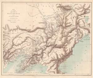
Map to accompany the Notes on Manchuria by the Rev. Alexander Williamson.
$300.00
Acquire
- Digital Map Information
- Suitable for large format printing
- File Size: 8.25 MB
- File Type: ZIP / TIFF
- ICC color profile embedded
- Delivered instantly via download link
This is an 1870 John Murray map of Manchuria, China - a region that within 20 years would become the stage for a global power struggle between Imperial Japan, Qing China, and Tzarist Russia. The map was drawn to accompany a paper written by Reverend Alexander Williamson and published in The Journal of the Royal Geographical Society. Parallel lines trace Williamson's travels through the region. Cities, towns, and villages are labeled throughout, including Mukden (Shenyang). The region's impressive topography leaps off the page, and its extensive river network is well illustrated. Part of the Willow Palisade (labeled here as Barrier of Stakes or Palisade) appears and traverses a southwest-northeast line through the map's center. The Willow Palisade, a system of embankments and ditches planted with willows, was built by the Qing in the late 17th century and separated traditionally Manchu areas from Mongol territory. (more details)
Landmark exploration of a previously unmapped region of Africa.
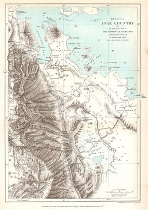
Map of the Afar Country and the Northern Part of the Abyssinian Highlands to illustrate the Journey of W. Munzinger Esqure. Late H.B.M. Consul at Massowa.
$200.00
Acquire
- Digital Map Information
- Suitable for large format printing
- File Size: 5.73 MB
- File Type: ZIP / TIFF
- ICC color profile embedded
- Delivered instantly via download link
This is an 1870 John Murray map of the Afar Country, comprising parts of modern-day Eritrea and Ethiopia. The map was created to accompany a The Journal of the Royal Geographical Society paper by Werner Munzinger. Dashed tracks follow Munzinger's groundbreaking exploration of the little known region. (more details)
'One of the most expensive affairs of honor in history.'
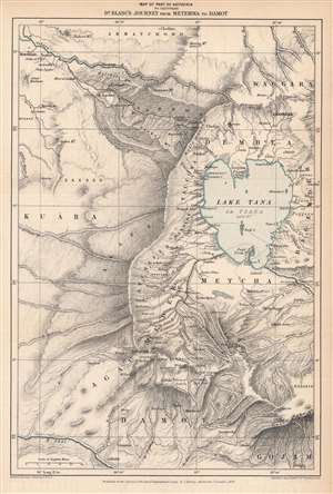
Map of Part of Abyssinia to Illustrate Dr. Blanc's Journey from Metemma to Damot.
$250.00
Acquire
- Digital Map Information
- Suitable for large format printing
- File Size: 7.51 MB
- File Type: ZIP / TIFF
- ICC color profile embedded
- Delivered instantly via download link
This is an 1870 Edward Stanford map of the Amara region of northwestern Abyssinia (Ethiopia) highlighting the route taken by Henry Blanc, one of the British subjects kidnapped by Ethiopian Emperor Tewodros II (r. 1855 - 1868), an act that prompted a punitive expedition by Great Britain in 1867 – 1868. (more details)
A 'Great Game' reconnaissance expedition from Beijing across the Gobi.
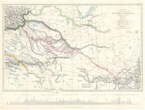
Map to illustrate A Journey Through Western Mongolia.
$800.00
Acquire
- Digital Map Information
- Suitable for large format printing
- File Size: 20.33 MB
- File Type: ZIP / TIFF
- ICC color profile embedded
- Delivered instantly via download link
This is an 1873 Ney Elias map of western Mongolia. Although not specifically described as such, this map and the Elias expedition were most likely British reconnaissance related to 'The Great Game'. This map was drawn by Elias after his 1872 expedition through the region. A thin red line follows his progress from Beijing (Peking), China, across the Gobi Desert to Bisk in Russia, where he arrived on January 4th, 1873. Elias marks each day's progress along his route and labels Uliassutai, the largest settlement he encountered. The pink shading around Elias's route highlights the limits of the surveys conducted by Elias during the expedition. Karakorum, which Elias refers to as the 'ancient Tartar capital', is marked in two places, suggesting ambugity over its actual location. The map traces the Great Wall along the bottom border, with the wall and the rivers leading from Lake Alak, Lake Tsui-yan, and Lake Sobi breaking the map's bottom border. Numerous lakes of varying sizes appear throughout. (more details)
The early days of British Aden.
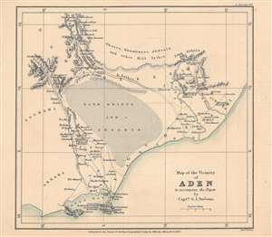
Map of the vicinity of Aden to accompany the paper by Captn. G. J. Stevens.
$350.00
Acquire
- Digital Map Information
- Suitable for large format printing
- File Size: 10.78 MB
- File Type: ZIP / TIFF
- ICC color profile embedded
- Delivered instantly via download link
This is an 1873 map of Aden, Yemen and its surroundings engraved by Edward Weller and published by the firm John Murray for the The Journal of the Royal Geographical Society. The map accompanied an article written by Captain G. J. Stevens of his travels through these lands. (more details)
The beginning of events leading to the Second Anglo-Afghan War.

Map of Eastern Persia to illustrate the Paper by Major General Sir F. J. Goldsmid.
$350.00
Acquire
- Digital Map Information
- Suitable for large format printing
- File Size: 6.04 MB
- File Type: ZIP / TIFF
- ICC color profile embedded
- Delivered instantly via download link
This is an 1873 John Murray map of eastern Persia, or modern-day south-central Iran. A thin red line highlights Sir Frederic John Goldsmid's route through the region from Bandar Abbas on the Strait of Hormuz north to Mash-had. Goldsmid was dispatched to this region in order to enforce a British-negotiated Selstan frontier boundary settlement, a move in the 'Great Game' intended to secure Persia and Afghanistan as buffer provinces between Russia and British India. (more details)
Great Game: Tsar's Acquisition of Transoxiana.
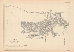
Notes on M. Fedchenko's Map of Maghian.
$250.00
Acquire
- Digital Map Information
- Suitable for large format printing
- File Size: 4.89 MB
- File Type: ZIP / TIFF
- ICC color profile embedded
- Delivered instantly via download link
This is an 1873 map of 'Maghian,' that is, the area that now comprises the westernmost portion of Sughd Province in Tajikistan, along the border with Uzbekistan. Based on a Russian map by Alexei Fedchenko, it was lithographed by Edward Weller and published by John Murray in the Journal of the Royal Geographical Society. (more details)
Pre-Japanese look at indigenous Taiwan.
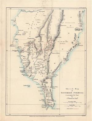
Sketch Map of Southern Formosa.
$650.00
Acquire
- Digital Map Information
- Suitable for large format printing
- File Size: 4.27 MB
- File Type: ZIP / TIFF
- ICC color profile embedded
- Delivered instantly via download link
This is a rare 1873 lithograph of the southern tip of Taiwan, published for the The Journal of the Royal Geographical Society. It encapsulates the geographical knowledge gained during an 1871 trip through southern Taiwan by the geographer and photographer John Thomson and his companion, the missionary James Laidlaw Maxwell. (more details)
'Most Desolate and Uninviting.' -Forrest
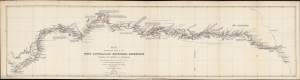
Map showing the route of the West Australian Exploring Expedition through the centre of Australia from Champion Bay on the west coast to the Overland Telegraph Line between Adelaide and Port Darwin.
$850.00
Acquire
- Digital Map Information
- Suitable for large format printing
- File Size: 136.62 MB
- File Type: ZIP / TIFF
- ICC color profile embedded
- Delivered instantly via download link
An 1875 map prepared by John Forrest, head of the Western Australia Exploring Expedition. It traces the progress and discoveries of the first extensive exploration of Western Australia's interior. (more details)
After the conquest of Khiva.
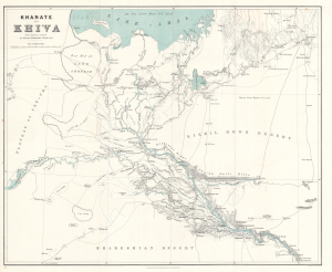
Khanate of Khiva after Russian sources.
$500.00
Acquire
- Digital Map Information
- Suitable for large format printing
- File Size: 24.08 MB
- File Type: ZIP / TIFF
- ICC color profile embedded
- Delivered instantly via download link
This is an 1875 Herbert William Wood map of the Khanate of Khiva in modern-day Uzbekistan - issued shortly after the 1873 Russian conquest of Khiva, a defining moment in the Great Game. (more details)
Traces the 1877 expedition of British Army officer William John Gill.
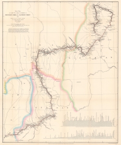
Route Map of Captain W. J. Gill's Journey in Western China and Eastern Tibet.
$850.00
Acquire
- Digital Map Information
- Suitable for large format printing
- File Size: 16.95 MB
- File Type: ZIP / TIFF
- ICC color profile embedded
- Delivered instantly via download link
This is a scarce and important 1878 William John Turner map of western China and eastern Tibet tracing Captain William John Gill's 1877 expedition through the region. (more details)
One of the first western maps of Xinjiang, China, illustrating a Great Game Era British trade mission.
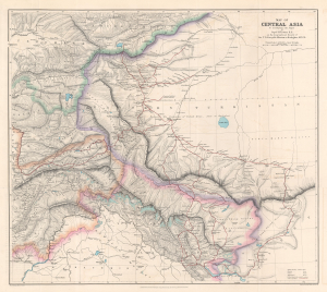
Map of Central Asia to accompany the Paper by Captain H. Trotter R.E., on the Geographical Results of Sir T.D. Forsyth's Mission to Kashgar, 1873 - 74.
$950.00
Acquire
- Digital Map Information
- Suitable for large format printing
- File Size: 24.76 MB
- File Type: ZIP / TIFF
- ICC color profile embedded
- Delivered instantly via download link
This is a 1878 William John Turner and Royal Geographical Society map of Xinjiang, China, that traces explorations of the 1873 - 1874 Forsyth Mission, making this one of the first detailed Western maps of the region. The map is a relic of the Great Game, a series of struggles between Britain and Russia to control Central Asia. (more details)
Surveying the interior of the Malay Peninsula.
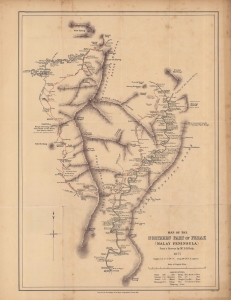
Map of the northern part of Perak (Malay Peninsula)...
$1,300.00
Acquire
- Digital Map Information
- Suitable for large format printing
- File Size: 12.31 MB
- File Type: ZIP / TIFF
- ICC color profile embedded
- Delivered instantly via download link
An early map of the northern part of the Perak Sultanate, now a state of Malaysia, prepared by pioneering British surveyor Dominic Daniel Daly for publication in the 1882 Proceedings of the Royal Geographical Society. It dates from soon after the establishment of a British residency in the sultanate, amid a tin mining boom that transformed the region's economy and society. (more details)
Expanding British influence in Malaya; early mention of Kuala Lumpur.
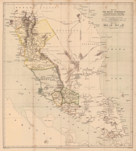
Map of the Malay Peninsula. To accompany the paper of Mr. D.D. Daly...
$1,100.00
Acquire
- Digital Map Information
- Suitable for large format printing
- File Size: 16.98 MB
- File Type: ZIP / TIFF
- ICC color profile embedded
- Delivered instantly via download link
An important map of the Malay Peninsula by Dominic Daniel Daly, lithographed by Edward Weller and published in 1882 in the Proceedings of the Royal Geographical Society. Daly's surveys of portions of the peninsula were the first scientific surveys conducted there. The map depicts the peninsula as British influence over the indigenous sultanates was expanding rapidly, aided by a boom in tin mining. (more details)
Botanical excursion through Central Asia.
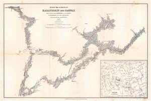
Survey Map of Route in Karateghin and Darwaz Made During the Expedition of Dr. Regel.
$375.00
Acquire
- Digital Map Information
- Suitable for large format printing
- File Size: 17.72 MB
- File Type: ZIP / TIFF
- ICC color profile embedded
- Delivered instantly via download link
This is an 1886 M. Kossiakof map of Turkestan in Central Asia. Red lines trace Kossiakof's route through the Rasht Valley (Karateghin) and Darvaz (Darwaz) regions with the 1881 Regel Expedition. The primarily botanically focused 1881 expedition was led by Johann Albert von Regel (1845 - 1909), a Swiss-Russian physician and botanist. Nonetheless, the Regel Expedition was one of the first European penetrations into the area. Kossiakof was a military topographer attached to the mission. He mapped the region, labeling cities, towns, and villages through which the group passed. Rivers are illustrated. In the lower right corner, an inset map of Asia and eastern Europe situates the depicted area in a continental manner. The map covers only the actual path followed, along with the observable surrounds, underscoring Kossiakof's integrity in illustrating only scientifically confirmed geography. (more details)
Connecting Burma and China by rail - bold but hopeless...
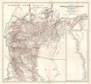
Parts of Burmah, Siam and the Shan States illustrating the explorations of Holt S. Hallett, C.E.
$400.00
Acquire
- Digital Map Information
- Suitable for large format printing
- File Size: 33.9 MB
- File Type: ZIP / TIFF
- ICC color profile embedded
- Delivered instantly via download link
This is an 1886 Henry Sharbau and H. A. Milne map of Burma (Myanmar) and Thailand. The map focuses on northern Thailand (Siam) and the railroad proposed by civil engineer Holt S. Hallett (1841 - 1911) and his associate Archibald Colquhoun (pronounced kuhl-HOON.) It was created to accompany a paper Hallett presented to the Royal Geographical Society. Red lines trace Hallett's explorations,
scouting and surveying the best railroad route. A dashed black and white line illustrated the proposed railway, running south from Kiang Hsen to the map's lower border. An inset along the right illustrates the route's continuation to Bangkok. (more details)
An early trek across southeastern Africa from Cape Town to Lake Malawi.
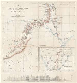
Map showing Route from the Cape of Good Hope across the Zambesi River at Tette to Lake Nyassa in 1884. From the Survey by W. Mantagu Kerr.
$350.00
Acquire
- Digital Map Information
- Suitable for large format printing
- File Size: 12.17 MB
- File Type: ZIP / TIFF
- ICC color profile embedded
- Delivered instantly via download link
This is an 1886 Henry Sharbau map of modern-day Zimbabwe, Mozambique, and Malawai tracing Walter Montagu Kerr's (1852 - 1888) exploration of the region. A thin red line follows Kerr's peregrinations, with towns and native villages labeled along the route. Major settlements including Gubuluwayo, Tette, Mpemba, Blantyre, and Quillimane near the mouths of the Zambezi River. The Zambezi is prominently illustrated, along with numerous smaller rivers. Marshes, mountain ranges, and other physical features are also noted, although very little detail is present in areas distant from Kerr's path. Red lettering marks tsetse fly territory - a serious danger to early explorers. An inset map in the lower right follows Kerr's route from Cape Town to Gubuluwayo. A profile of the 'section of route from Port Elizabeth to Lake Nyassa and Quillimane' is included below the bottom border. (more details)
Exploration of Mozambique and Malawi.
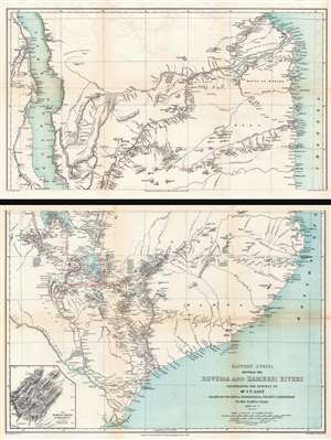
Eastern Africa Between the Rovuma and Zambesi Rivers Illustrating the Surveys of Mr. J.T. Last Leader of the Royal Geographical Society's Expedition to the Namuli Peaks 1885 - 6 - 7.
$950.00
Acquire
- Digital Map Information
- Suitable for large format printing
- Full resolution TIFF file
- ICC color profile embedded
- Delivered instantly via download link
This is an 1890 William Shawe map of southeastern Africa detailing the expedition of Joseph Thomas Last to Portuguese East Africa. Printed on two sheets, the map depicts the region from Lake Nyasa to the Mozambique Channel and from the mouth of the Lindi River south to the mouths of the Zambezi River. In modern terms, this map covers Malawi and Mozambique from Lake Malawi (Nyasa) eastward to the Indian Ocean (Mozambique Channel). This region was at the time Portuguese Mozambique (Portuguese East Africa / África Oriental Portuguesa). Although the British never made a serious play for Portuguese East Africa, the cartographic work here can be best understood as reconnaissance for potential British colonial annexation. (more details)
Details gold fields in northeastern modern-day South Africa.
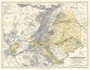
Map of the Zoutpansberg Goldfields.
$300.00
Acquire
- Digital Map Information
- Suitable for large format printing
- File Size: 14.72 MB
- File Type: ZIP / TIFF
- ICC color profile embedded
- Delivered instantly via download link
This is an 1893 Friedrich Jeppe map of the Zoutpansberg Goldfields in northeastern South Africa, what was then the South African Republic. Per Jeppe, Zoutpansberg, a district in the northern portion of the South African Republic, covered about 25,000 square miles. Here, the proclaimed gold fields are highlighted in yellow, with the known gold belts further emphasized by yellow dashes within these yellow sections. The gray areas mark lands set aside for native Africans that were administered by the tribes. Gold and other mineral deposits were known to exist in some of these areas, and certain tribes allowed for mining and prospecting rights on their land. Settlements are identified, all of which, per Jeppe, are connected by telegraph and roads. (more details)
Scarce 1893 map of the Russian Frontier in Central Asia
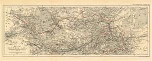
Map of Central Asia Showing the Route of the Earl of Dunmore 1892-3.
$450.00
Acquire
- Digital Map Information
- Suitable for large format printing
- File Size: 19.05 MB
- File Type: ZIP / TIFF
- ICC color profile embedded
- Delivered instantly via download link
This is an 1893 map by William and Alexander Keith Johnston of Central Asia, published by the Royal Geographic Society, to trace the route taken by the Earl of Dunmore in his travels through Kashmir, the Xinjiang province of China, Tajikistan, Kyrgyzstan, Uzbekistan, and through Turkmenistan to the Caspian Sea. The region - largely a Chinese frontier - was the site of significant Russian efforts to exert influence at the time, and it is in that context that the Earl of Dunmore’s journey took place. Following the track, for example, one sees what appears to be a curious detour into the Pamir mountains between Yarkand and Kashgar; here, Dunmore’s expedition was following a Chinese force sent to counter Russian incursions Aktash region. The region was also the site of conflict between Russian and Afghan forces - indeed, the journey took place only a few years before the border between Russia and Afghanistan was set with the signing of the Pamir Boundary Commission protocols in 1895. Dunmore's return route from Samarkand was undertaken on the Russian Trans-Caspian Railway; constructed in order to facilitate Russian troop movements along the frontier, the British considered this railway to be a particular threat to their interests in Asia. (more details)
This expedition established without question that Greenland is an island.
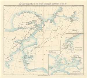
Map Shewing Route of the North Greenland Expedition of 1891-92. R.E.Peary, U.S. Navy.
$450.00
Acquire
- Digital Map Information
- Suitable for large format printing
- File Size: 9.16 MB
- File Type: ZIP / TIFF
- ICC color profile embedded
- Delivered instantly via download link
This is an 1893 Royal Geographical Society map of northern Greenland depicting the 1891-92 Peary Expedition to confirm the insularity of Greenland. Different patterns are used to trace both Peary’s inbound and outbound routes between McCormick Bay and Independence Bay. Channels, capes, basins, fjords, and other formations are labeled. Two inset maps are situated in the lower right quadrant, with one detailing Independence Bay and the Academy Glacier that marked the end of Peary’s outbound journey, while the other, larger inset details the area immediately surrounding McCormick Bay and Peary’s base of operations for the entire expedition. (more details)
The only railroad built in tropical Africa during the 'Scramble for Africa'.
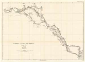
Mombasa - Victoria Lake Railway.
$650.00
Acquire
- Digital Map Information
- Suitable for large format printing
- File Size: 23.19 MB
- File Type: ZIP / TIFF
- ICC color profile embedded
- Delivered instantly via download link
This is an 1893 Royal Geographical Society map of the Mombasa-Lake Victoria Railway in modern-day Kenya. The map details the early planning and construction stages of one of the worlds more infamous and loved heritage railroads, the famed 'Lunatic Line'. Parts of the railroad still run. (more details)
Focuses on the Shire Highlands, a region in Central Africa claimed by both the British and Portuguese.
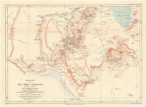
Sketch Map of the Shire Highlands shewing the routes of B.L. Sclater, R.E. F.R.G.S.
$450.00
Acquire
- Digital Map Information
- Suitable for large format printing
- File Size: 9.58 MB
- File Type: ZIP / TIFF
- ICC color profile embedded
- Delivered instantly via download link
This is an 1893 William Shawe map of the Shire Highlands in Malawi, which then was part of the British Central Africa Protectorate. Depicting the region just south of Lake Malawi, known then as Lake Nyasa, black lines track the movements of Lieutenant B.L. Sclater during the two years when he served as an assistant to the Commissioner of British Central Africa. Numerous towns and villages are labeled, as are rivers, mountains, and other locations. Printed notes, such as ‘open grass plain’ and ‘rolling plain, poorly forested’, provide some insight into the terrain. The Shire River arcs through the left half of the map. (more details)
One of the first scientific surveys of eastern Tibet.
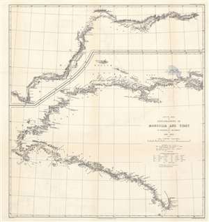
Route Map of Explorations in Mongolia and Tibet by W. Woodville Rockhill in 1891 - 1892.
$650.00
Acquire
- Digital Map Information
- Suitable for large format printing
- File Size: 21.36 MB
- File Type: ZIP / TIFF
- ICC color profile embedded
- Delivered instantly via download link
This is an important 1894 William Woodville Rockhill 'Great Game' map of western China, eastern Tibet, and part of Mongolia. The map depicts from Zhangjiakou, China to Xikangbatang, China and follows Rockhill's route in his attempt to reach Lhasa, Tibet. (more details)
Earliest map to compile the exploration of the Congo River Valley during the Scramble for Africa
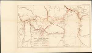
Map of Part of the South Eastern Congo-Basin Showing Recent Exploration
$850.00
Acquire
- Digital Map Information
- Suitable for large format printing
- File Size: 18.37 MB
- File Type: ZIP / TIFF
- ICC color profile embedded
- Delivered instantly via download link
A rare 1895 Royal Geographic Society map of the southeastern Congo River Basin - the first detailed map to compile over twenty years’ exploration along the courses of the Sankuru, Lomami and Lualaba rivers. This period culminated in the Congo Arab War, a conflict pitting the Belgian proxy government against a coalition of Arab slavers attempting to wrest control of the Congo Free State. (more details)
The first successful ascent of Aconcagua, the tallest mountain in America.
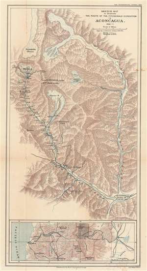
Sketch Map to illustrate the Route of the Fitzgerald Expedition to Aconcagua 1896 - 7.
$700.00
Acquire
- Digital Map Information
- Suitable for large format printing
- File Size: 14.7 MB
- File Type: ZIP / TIFF
- ICC color profile embedded
- Delivered instantly via download link
This is an 1898 Francis Sidney Weller map of This is an 1898 Francis Sidney Weller map of Mount Aconcagua, Mendoza Province, Argentina. The map depicts the region around Aconcagua, principally the Horcones Valley and the Vacas Valley. Black lines trace the 1896 – 1897 expedition financed and led by Edward Fitz Gerald (FitzGerald) that made the first successful ascent of Aconcagua. Aconcagua, labeled here in large block characters, is the tallest mountain outside Asia, as such it is also the tallest mountain in the Americas and in the Western and Southern Hemispheres. The region's topography is illustrated by hachure, and the area's glaciers and other major peaks are identified. An inset map along the bottom border situates Aconcagua in the larger region, placing it between Valparaiso, Chile and Mendoza, Argentina, where Fitz Gerald's team started their ascent. The proposed Trans-Andine Railway is illustrated here as well, with black lines detailing its progress through the mountains. (more details)
An early map of the Bermejo River by Captain Henry Bolland - an expert on the navigation of South American rivers.
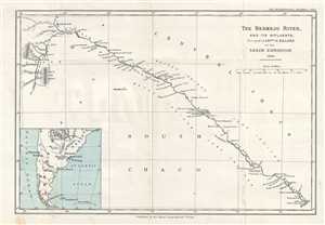
The Bermejo River, and its Affluents.
$250.00
Acquire
- Digital Map Information
- Suitable for large format printing
- File Size: 2.12 MB
- File Type: ZIP / TIFF
- ICC color profile embedded
- Delivered instantly via download link
This is an 1899 Captain Henry Bolland map of the Bermejo River and its tributaries in Argentina. The map depicts the river from its confluence with the San Francisco River (Rio San Francisco) to its confluence with the Paraguay River (Rio Paraguay). Perhaps the ... (more details)
A first-hand accounting of a 'hitherto blank piece of country' created in the early 20th century.
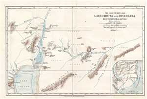
The Country Between Lake Chiuta and River Luli. British Central Africa.
$250.00
Acquire
- Digital Map Information
- Suitable for large format printing
- File Size: 2.49 MB
- File Type: ZIP / TIFF
- ICC color profile embedded
- Delivered instantly via download link
Depicting what Pearce calls 'the hitherto blank piece of country between Lake Chiuta and the Luli river', this is a 1900 Captain F. B. Pearce map of part of Malawi and Mozambique. Then divided between British Central Africa and Portuguese Mozambique, this map ... (more details)
The contentious borders between Bolivia and Peru.
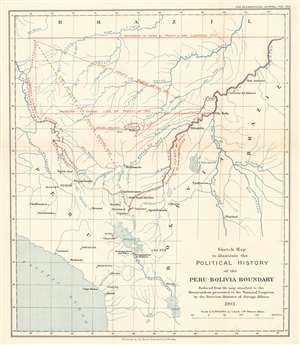
Sketch Map to illustrate the Political History of the Peru-Bolivia Boundary.
$250.00
Acquire
- Digital Map Information
- Suitable for large format printing
- File Size: 5.02 MB
- File Type: ZIP / TIFF
- ICC color profile embedded
- Delivered instantly via download link
This is a 1916 Royal Geographical Society map of Bolivia and Peru. Depicting the region from the Rio Ucayali to Brazil and from the Rio Yurua in Brazil to Lake Poopo and the Pacific coast. Red overprinting highlights the regional fluidity of national borders. Claims spanning from the late 18th into the early 20th century are traced by variously coded delimiters. Labels inform the viewer of the many claims and treaties, underscoring the region's complex diplomatic situation. Eventually, Bolivia and Brazil signed a treaty that set their mutual border. Bolivia and Peru, however, submitted their border dispute to international arbitration, ultimately conducted by the government of Argentina. (more details)
The oldest connection between Europe and Asia: the Aleppo - Basra Caravan Route.
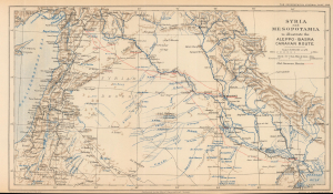
Syria and Mesopotamia to illustrate the Aleppo-Basra Caravan Route.
$375.00
Acquire
- Digital Map Information
- Suitable for large format printing
- File Size: 8.26 MB
- File Type: ZIP / TIFF
- ICC color profile embedded
- Delivered instantly via download link
This is a 1918 Royal Geographical Society map of Syria and Mesopotamia, highlighting the ancient caravan route between Aleppo and Basra. Depicting from Cyprus to the Persian Gulf, red dotted lines trace the old caravan routes between Aleppo, Syria, and Baghdad and Basra, Iraq. Aleppo, Baghdad, and Basra are underlined in red to emphasize their importance. Numerous other cities, including Jerusalem, Beirut, Mosul, Gaza, and Damascus, are identified, and the region's rivers, including the Tigris and Euphrates, are illustrated in blue. The Hamrin Mountains, a mountain range in northeastern Iraq, act as the map's eastern boundary. (more details)
British diplomat's travels through Shaanxi.
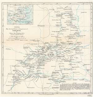
China. Map showing Routes in the province of Shensi by Eric Teichman, B.A.
$175.00
Acquire
- Digital Map Information
- Suitable for large format printing
- File Size: 8.78 MB
- File Type: ZIP / TIFF
- ICC color profile embedded
- Delivered instantly via download link
This is a 1918 Eric Teichman map of Shaanxi (Shensi) Province, China, created to accompany of an article written by Teichman for The Geographical Journal. A dashed line traces Teichman's route through the region, some of which follows the Huang Ho (Yellow) River. Towns and villages along the route are labeled, along with major towns around the region not encountered by Teichman. The area's many rivers are illustrated and labeled. Per the note in the lower right corner
This map is based on an original M.S. compiled by Mr. Teichman from his recent prismatic compass traverses, Chinese maps and local information, and adjusted at the places indicated by letters to the surveys and astronomically determined positions of Clementi (C), Tufel (T) and Filchner (F). Heights along the routes are from Mr. Teichman's readings of two aneroids, and should be considered as approximate only. Those obtained from other travelers are shown by letters attached as above. Heights marked (G) are from the Karte von Ost-China 1/M.(more details)
Surveying for the never-built Haifa-Baghdad railroad.
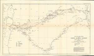
Motor and Camel Surveys in the North Arabian Desert.
$500.00
Acquire
- Digital Map Information
- Suitable for large format printing
- File Size: 11.09 MB
- File Type: ZIP / TIFF
- ICC color profile embedded
- Delivered instantly via download link
This is a 1923 A. L. Holt map of Syria and Lebanon as well as parts of Iraq, Saudi Arabia, and Palestine / Israel. Coverage extends from Jerusalem to Baghdad, and from Beirut to Jauf and the Nafud. The map highlights the motor route from Amman to Ramadi, along with other overland routes. Railways connecting Beirut, Damascus, and Amman with points farther south are also noted. (more details)
The First Mapping of the Great Desert of Eastern Arabia.
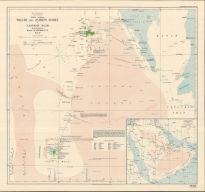
Arabia Routes between 'Oqair and Jabrin Oasis in Eastern Nejd.
$800.00
Acquire
- Digital Map Information
- Suitable for large format printing
- File Size: 535.1 MB
- File Type: ZIP / TIFF
- ICC color profile embedded
- Delivered instantly via download link
An impressive 1925 map recounting the incredible journey of R. E. Cheesman, the first European to cross the 'Great Desert' or 'Empty Quarter' (Rub' al Khali) in eastern Arabia. Based on Cheesman's surveys, the map appeared in conjunction with an article penned by him that appeared in The Geographical Journal. (more details)
Rivers and Villages.
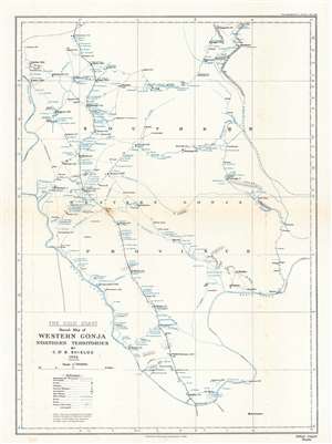
The Gold Coast. Sketch Map of Western Gonja Northern Territories.
$200.00
Acquire
- Digital Map Information
- Suitable for large format printing
- File Size: 4.57 MB
- File Type: ZIP / TIFF
- ICC color profile embedded
- Delivered instantly via download link
This is a 1926 Christopher St. Barbe Shields map of western Gonja Province in the Gold Coast, modern-day western Ghana. The map appears minimalist, with towns and villages noted only along rivers. It otherwise features minimal topography and no substantial detail away from the rivers - reflecting not only the reality of life in the region, but also the level of penetration then available to colonial administrators. Today, the Black Volta River serves as the border between Ghana and the Cote d'Ivoire. Here, that international border is marked by small black crosses and separates Gold Coast from the French colony of Cote d'Ivoire. (more details)