This item has been sold, but you can get on the Waitlist to be notified if another example becomes available, or purchase a digital scan.
1833 Cary Large-Format Case Map of the British Isles
BritishIsles-cary-1833$600.00

Title
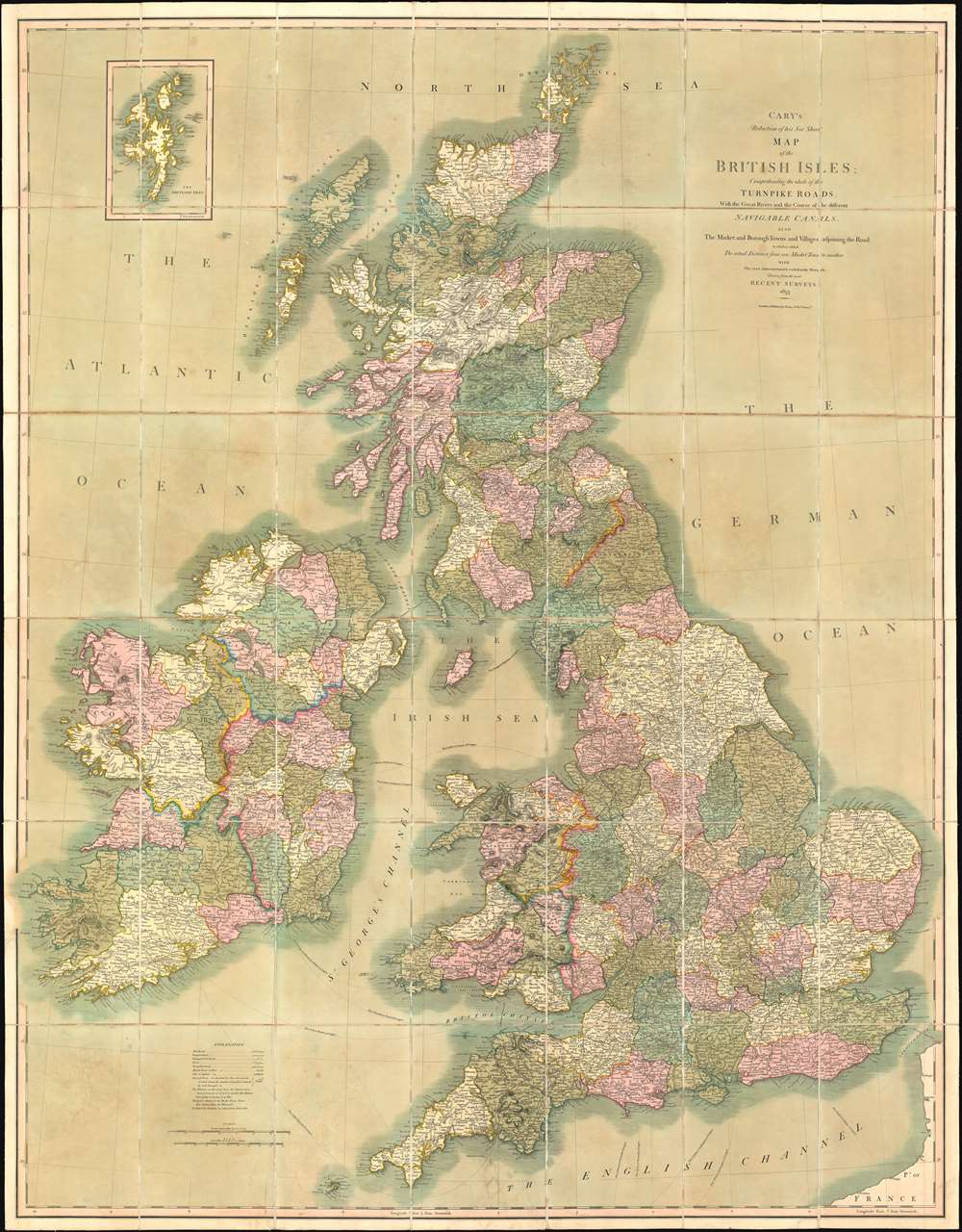
Cary's Reduction of his Six Sheet Map of the British Isles; Comprehending the whole of the Turnpike Toads, With the Great Rivers and the Course of the different Navigable Canals, also the Market and Borough Towns and Villages adjoining the Road, to which is added The actual Distance from one Market Town to another, with The exact admeasurement to each from the Metropolis.
1833 (dated) 49.75 x 38.75 in (126.365 x 98.425 cm) 1 : 920000
1833 (dated) 49.75 x 38.75 in (126.365 x 98.425 cm) 1 : 920000
Description
This is a stunning 1833 John Cary large-format folding case map of the British Isles. The map depicts the entirety of the British Isles, including England, Scotland, Wales, and Ireland. Coverage extends from the Blasket Islands and County Kerry in Ireland to the North Sea and from the Orkney Islands to the English Channel and northern France. Cities towns, and villages throughout the Isles are labeled, including London, Glasgow, Edinburgh, Dublin, and Belfast. Counties are identified and shaded different colors to allow for easy differentiation. Mail roads, turnpike roads, and principal cross roads are also illustrated.
Publication History and Census
This map was created and published by John Cary in 1833. Cary published several editions of this map, the first being 1818, with the current example being the 1833 4th edition. Editions are known from 1818, 1828, 1833, and 1843. After 1843, publication was taken over by George Crutchley, who published his own revised editions in the 1850s. The OCLC catalogs four examples of this map in institutional collections at Harvard, the University of Wisconsin - Milwaukee, the University of Victoria in British Columbia, and the University of Oxford. No matter the edition, this incredibly beautiful map is rare on the market.Cartographer
John Cary (1754 - 1835) was a London based cartographer active in the early part of the 19th century. Ronald Vere Tooley, the prominent English map historian, writes of Cary, "As an engraver he was elegant and exact with fine clear lettering and great delicacy of touch." Cary began his work as an engraver, cartographer, and globe maker in 1776 with his New and Correct English Atlas. This important atlas represented a new phase in cartography where accuracy and detail rose in prominence over the decorative embellishments of the 18th century. This change was indicative of the times when travel and commerce were expanding globally as never before. Cary's mastery of both engraving and cartography resulted in a series of seminal works that redefined mapmaking in the early 19th century. His stupendous Cary's New Universal Atlas, published in 1808, set the standard for all cartographers who followed. Cary reissued this seminal atlas in 1811, 1819, 1824, 1828, 1833, 1836 and 1844. Cary also did considerable work on the English Ordinance Survey prior to 1805. His cartographic work particularly inspired the Edinburgh school of cartography as represented by John Pinkerton and John Thomson. In America, Cary's work was used as the basis for Tanner's important New American Atlas. Cary's last published atlas appeared posthumously in 1844, however, by 1850 Cary's work was being carried on by his sons and other well-known cartographers including James Wyld, John Tallis & Company, and Crutchley. More by this mapmaker...
Condition
Very good. Dissected and mounted on linen in 42 panels. Light wear along original folds. Blank on verso. Accompanied by original slipcase.
References
OCLC 863385560.