This item has been sold, but you can get on the Waitlist to be notified if another example becomes available, or purchase a digital scan.
1913 Brooklyn Eagle / Williams Map of Brooklyn, Staten Island
BrooklynStatenIsland-brooklyndailyeagle-1913$250.00

Title
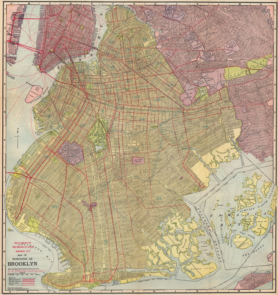
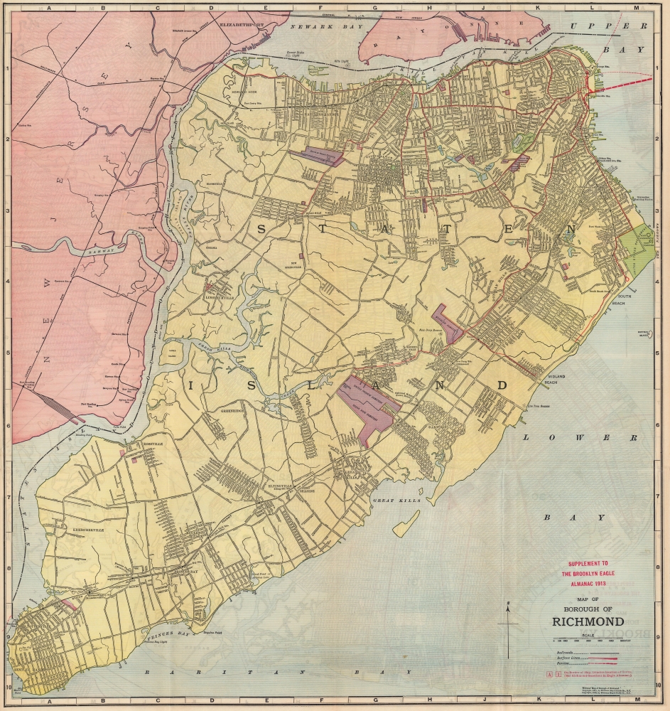
Supplement to the Brooklyn Eagle Almanac 1913, Map of Borough of Brooklyn / Map of Borough of Richmond.
1913 (dated) 20.75 x 22 in (52.705 x 55.88 cm) 1 : 33250
1913 (dated) 20.75 x 22 in (52.705 x 55.88 cm) 1 : 33250
Description
A colorful, richly detailed 1913 two-sided indexed map of the Brooklyn and Richmond (Staten Island) produced by the William Map and Guide Co. and published in the Supplement to the Brooklyn Eagle Almanac. It depicts Brooklyn fully-formed, reaching roughly its current street grid and extent of development.
The verso displays a similar map of Richmond (Staten Island). Urban development can be seen on the island's northern portion, along with a growing streetcar network and the Staten Island Railway.
A Closer Look
The recto map includes the Borough of Brooklyn along with portions of Manhattan and Queens. An alphanumeric grid surrounds the map in the border. Ward numbers and boundaries are noted in light blue. Railroad, subway, streetcar, and ferry lines are indicated throughout. Though less integrated than today's Metropolitan Transit Authority system, the mass transit system seen here had wider coverage, with streetcars reaching nearly all corners of the borough and providing more connections with Queens. This was the heyday of Coney Island, explaining the numerous means available to beachgoers and fun seekers for reaching the area.The verso displays a similar map of Richmond (Staten Island). Urban development can be seen on the island's northern portion, along with a growing streetcar network and the Staten Island Railway.
The Expanding Metropolis
The scope of this map demonstrates the explosive growth of Brooklyn at the turn of the 20th century. In 1870, the borough (then still an independent city) had less than 500,000 residents, but by 1910 the number had surpassed 1.5 million. Staten Island saw a similar pace of population growth, albeit starting from a much lower base.Publication History and Census
This map was produced by the Williams Map and Guide Co. for the 1913 Supplement to the Brooklyn Eagle Almanac. Up until 1912, the Supplement to the Brooklyn Eagle Almanac had included an 1898 map by Robert Servoss, which was the first map of Brooklyn as a Borough of New York City. Then, the Williams Map and Guide Co. produced an updated map, seen here, which was used until the mid-1920s, when a map by the Hagstrom Map Co. replaced the Williams Map. Neither the present map nor the 1913 almanac are cataloged in OCLC.Cartographer
Brooklyn Eagle (1841 – 1955; 1960 – 1963) was a daily newspaper published in Brooklyn that at one point was the afternoon paper with the largest circulation in the U.S. Its editors included Walt Whitman and the paper was closely connected with the Democratic Party in New York. It closed during a long strike in 1955 and was briefly revived in the early 1960s before folding again. A much smaller-scale newspaper reviving the name Brooklyn Eagle has been in publication since 1996. More by this mapmaker...
Source
Supplement to the Brooklyn Eagle Almanac 1913, (New York: Williams Map and Guide Co.) 1913.
Condition
Very good.