1915 Bemporat Map of Buenos Aires, Argentina
BuenosAires-bemporat-1915$1,200.00


Title
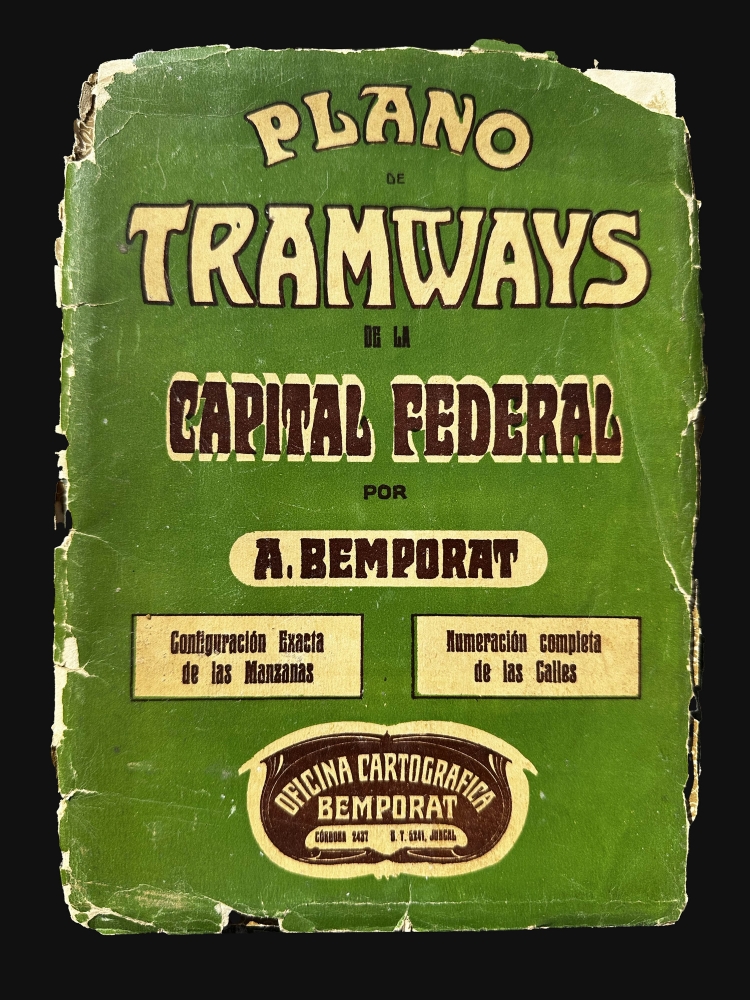
Plano Centenario de la Capital Federal / Plano de Tramways de la Capital Federal.
1915 (undated) 33 x 44.5 in (83.82 x 113.03 cm) 1 : 21500
1915 (undated) 33 x 44.5 in (83.82 x 113.03 cm) 1 : 21500
Description
This c. 1915 map is an early example Aquiles Bemporat's map of Buenos Aires, issued as the city was undergoing a period of during a period of cultural and economic florescence. Bemporat was one of the most prominent 20th century cartographers of his home city and country, and this beautiful example is one of the finest we have seen of his work.
A Closer Look
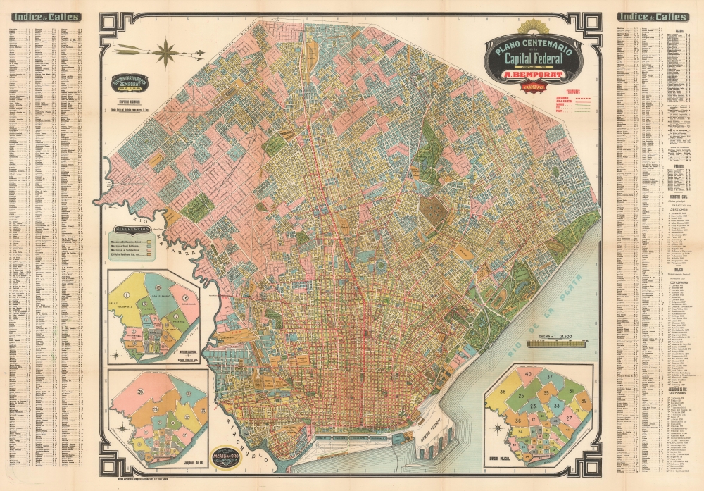
Oriented towards the west, the map employs vivid chromolithographic color to shade different blocks (manzanas) of the city according to their density and function, with public buildings, train stations, barracks, armories, the city's aerodrome, and the like appearing in dark orange. Parks, cemeteries, golf courses, and sports stadiums are also clearly distinguished. The city's extensive tramway and recently-opened underground network, for which it was world-renowned at the time, is displayed prominently in red lines. The rail network leading into and through the city, and emanating to points throughout South America, which was also world class, is readily apparent. Three inset maps oriented towards the west display the city's electoral, administrative, and judicial districts. On either side of the map, a detailed index of street names appears, corresponding to a grid surrounding the map. At right are lists of plazas, parks, and government offices. Some of the urban development displayed here is speculative, especially in the city's southwest, as ghosted in streets and buildings overlie rivers and existing buildings that did not conform to the city's near geometric grid.Tramways and Subways
At the time of this map's publication, Buenos Aires and Argentina as a whole were rightly regarded as world leaders in the development of railways, tramways, and underground railways. Infrastructure, industrialization, and immigration went hand-in-hand, and Buenos Aires became a great magnet for money and people in the late 19th century. New neighborhoods sprang up in a handful of years, and the city grew rapidly, necessitating the development of tramways extending throughout the city. The Buenos Aires Underground (Subte for short), opened in 1913, was the first in Latin America, first in the Southern Hemisphere, and first in the Spanish-speaking world.Publication History and Census
This map was published by Aquiles Bemporat in 1915 or shortly thereafter. A small circle at bottom-left notes that Bemporat was awarded a gold medal at the 1915 Panama-Pacific International Exposition in San Francisco, indicating that this map was produced shortly afterwards (it is unclear if the award was for this map in particular or for his general output). The lack of a date or edition number make it difficult to establish a census, but other Bemporat plans of Buenos Aires from the era that we have been able to locate include either a date or an edition number, suggesting that this is an unrecorded example.Cartographer
Aquiles Bemporat (1869 - September 22, 1957) was an Argentine-Italian cartographer and map publisher based in Buenos Aires. He was born in Trieste, Italy and emigrated to Buenos Aires sometime in the late 1870-80s, when he was a child. His firm, Oficina Cartográfica Bemporat, was founded around 1910 and remained active until at least 1960. Bemporat himself is elusive, despite a significant publication corpus. His map c. 1915 map of Buenos Aires won a gold medal at the 1915 San Francisco Exposition Universal. A 1949 CIA analysis of his work suggested that most of the map compilation was done in house by Bemporat himself, then over 70, and printed locally by network of small independent printers. The CIA report ultimately dismissed his maps as 'insufficiently accurate for intelligence use.' Nonetheless, Bemporat's work was highly decorative and enjoyed a strong local and international following, particularly in Latin America and Europe. He was widely admired for his longevity and continued to publish until his death at age 88. More by this mapmaker...
Condition
Very good. Some verso reinforcement and surface soiling along original fold lines. Slight loss reinstated a t a couple of fold intersections. Detached from but accompanied by original binder, which itself exhibits considerable wear.