
Bemporat, Aquiles

Aquiles Bemporat (1869 - September 22, 1957) was an Argentine-Italian cartographer and map publisher based in Buenos Aires. He was born in Trieste, Italy and emigrated to Buenos Aires sometime in the late 1870-80s, when he was a child. His firm, Oficina Cartográfica Bemporat, was founded around 1910 and remained active until at least 1960. Bemporat himself is elusive, despite a significant publication corpus. His map c. 1915 map of Buenos Aires won a gold medal at the 1915 San Francisco Exposition Universal. A 1949 CIA analysis of his work suggested that most of the map compilation was done in house by Bemporat himself, then over 70, and printed locally by network of small independent printers. The CIA report ultimately dismissed his maps as 'insufficiently accurate for intelligence use.' Nonetheless, Bemporat's work was highly decorative and enjoyed a strong local and international following, particularly in Latin America and Europe. He was widely admired for his longevity and continued to publish until his death at age 88.
La Reina del Plata.
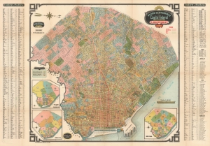
Plano Centenario de la Capital Federal / Plano de Tramways de la Capital Federal.
$1,200.00
Acquire
- Digital Map Information
- Suitable for large format printing
- File Size: 208.06 MB
- File Type: ZIP / TIFF
- ICC color profile embedded
- Delivered instantly via download link
This c. 1915 map is an early example Aquiles Bemporat's map of Buenos Aires, issued as the city was undergoing a period of during a period of cultural and economic florescence. Bemporat was one of the most prominent 20th century cartographers of his home city and country, and this beautiful example is one of the finest we have seen of his work. (more details)
Use a transparency to find nearly any street in Buenos Aires.
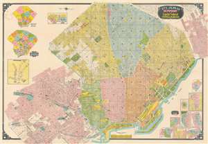
This is a c. 1966 Bemporat city map of Buenos Aires, Argentina. Buildings throughout are illustrated and identified, including the River Plate football team's stadium, the 'Hipodromo Argentino', sports clubs, hospitals, and municipal buildings. City parks and squares leap off the page in bright green. Streets throughout are labeled and city blocks numbered, facilitating navigation. Nine insets situated in the lower right detail neighborhoods. Insets in the upper left illustrate municipal divisions and police precincts. A final inset, along the left border, depicts the Buenos Aires subway network, known as the Subte de Buenos Aires. (more details)