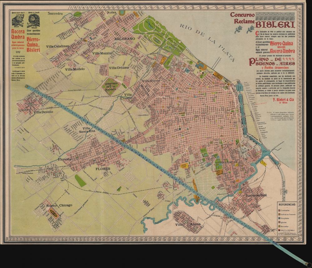
1901 Cassoli and Bisleri City Plan or Map of Buenos Aires, Argentina
BuenosAires-cassolibisleri-1901$500.00

Title
Plano de Buenos Aires y Pueblos circunvecinos.
1901 (dated) 19.75 x 24.75 in (50.165 x 62.865 cm)
1901 (dated) 19.75 x 24.75 in (50.165 x 62.865 cm)
Description
This is a 1901 Cassoli and Bisleri city map of Buenos Aires, Argentina, featuring a novel attached tape measure to accurately calculate locations. In September 1900, Bisleri of Milan launched a contest (Concurso Reclame Bisleri) to create the best way to advertise two of their products: their aperitif liqueur (Hierro Quina Bisleri) and their natural carbonated mineral water (Nocera Umbra). In June 1901, they published the present map (complete with advertisements for both the liqueur and the mineral water), which had been designed by Mr. E. Cassoli.
A Closer Look
The map depicts Buenos Aires and its environs from Nuñez and Saavedra to Villa Alsina and from Villa Devoto to the Rio de la Plata. Streets are labeled throughout, including those that end at the four dique. Tram stations, churches, markets, hospitals, and police stations are highlighted. The Parque 3 de Febrero stands out in bright green.The Tape
The tape (cintita) is attached to the map near the left border and stretches across the piece. The tape and the numbers around the border are used in concert to locate specific sites according to the accompanying index.Publication History and Census
This map was created by E. Cassoli and published by Bisleri in 1901. This is the only known cataloged example.Condition
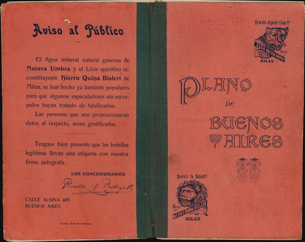
Very good. Wear along original fold lines. Verso repairs to fold separations and at fold intersections. Accompanied by original index.