1953 Peuser Map of Buenos Aires
BuenosAires-peuser-1953$400.00

Title
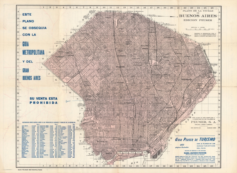
Plano de la Ciudad de Buenos Aires.
1953 (undated) 17.25 x 22 in (43.815 x 55.88 cm) 1 : 40000
1953 (undated) 17.25 x 22 in (43.815 x 55.88 cm) 1 : 40000
Description
A detailed and highly practical c. 1953 map of Buenos Aires, produced by Peuser, the premier guide map publisher of the time. Among other features, it reflects the social welfare policies of the first administration of President Juan Perón.
A Closer Look
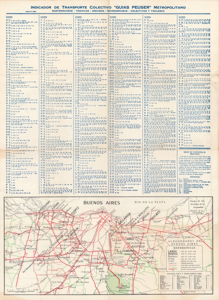
Oriented towards the west, this highly detailed map of Buenos Aires takes in both the city's historic core near the Rio de la Plata as well as the more recent urban sprawl further inland to the west. A grid surrounds the map, and the contours of the city itself at left, corresponding to an index of subway, tram (streetcar), and bus lines on the verso. At bottom-right, the locations of Peuser bookshops in Buenos Aires and other cities are listed. At bottom on the verso is a map of the wider region around Buenos Aires.Public Works for the People
This map was produced in the latter part of Juan Perón's first presidency (1946-1955). As a populist, Perón drew support from working-class neighborhoods in the western part of Buenos Aires, some of which were very poor shanty towns. Whatever his faults (such as an authoritarian streak and torturing political opponents), Perón did channel great sums towards public works, infrastructure, public housing, and other measures that improved people's daily lives. The already excellent rail and subway network of Buenos Aires was expanded, public housing projects were built on a massive scale to replace slums, and utilities like the Obras Sanitarias de la Nación, towards top-left here, were given large budget increases. These measures gained Perón ardent support and even a cult of personality, resulting in buildings (such as the Retiro rail station at bottom-right) and an entire barrio (at top-right) being named for him.Publication History and Census
This map was produced around the year 1953 by Peuser, a local bookstore and publisher. Though it is undated, the inclusion of the Autodromo Municipale towards top left (now the Autódromo Oscar y Juan Gálvez) indicates a date of 1952 or later. Peuser produced multiple editions of the map from the 1920s - 1960s for their Buenos Aires guides, but the lack of a printed date has led to cataloging ambiguities. The closest likely match to the present map is cataloged as 1949 and held by the University of California Berkeley (OCLC 23076492).Cartographer
Jacobo Peuser (1842 - November 9, 1901) was the German-born founder of a bookshop and publishing house in Buenos Aires that bore his name. When he was 12, his family moved to La Plata in Argentina. Jacobo became interested in arts and printing and began working in the industry in nearby cities, before moving to Buenos Aires at age 23 and establishing his own stationery and book shop. He found quick success and expanded his business, acquiring competitors and building a grand new headquarters in 1891. New locations were added, including in other cities, and Peuser developed a reputation as a premier bookstore in Argentina with an extensive collection of works in different fields. Peuser Guides for Buenos Aires and other cities became the gold standard for tourists and locals alike. He also expanded into publishing postcards late in life. After his death in 1901, Peuser's descendants continued the business under his name until it closed in 1964. Peuser's headquarters still stands at Avenida Patricios 567 in Buenos Aires, with the words 'Fundado 1867' displayed prominently on the building's façade. More by this mapmaker...
Condition
Very good. Minor wear and discoloration along fold lines and fold intersections. Offsetting.