This item has been sold, but you can get on the Waitlist to be notified if another example becomes available, or purchase a digital scan.
1903 Poole Brothers Railroad Map of California w/ a List of Hotels
CaliforniaHotels-poolebros-1903$87.50

Title
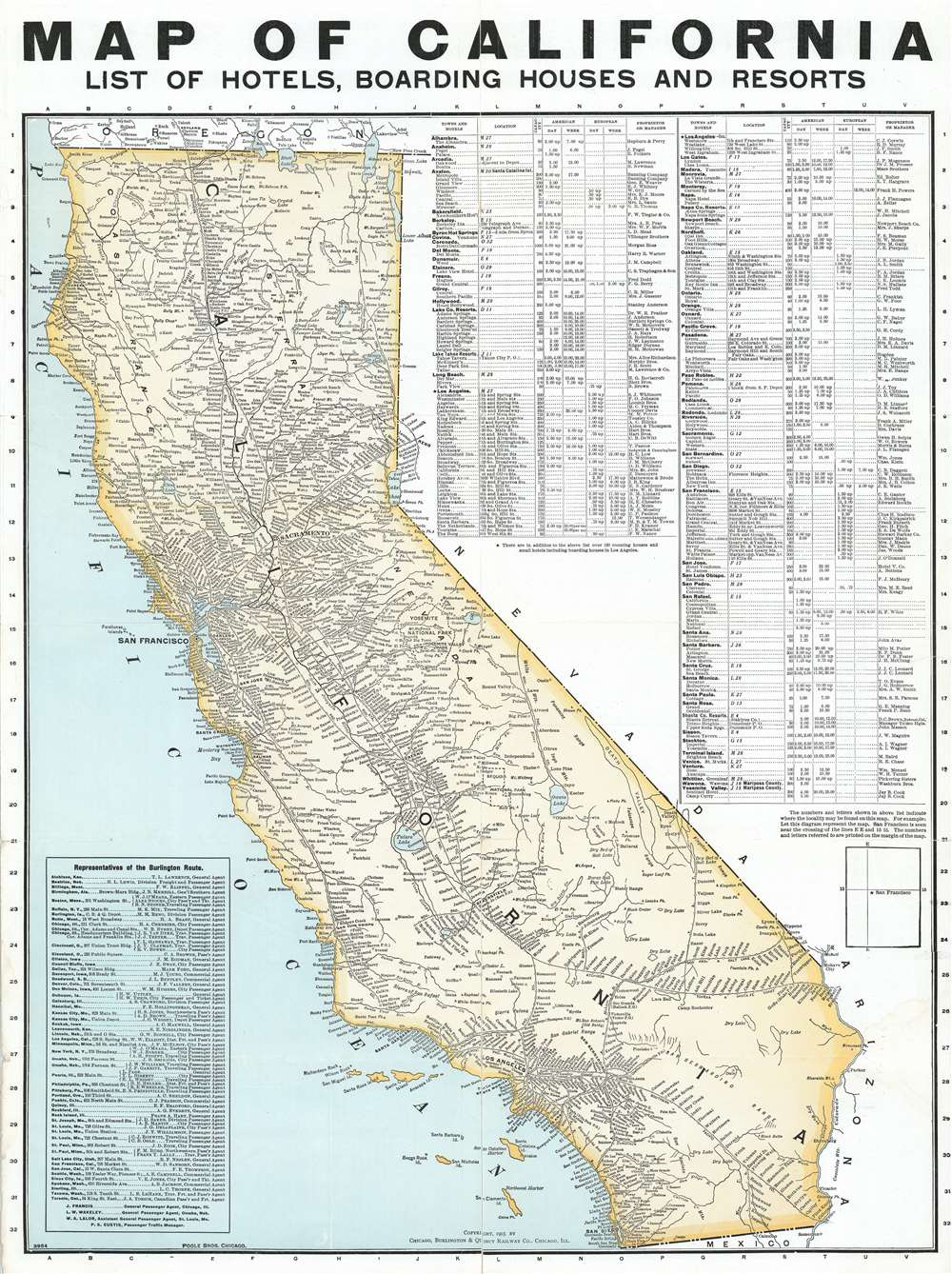
Map of California. List of Hotels, Boarding Houses and Resorts.
1903 (dated) 23 x 17.25 in (58.42 x 43.815 cm) 1 : 2140160
1903 (dated) 23 x 17.25 in (58.42 x 43.815 cm) 1 : 2140160
Description
This is a 1903 Poole Brothers railroad map of California featuring an index of hotels, boarding houses, and resorts. Cities and towns throughout the state are identified, with particular attention paid to the stops along the state's many railroads, including San Francisco, Los Angeles, and Sacramento. Routes of the Southern Pacific; the Atchison, Topeka, and Santa Fe; the San Pedro, Los Angeles, and Salt Lake; and the California Northern are labeled. The index of hotels is situated along the right border and lists cities in California in alphabetical order, the location, capacity, American and European rates, and the proprietor. A text box in the lower left corner lists the representatives of the Chicago, Burlington, and Quincy Railroad from in alphabetical order by city from Atchison, Kansas to Toronto, Ontario.Publication History and CensusThis map was created by Poole Brothers and published by the Chicago, Burlington, and Quincy Railroad in 1903. This map was published in at least two states and is rare. Not in the OCLC.
Cartographer
Poole Brothers (1878 - 1968) were a Chicago based firm active in the late 19th and early 20th century with an initial focus on promotional railroad maps. Poole Brothers was founded by George Amos Poole (March 20, 1843 – September 7, 1918). In 1868, Poole, along with his uncle William H. Rand (1828 - 1915) and Andrew McNally (1836 - 1904), purchased the Chicago Tribune's job printing plant and formed the firm Rand McNally. In 1878, he left Rand McNally to form, with his brother William H. Poole, Poole Brothers, a direct competitor to Rand McNally for the lucrative railroad business. Like many of its competitors, Poole Brothers maintained an office on Chicago's Printer's Row (downtown Loop district). Their earliest known work is an 1880 map of Yellowstone National Park. In 1887, Poole Brothers, Andrew McNally, and several others formed the United Typothetae of America, a master printers association. In 1848, they were cited, along with Rand McNally and George Cram, by the Federal Trade Commission for price fixing. Their earliest known work is an 1880 map of Yellowstone National Park. Afterward they went on to produce a vast range of maps and other print products including tickets, cards, coupons, and restaurant menus. In time Poole Brothers merged with Newman-Randolph, which was then acquired by the American Can Company in the early 1960s. The American Can Company liquidated its printing concerns later in the same decade. More by this mapmaker...
Condition
Good. Centerfold separations professionally repaired on verso. Closed tears extending one quarter inch (.25) and one half inch (.5) into printed area professionally repaired on verso. Text on verso.