This item has been sold, but you can get on the Waitlist to be notified if another example becomes available, or purchase a digital scan.
1931 National Development Bureau Road Map of Western Canada and the U.S.
CanadaPacific-natdevbureau-1931$62.50

Title
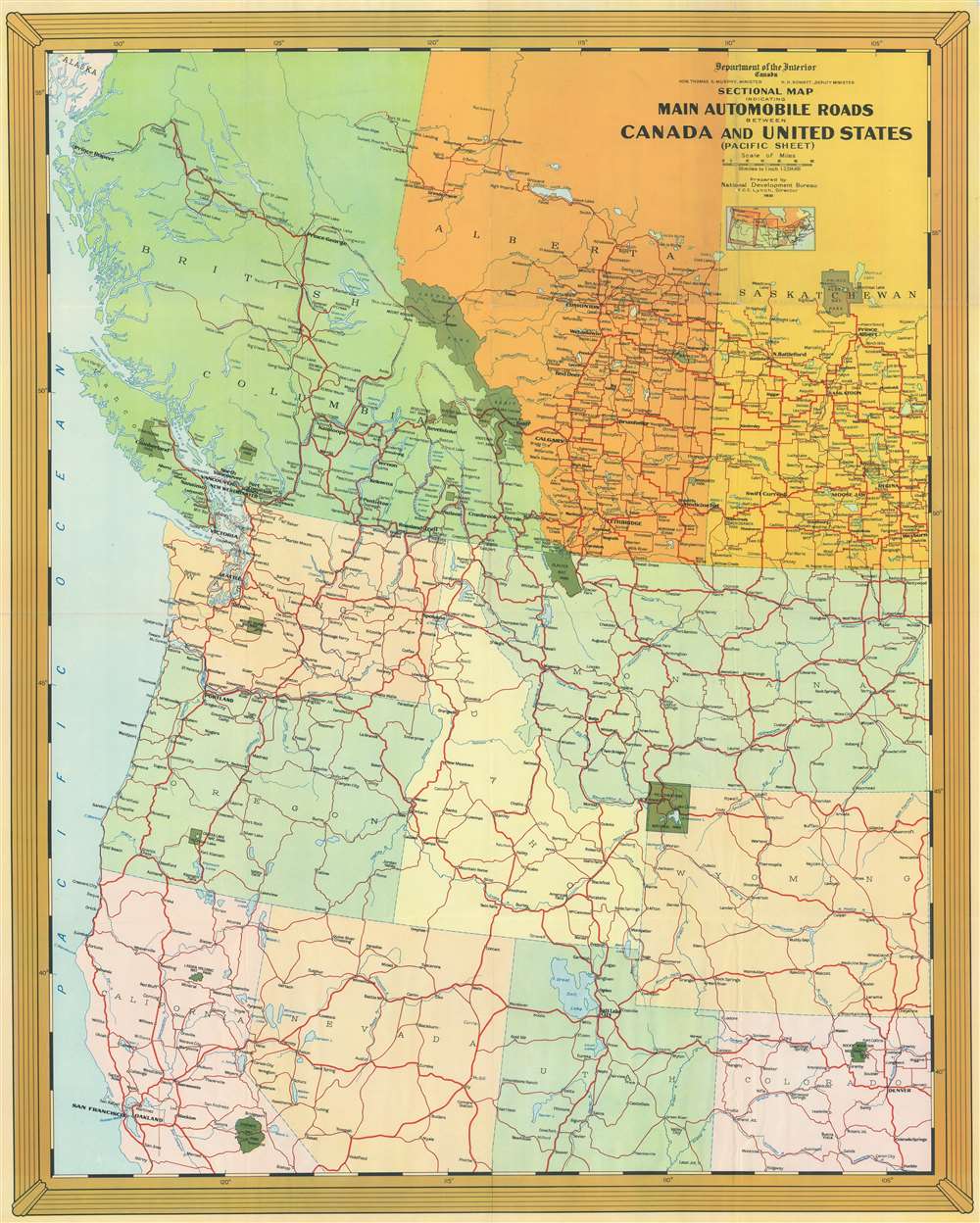
Sectional Map Indicating Main Automobile Roads Between Canada and United States (Pacific Sheet).
1931 (dated) 38 x 30.25 in (96.52 x 76.835 cm) 1 : 2534400
1931 (dated) 38 x 30.25 in (96.52 x 76.835 cm) 1 : 2534400
Description
This is a National Development Bureau road map of western Canada and the western United States. Depicting the region from Notikewen, Alberta to Pueblo, Colorado, and from the Pacific Ocean to Cheyenne, Wyoming, the map highlights road connections between the two countries. Red lines representing major highways meander their way across the continent. Green splotches marking national parks stand out against the multicolored American states and Canadian provinces.
Publication History and Census
This map was created by the National Development Bureau, which took charge of promoting tourism in Canada in the early 1930s. Seven examples are cataloged in OCLC and are part of the collections at the University of Chicago, the Newberry Library, the University of Texas, the Denver Public Library, Montana State University, the University of California Los Angeles, the University of California Berkeley.Condition
Very good. Light wear and toning along original fold lines. Blank on verso.
References
OCLC 29354429.