1912 Poole Brothers Railroad Map of the United States and Canada
CanadianPacificRailway-poolebros-1912$250.00

Title
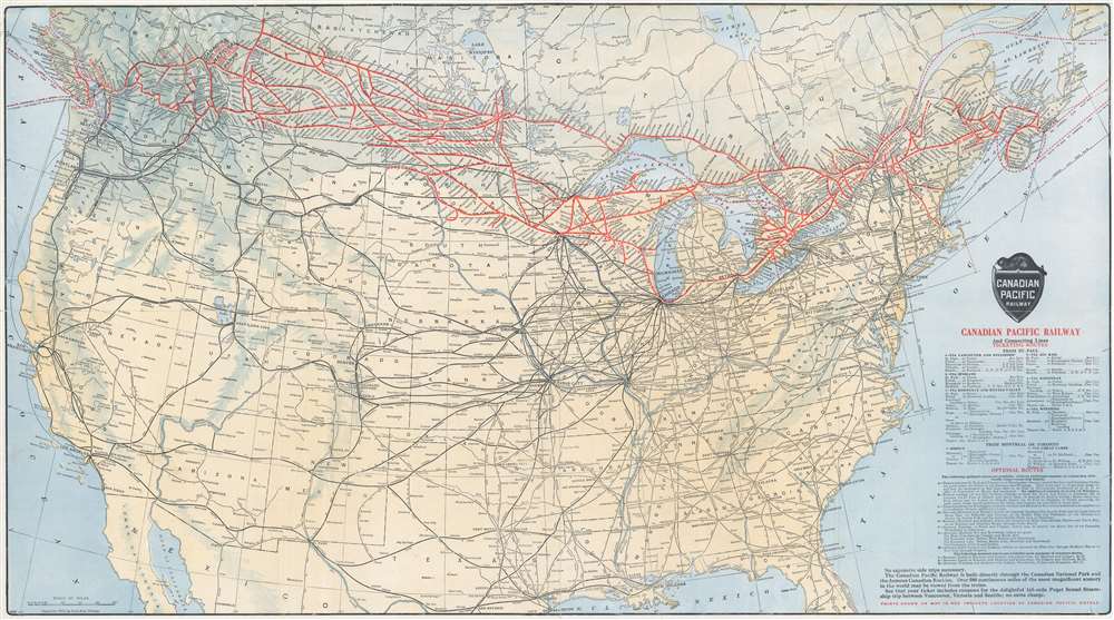
Canadian Pacific Railway and Connecting Lines.
1912 (dated) 17.5 x 31.5 in (44.45 x 80.01 cm) 1 : 6336000
1912 (dated) 17.5 x 31.5 in (44.45 x 80.01 cm) 1 : 6336000
Description
This 1912 Poole Brothers railroad map of the United States and Canada details the Canadian Pacific Railway and its many connections. Created with both vacationers and business travelers in mind, bright red lines highlight the Canadian Pacific Railway's network throughout southern Canada and the northern United States. These lines connect Boston, Ottawa, Montreal, Detroit, Minneapolis, Chicago, Winnipeg, and Vancouver. Canadian national parks, such as Banff, are labeled in bold. Thinner but bold black lines promote lines connecting cities further afield throughout the United States, underscoring the railroad's continental reach. Additionally, dashed lines trace steamship routes, including one between Vancouver, Victoria, and Seattle. Information concerning ticketing routes and optional routes appears in the lower right.
Publication History and Census
This map was created by Poole Brothers and published by the Canadian Pacific Railway. Several editions of this map were published both before and after 1912. A single example of this 1912 edition is cataloged in OCLC, part of the collection at Stanford University.Cartographer
Poole Brothers (1878 - 1968) were a Chicago based firm active in the late 19th and early 20th century with an initial focus on promotional railroad maps. Poole Brothers was founded by George Amos Poole (March 20, 1843 – September 7, 1918). In 1868, Poole, along with his uncle William H. Rand (1828 - 1915) and Andrew McNally (1836 - 1904), purchased the Chicago Tribune's job printing plant and formed the firm Rand McNally. In 1878, he left Rand McNally to form, with his brother William H. Poole, Poole Brothers, a direct competitor to Rand McNally for the lucrative railroad business. Like many of its competitors, Poole Brothers maintained an office on Chicago's Printer's Row (downtown Loop district). Their earliest known work is an 1880 map of Yellowstone National Park. In 1887, Poole Brothers, Andrew McNally, and several others formed the United Typothetae of America, a master printers association. In 1848, they were cited, along with Rand McNally and George Cram, by the Federal Trade Commission for price fixing. Their earliest known work is an 1880 map of Yellowstone National Park. Afterward they went on to produce a vast range of maps and other print products including tickets, cards, coupons, and restaurant menus. In time Poole Brothers merged with Newman-Randolph, which was then acquired by the American Can Company in the early 1960s. The American Can Company liquidated its printing concerns later in the same decade. More by this mapmaker...
Condition
Very good. Closed margin tears professionally repaired on verso. Area of verso reinforcement. Exhibits slight loss to left margin not effecting printed area.
References
OCLC 978670421.