
This item below is out of stock, but another example (left) is available. To view the available item, click "Details."
Details
1930 Mons Pictorial Map of the Cape Ann Trail, Massachusetts
$250.00
1930 Mons Pictorial Map of the Cape Ann Trail, Massachusetts
CapeAnnTrail-mons-1930$125.00

Title
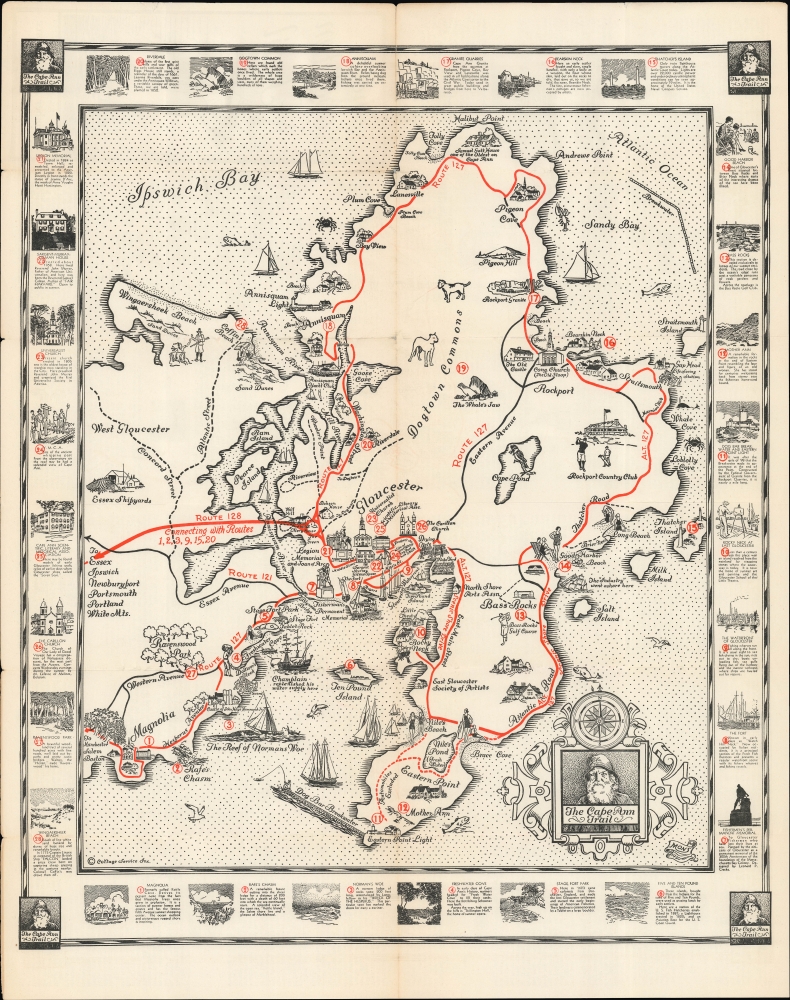
The Cape Ann Trail.
1930 (dated) 23.25 x 19.5 in (59.055 x 49.53 cm) 1 : 16000
1930 (dated) 23.25 x 19.5 in (59.055 x 49.53 cm) 1 : 16000
Description
A lovely 1930 pictorial map of Cape Ann, Massachusetts, including Rockport and Gloucester, illustrated by the artist 'Mons' and published by the Gloucester Chamber of Commerce. It outlines a trail around the peninsula that hits its best-known attractions and historical sites, most of which relate to the colonial era or the area's nautical orientation, including its famous fishing industry.
The map was reissued at least once, in 1964, and this, combined with uncertainty over its authorship, have led to it appearing in seven listings in the OCLC. In any event, the 1930 original printing looks to be held by eleven institutions.
A Closer Look
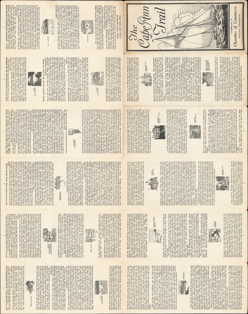
The entirety of the Cape Ann peninsula is illustrated, with towns indicated throughout. Red lines prominently trace the routes of the Cape Ann Trail and other major roads, including State Route 128, which connects Cape Ann with the Boston metropolitan area. Illustrations of people and animals, buildings, and natural sites appear throughout. Historical references are included as well, such as the supposed spot where Samuel de Champlain stopped to collect fresh water and Norman's Woe, a reef famous for shipwrecks throughout Gloucester's history. Red numbered circles refer to the locations of attractions and historically significant sites, which are illustrated and briefly discussed in the border. The verso includes extensive text regarding the route of the 'trail' around Cape Ann and the history of the sites noted on the recto, along with additional illustrations.Publication History and Census
This pictorial map is signed by 'Mons' and dated to 1930. The text on the verso was written by local author Edward Vassar Ambler (c. 1884 - 1959), and for this reason the map itself is sometimes attributed to him. It is copyrighted by Cottage Service Inc. and was published by the Gloucester Chamber of Commerce. This map should be distinguished from other contemporary pictorial maps of Cape Ann, including Coulton Waugh's 1927 'Cape Ann and the North Shore' and Errol William Gough's 1934 'A Picture Map of Cape Ann and the North Shore' (previously sold by us).The map was reissued at least once, in 1964, and this, combined with uncertainty over its authorship, have led to it appearing in seven listings in the OCLC. In any event, the 1930 original printing looks to be held by eleven institutions.
Condition
Good. Wear along original fold lines. Slight loss a few fold intersections. Some toning. Text on verso.
References
OCLC 5571403, 928042852, 861928970.