1936 Crawford Press Pictorial Map of Cape Cod, Massachusetts
CapeCod-crawfordpress-1936$850.00

Title
Cape Cod.
1936 (dated) 15.5 x 16 in (39.37 x 40.64 cm) 1 : 181000
1936 (dated) 15.5 x 16 in (39.37 x 40.64 cm) 1 : 181000
Description
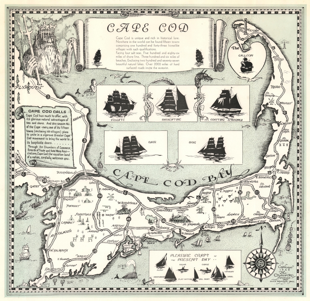
This is a 1936 Crawford Press pictorial map of Cape Cod, Massachusetts. The map celebrates the iconic villages, sights, and maritime history of Cape Cod.
A Closer Look
Illustrations fill Cape Cod, including herds of deer, golfers, equestrians, windmills, cabins, lighthouses, and airplanes. The Pilgrim Monument is illustrated in Provincetown. Silhouettes illustrate the profiles of many of the ship-types that visited Cape Cod - here divided into historical vessels and modern-day pleasure craft. The Cape Cod sea serpent makes an appearance above these illustrations, not far from a mermaid. (The 'Sea Serpent' is said to ply the waters from Cape Cod to Cape Ann. There have been numerous sightings and some photographs of 'serpents' caught in fisherman's nets. Both the sightings and the captured fish are almost certainly very real and sea-serpent-like deepwater oarfish). King Neptune overlooks the scene from the upper left corner, just off the coast of Plymouth. Silhouettes of present-day 'pleasure craft' are included along the bottom border.Publication History and Census
This map was created and published by the Crawford Press in 1936. We note a single cataloged example in OCLC, which is part of the collection at Harvard University. We also note an example in the collection at the Sturgis Library in Barnstable, Massachusetts. This map appears on the private market from time to time.Condition
Very good.
References
OCLC 45874632.