1929 Turell Silk Road Map of Catalonia, Spain
CarreterasCataluna-turell-1929$250.00

Title
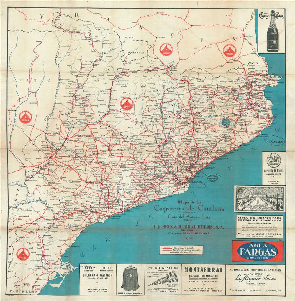
Mapa de las Carreteras de Cataluña publicado por la Guía del Automovilista (VII Año).
1929 (dated) 28.25 x 27 in (71.755 x 68.58 cm) 1 : 600000
1929 (dated) 28.25 x 27 in (71.755 x 68.58 cm) 1 : 600000
Description
This is a 1929 Vicente Turell road map of Catalonia, Spain, printed on silk. Created for an automotive guidebook, its publishers hoped to continue to benefit from the relative economic prosperity of the late 1920s. Major roads are traced in red, while advertisements for restaurants, automotive repair shops, and car manufacturers occupy the space created by the Mediterranean. The logo of Saurer, a Swiss automotive company, appears five times in black areas created by the road network, suggesting that Saurer was a significant contributor to the guidebook's publishers.
Publication History
This map was drawn by Vicente Turell and published in the seventh edition of the Guía del Automovilista by L.G. Seix and Barral Herms of Barcelona in 1929.Condition
Good. Printed on silk. Exhibits soiling. Some soiling and wear along original fold lines.