1952 Neal Cartoon Pictorial Map of Tokyo, Japan
CartoonMapTokyo-neal-1952$400.00

Title
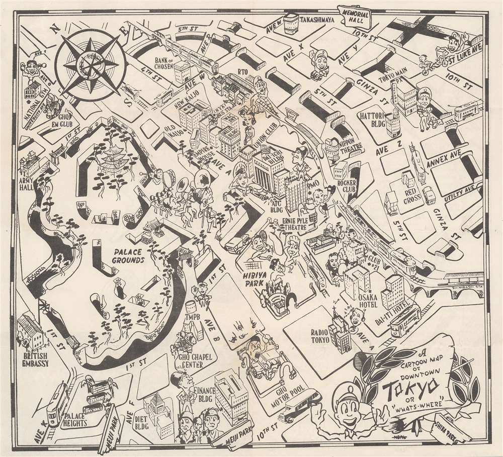
A Cartoon Map of Downtown Tokyo or 'What's Where'.
1952 (undated) 9.75 x 10.75 in (24.765 x 27.305 cm)
1952 (undated) 9.75 x 10.75 in (24.765 x 27.305 cm)
Description
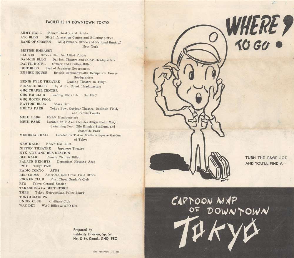
This is a 1952 Neal cartoon pictorial map of downtown Tokyo during the last year of the Allied occupation. Caricatured figures appear throughout, many of them wearing military hats or helmets (if they represented the military police). Women are illustrated throughout the city as well, since hundreds of thousands of American civilians worked for the occupation forces. Buildings around Tokyo are illustrated and labeled, including the Dai-Ichi building, MacArthur's headquarters, the British Embassy, the Ernie Pyle Theatre, the main PX where American servicemen would have gone to get supplies, and the Diet Building, the seat of the Japanese government. All buildings are included in a list printed on the verso, which explains what services American personnel could find in each. Streets, some with streetcars, are labeled.
The Allied Occupation of Japan
Following the Japanese surrender on September 2, 1945, Allied forces occupied Japan until 1952. Over one million Allied soldiers rotated through post-war Japan overseeing the transition to a democratic government. Unlike in Germany, where the entire government fell apart after the defeat of the Nazi regime, the Japanese government remained mostly intact, meaning that a full-scale military government was never implemented. The Allied occupation force focused on feeding the starving Japanese populace, creating access to healthcare, education, and land reform, overseeing the writing of a new constitution, enfranchising women, and prosecuting war criminals. Intriguingly, we have located very little literature about life in occupied Tokyo.Publication History and Census
This map was created by an artist known only by the last name Neal and published by the Publicity Division, Special Services, Hq. and Sv. Command, GHQ, FEC (Far East Command). We note one cataloged example in OCLC at the Wisconsin Veterans Museum Research Center.Condition
Very good. Light wear along original fold lines.
References
OCLC 773926016.