This item has been sold, but you can get on the Waitlist to be notified if another example becomes available, or purchase a digital scan.
1843 Blake Nautical Chart or Map of Key West, Florida
ChartKeyWest-blake-1843$375.00

Title
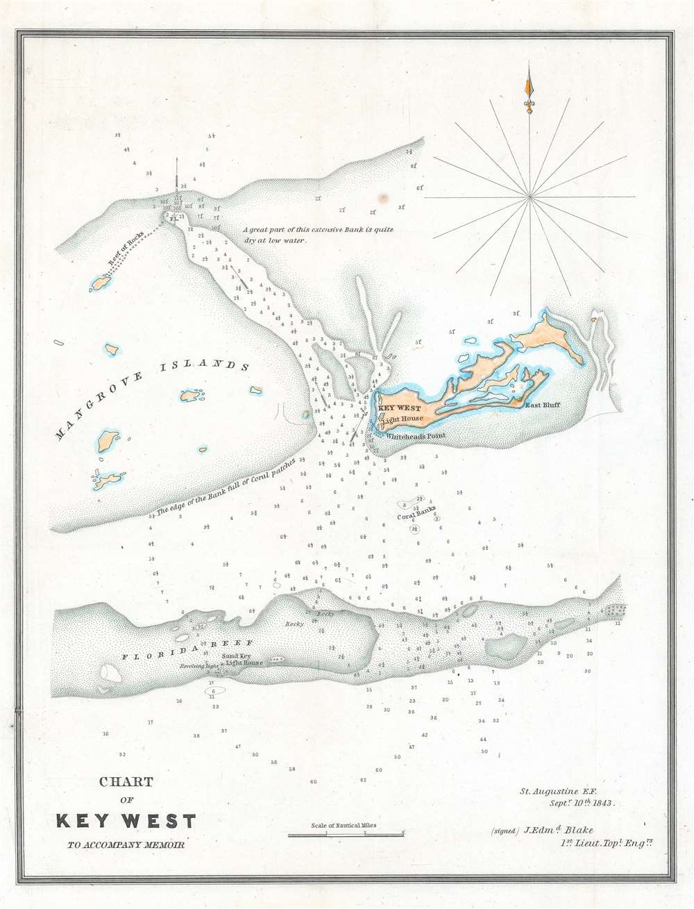
Chart of Key West to Accompany Memoir.
1843 (dated) 12.5 x 9.75 in (31.75 x 24.765 cm) 1 : 130000
1843 (dated) 12.5 x 9.75 in (31.75 x 24.765 cm) 1 : 130000
Description
This is an 1843 Jacob Edmund Blake nautical chart or map of Key West, Florida and the immediate vicinity. Blake notes mangrove islands, the Florida Reef, and an 'extensive bank' part of which 'is quite dry at low water'. Numerous depth soundings are indicated, along with currents and the Sand Key Light House. An anchor marks the safe harbor on the west side of Key West.
The 1843 and 1845 Blake Surveys of Florida
After the Second Seminole War (1835 - 1842), Blake served on the staff of General William Worth in Florida. General Worth assigned Blake the task of surveying Florida, with particular attention to a proposed canal connecting the Mosquito and Indian Rivers. This connection would provide a continuous water route to Cape Florida by erasing the 725 yard 'haulover' between the two rivers. This would facilitate the Army's desire to help American settlers move into the territory as a bulwark against the Seminoles. Over the course of the three years Blake conducted his surveys, the focus changed from settlement to military objectives, particularly accessing and supplying the new military fortifications on Key West.Publication History and Census
This map was created by Jacob Edmund Blake in 1843 to accompany the reports detailing his survey work in Florida. We note two examples cataloged in OCLC, part of the collections at Harvard University and the University of California Los Angeles. We are aware of one other privately held example.Cartographer
Jacob Edward Blake (January 17, 1812 - May 9, 1846) was an American army officer and engineer. A native of Pennsylvania, Blake attended the United States Military Academy at West Point from July 1, 1829 until July 1, 1833, when he graduated and was commissioned as a brevet second lieutenant in the 6th U.S. Infantry Regiment. He was promoted to second lieutenant on July 31, 1836, and first lieutenant on September 6, 1837. He joined the newly created Corps of Topographical Engineers on July 7, 1838, where he would spend the rest of his U.S. Army career. He served in Florida during the Second Seminole War in 1838 and 1839, and then worked constructing harbors on Lake Erie from 1839 until 1841. Then, he was part of the team that surveyed the U.S.-Texas border in 1841 and 1842. Blake returned to Florida in 1842 to served on brevet Brigadier General William J. Worth's staff as the leader of its survey team. Blake worked on surveys of Florida for three years, until he was transferred to General Zachary Taylor's army in 1845. Blake served with distinction during the Mexican American War (1846 - 1848). In his official report, General Taylor mentioned Blake's daring reconnaissance of the Mexican lines before the Battle of Palo Alto (May 8, 1846). Blake spent nearly twenty-four hours in the saddle during and after the Battle of Palo Alto. After returning to camp, Blake was unsaddling his horse when his holsters hit the ground and his gun went off. The ball struck him, and he died a few hours later. More by this mapmaker...
Condition
Very good. Backed on archival tissue for stability.
References
OCLC 233986066.