This item has been sold, but you can get on the Waitlist to be notified if another example becomes available, or purchase a digital scan.
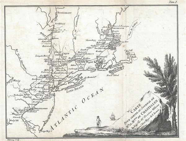
1786 Dezoteux Map of Northeast United States Showing Chastellux's Route (Revolutionary War)
Chastellux-dezoteux-1786$225.00

Title
Carte Pour Servir Au Journal de Mr. Le Mquis. de Chastellux.
1786 (dated) 8 x 10 in (20.32 x 25.4 cm)
1786 (dated) 8 x 10 in (20.32 x 25.4 cm)
Description
This is a scarce 1786 Revolutionary War era map of northeast United States by Dezoteux depicting the travels of Marquis de Chastellux. Centered on Long Island and Newport, the map covers the northern colonies from the Delaware Bay and Cape May in Philadelphia north to Portsmouth. Throughout, several important towns, cities, rivers, churches, court houses, battlefields and topography are noted. The map follows the route taken by Chastellux, a French military officer during the Revolutionary War who served under general Comte de Rochambeau. His work is described as ‘a heterogeneous and multifarious account of everything that caught the lively traveler’s eager eye and minute attention; and as nothing escaped his active investigation, his work abounds not only with observations which are of importance, but with details of even the most trifling incidents that bad roads, inconvenient inns, and distracted times usually afford.’
This map was created by Dezoteux and engraved by Aldring.
This map was created by Dezoteux and engraved by Aldring.
Condition
Very good. Minor wear along original fold lines. Minor spotting. Original platemark visible.