1956 Welt-Brooks Pictorial Map of Chatham, Massachusetts, Cape Cod
ChathamMA-weltbrooks-1956$350.00


Title
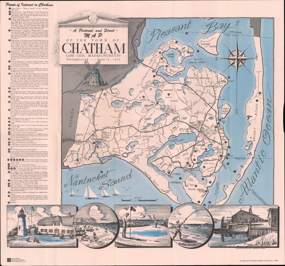
A Pictorial and Street Map of the Town of Chatham Cape Cod, Massachusetts Incorporated --- June 11, 1712.
1956 (dated) 18.5 x 20 in (46.99 x 50.8 cm) 1 : 26400
1956 (dated) 18.5 x 20 in (46.99 x 50.8 cm) 1 : 26400
Description
An attractive 1956 first-edition pictorial map of Chatham, Massachusetts drawn by Welt-Brooks Studio and printed by the Spaulding-Moss Company for the Chatham Chamber of Commerce. It highlights local attractions, from historical sites to summertime activities.
A Closer Look
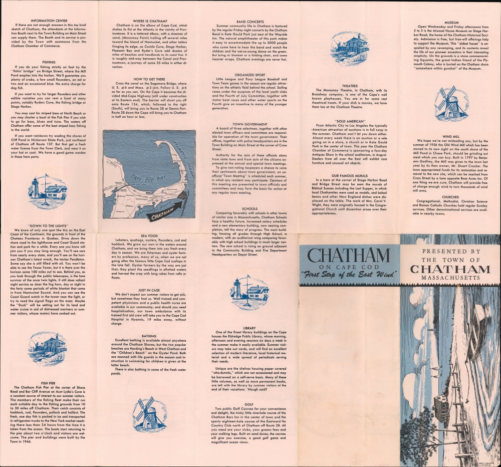
Located at the 'elbow' in the southeast corner of Cape Cod, Chatham is known for its long history, having been visited by Samuel de Champlain in 1606, and for being a favorite summer destination for travelers and seasonal residents. The map covers the town and labels waterways, roads, islands, neighborhoods, and other features. Numbers throughout correspond to an index of 'points of interest' at left, while illustrations on and below the map depict quaint local scenes, including the Chatham Windmill and Chatham Light (like other towns on the coast of Massachusetts, Chatham's long history has endowed it with several historical buildings that are very old by American standards). The verso includes detailed information on directions to Chatham, favorite local activities (summer concerts, fishing, and beaches), institutions, such as the library, schools, and churches.Publication History and Census
This map was drawn by Welt-Brooks Studio, a short-lived outfit that included local artist Milton Welt, and printed by the Spaulding-Moss Company for the Chatham Chamber of Commerce in 1956. It was issued several times, but all examples in institutional collections are dated to 1960 (the University of Toronto) and 1961 (the Boston Public Library).CartographerS
Milton H. Welt (April 17, 1914 - October 1, 2011) was an artist based in Cape Cod, Massachusetts. Born in Everett, Massachusetts, he was raised in Wallaston and graduated from the Thayer Academy in Braintree. He then attended art school in Portland, Maine and studied with watercolorists Carleton Plummer, Claude Croney, and Betty Lou Schlemm. Welt spend most of his life in the town of Harwich and his art typically dealt with the architecture and natural landscape of Cape Cod. He was a founding member of the Guild of Harwich Artists. More by this mapmaker...
Charles Spaulding (c. 1863 - 1915) was a Massachusetts-based inventor and printer. Born in South Boston, he began work as a draughtsman in his youth and then opened an art supply company. He found great success after patenting a blueprint coating machine in 1903 and forming the Spaulding Print Paper Company. In 1917, his company merged with the Charles E. Moss Company to become the Spaulding-Moss Company, based in Boston, notable as one of the first photostat companies in the United States. Learn More...
Condition
Very good. Light wear on original folds. Sights and attractions on verso.
References
OCLC 977428204 (1960 edition), 1336963370 (1961 edition).