This item has been sold, but you can get on the Waitlist to be notified if another example becomes available, or purchase a digital scan.
1893 Rand McNally Map of Chicago, World's Columbian Exposition
ChicagoExpo-randmcnally-1893$300.00


Title
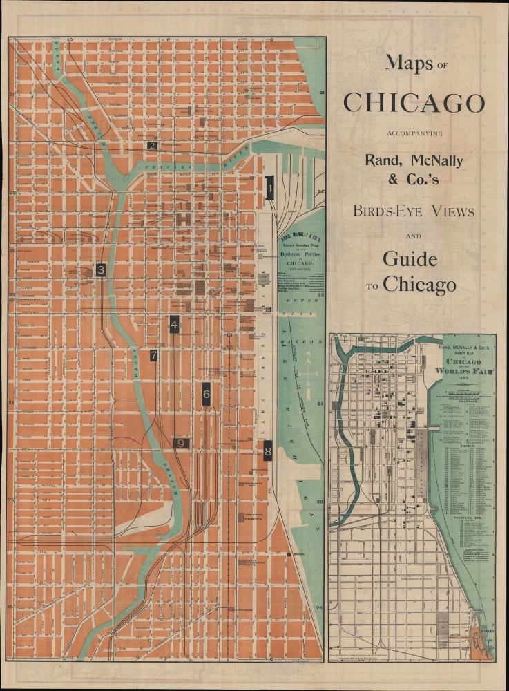
Rand McNally and Co.'s new and concise map of Chicago showing the new city limits and location of the World's Columbian Exposition, streets, parks, boulevards, railroads, street car lines, etc.
1893 (dated) 27.5 x 19.5 in (69.85 x 49.53 cm) 1 : 21000
1893 (dated) 27.5 x 19.5 in (69.85 x 49.53 cm) 1 : 21000
Description
A delightful map of Chicago published in 1893 by Rand McNally to coincide with the Chicago World's Fair, also known as the World's Columbian Exposition. It demonstrates the growth and modernization of the city as it recovered from the devastating 1871 Great Fire. The map has added significance as Rand McNally was (and remains) based in Chicago.
Within the city, streets are named in great detail and the city is divided into numbered blocks grouped 36 at a time. An alphanumeric grid surrounds the map, allowing for the easy location of sites by coordinates. Railroad lines, depots, transfer points (including the Union Stock Yards and Chicago Union Transfer Railway), streetcar (cable car) lines, elevated lines, and stations are all indicated. A list of railroad lines and depots appears under the title, which corresponds with the maps on the verso.
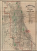
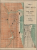
The verso includes two maps: a 'Street Number Map of the Business Portion of Chicago,' that is, Downtown Chicago, along with 'Rand McNally and Co.'s Handy Map of Chicago and the World's Fair' listing railroads, hotels, and theaters downtown and connections with the fairgrounds further south. The title on the verso suggests that this two-sided sheet was included in a special guide published by Rand McNally for visitors to the World's Fair.
A Closer Look
Coverage includes the entirety of the city of Chicago along with nearby suburbs to the west and southeast, just beyond city limits (outlined in red). Primacy of place is given to the grounds of the World's Columbian Expo, shaded red, which were built in Jackson Park on the shores of Lake Michigan. Parks, cemeteries, and greenbelts, or tree-lined boulevards running through the city, are prominently shaded green. The city's park and greenbelt system was designed by Frederick Law Olmstead prodigy William Le Baron Jenny in 1871.Within the city, streets are named in great detail and the city is divided into numbered blocks grouped 36 at a time. An alphanumeric grid surrounds the map, allowing for the easy location of sites by coordinates. Railroad lines, depots, transfer points (including the Union Stock Yards and Chicago Union Transfer Railway), streetcar (cable car) lines, elevated lines, and stations are all indicated. A list of railroad lines and depots appears under the title, which corresponds with the maps on the verso.
The verso includes two maps: a 'Street Number Map of the Business Portion of Chicago,' that is, Downtown Chicago, along with 'Rand McNally and Co.'s Handy Map of Chicago and the World's Fair' listing railroads, hotels, and theaters downtown and connections with the fairgrounds further south. The title on the verso suggests that this two-sided sheet was included in a special guide published by Rand McNally for visitors to the World's Fair.
1893 Columbian Exposition
The 1893 Chicago World's Fair or Columbian Exposition, so-named because it coincided with the 400th anniversary of Columbus' first transatlantic voyage, was a pivotal moment in the history of the United States. Chicago, keen to parade to the world its remarkable recovery from the disastrous 1871 Great Fire, won the right to host the World's Fair over New York, Washington D.C., and St. Louis. During its six-month run, nearly 27,000,000 people attended the Columbian Exposition, correlating to roughly half the 1893 population of the United States. Its numerous displays and exhibits established conventions for architecture, design, and decorative arts, in addition to initiating a new era of American industrial optimism.Publication History and Census
This map was published in 1893 by Rand McNally and Co. A note at bottom-left on the recto indicates that the map was based on the same company's 1890 'Map of Chicago and Suburbs' with updates and annotations (similar notes on the verso reveal that those two maps are copyrighted 1893). The map is noted among the holdings of Northwestern University, Harvard University, the Buffalo and Erie County Public Library, the Library of Michigan, and the New York Public Library. However, some catalog listings indicate that different maps appear on the verso than those present here, suggesting multiple printings or variations of the two-sided sheet.Cartographer
Rand, McNally and Co. (fl. 1856 - present) is an American publisher of maps, atlases and globes. The company was founded in 1856 when William H. Rand, a native of Quincy, Massachusetts, opened a print shop in Chicago. Rand hired the recent Irish immigrant Andrew McNally to assist in the shop giving him a wage of 9 USD per week. The duo landed several important contracts, including the Tribune's (later renamed the Chicago Tribune) printing operation. In 1872, Rand McNally produced its first map, a railroad guide, using a new cost effective printing technique known as wax process engraving. As Chicago developed as a railway hub, the Rand firm, now incorporated as Rand McNally, began producing a wide array of railroad maps and guides. Over time, the firm expanded into atlases, globes, educational material, and general literature. By embracing the wax engraving process, Rand McNally was able to dominate the map and atlas market, pushing more traditional American lithographic publishers like Colton, Johnson, and Mitchell out of business. Eventually Rand McNally opened an annex office in New York City headed by Caleb S. Hammond, whose name is today synonymous with maps and atlases, and who later started his own map company, C. S. Hammond & Co. Both firms remain in business. More by this mapmaker...
Condition
Very good. Slight wear on original fold lines.
References
OCLC 950884011, 827776937, 45657296.