This item has been sold, but you can get on the Waitlist to be notified if another example becomes available, or purchase a digital scan.
1940 Robinson Map of East Asia: China, Japan, Mongolia, Manchukuo
ChinaJapan-hecrobinson-1940$125.00


Title
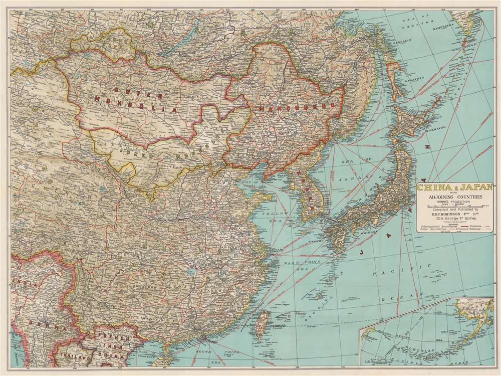
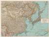
China and Japan with Adjoining Countries.
1940 (undated) 28.25 x 38.5 in (71.755 x 97.79 cm) 1 : 6000000
1940 (undated) 28.25 x 38.5 in (71.755 x 97.79 cm) 1 : 6000000
Description
This is a c. 1940 H.E.C. Robinson map of east Asia including China, Japan, Mongolia, Manchukuo (the Japanese puppet state), and Tannu Tuva (a Soviet puppet state) during the Second Sino-Japanese War. Black lines trace railroad lines, including the Trans-Siberian Railway. Solid red lines mark shipping lanes.
Manchukuo
Manchukuo, a Japanese controlled puppet state, was established in 1932 after the 1931 Japanese invasion of Manchuria. The Japanese installed a pro-Japanese government led by Puyi, the exiled Qing Emperor. Manchukuo was seized by the Soviets in August 1945, and the Manuchuko government dissolved a the end of World War II. Manchuria was returned to China in 1946.The Tuvan People's Republic
The Tuvan People's Republic, also known as the Tannu Tuva People's Republic, was a partially recognized socialist republic between the Soviet Union and Mongolia that existed from 1921 until 1944. The territory corresponds with the modern-day Tuva Republic, a federal subject of Russia. Only the Soviet Union and Mongolia officially recognized the republic, which was annexed by the Russian SFSR at the request of the Tuvan parliament in October 1944.The Second Sino-Japanese War
The Second Sino-Japanese War was fought between the Kuomintang (KMT) led Republic of China and the Empire of Japan between 1937 and 1945. The war started with the July 7, 1937, Marco Polo Bridge Incident. Following the Battle at Marco Polo Bridge, Japanese forces proceeded to capture both Beijing and its port city of Tianjin. Most believ the war staged by the Japanese to force greater influence in China and control over resource and labor rich Manchuria. After five months of fighting wherein the Japanese were mostly victorious, the puppet state of Manchukuo was created. Puyi, the exiled Qing Emperor of China, himself Manchurian, was installed as ruler. Following the Japanese attack on Pearl Harbor on December 7, 1941, the Second Sino-Japanese War is usually folded into the China-Burma-India Theater of World War II, which accounted for the majority of casualties during the Pacific War. The war ended in August 1945, following the American bombings of Hiroshima and Nagasaki. The Empire of Japan unconditionally surrendered to the Allies on September 2, 1945, bringing an end to the largest Asian war of the 20th century.Publication History and Census
This map was created and published by H.E.C. Robinson c. 1940. Several editions were published from the 1930s through the 1940s. Uncommon.Cartographer
Herbert Edward Cooper Robinson (November 18, 1856 - January 17, 1933) was a Sydney based Australian cartographer active in the late 19th and early 20th centuries. Cooper was born in Winchester, England and emigrated to Australia with his family, settling in Geelong, Victoria. At around 20 - 25 years of age, Robinson moved to Sydney to join the public service, where he mastered cartographic draftsmanship at the Lands Department. In 1882 he left the Lands Office to found a private firm with the Messrs. Higginbotham and Harris, under the imprint of 'Messrs. Higginbotham, Robinson, and Harris.' Within 2 years, both Higginbotham and Harris left the firm, driving it into bankruptcy and leaving Robinson on his own. In 1895, Robinson set up his own map publishing business at Wentworth Court, moving in 1906 to Phillip Street, and in 1913 to permanent location at 221-223 George Street, Sydney. In 1917, the firm formally incorporated as 'H. E. C. Robinson Ltd.' Although based in Sydney, the firm received multiple government contracts and opened annex firms in the Canberra. Robinson is best known for Australian city and regional guides, but he also published Sir Edgeworth David’s gigantic 1932 Geological Map of the Commonwealth of Australia and Donald Mackay's 1930+ aerial surveys of Australia. In addition to his printing work, in 1885, he became a founding member of the Geographical Society of Australasia. He became a fellow of the Royal Geographical Society in the late 1920s. Robinson had two children, Cecil Robinson and Eileen Robinson Brooks, both of whom emigrated to America. His daughter, Eileen, became a famous American stage actress. More by this mapmaker...
Condition
Very good. Exhibits light wear along original fold lines. Verso repairs to separations at fold intersections.